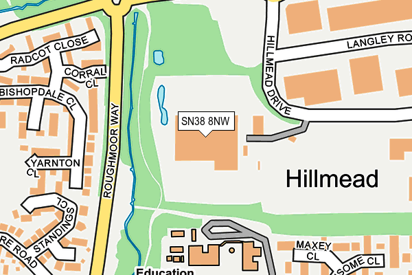
SN38 8NW is located in the Shaw electoral ward, within the unitary authority of Swindon and the English Parliamentary constituency of South Swindon. The Sub Integrated Care Board (ICB) Location is NHS Bath and North East Somerset, Swindon and Wiltshire ICB - 92 and the police force is Wiltshire. This postcode has been in use since August 1993.


GetTheData
Source: OS OpenMap – Local (Ordnance Survey)
Source: OS VectorMap District (Ordnance Survey)
Licence: Open Government Licence (requires attribution)
| Easting | 411410 |
| Northing | 185946 |
| Latitude | 51.572270 |
| Longitude | -1.836760 |
GetTheData
Source: Open Postcode Geo
Licence: Open Government Licence
| Country | England |
| Postcode District | SN38 |
➜ Where is Swindon? | |
GetTheData
Source: Land Registry Price Paid Data
Licence: Open Government Licence
Elevation or altitude of SN38 8NW as distance above sea level:
| Metres | Feet | |
|---|---|---|
| Elevation | 90m | 295ft |
Elevation is measured from the approximate centre of the postcode, to the nearest point on an OS contour line from OS Terrain 50, which has contour spacing of ten vertical metres.
➜ How high above sea level am I? Find the elevation of your current position using your device's GPS.
GetTheData
Source: Open Postcode Elevation
Licence: Open Government Licence
| Ward | Shaw |
| Constituency | South Swindon |
GetTheData
Source: ONS Postcode Database
Licence: Open Government Licence
| Shaw Roundabout (Cartwright Drive) | Shaw | 277m |
| Shaw Roundabout (Cartwright Drive) | Shaw | 294m |
| Brookfield School (Cartwright Drive) | Shaw | 297m |
| Standings Close (Sandacre Road) | Nine Elms | 305m |
| Brookfield School (Cartwright Drive) | Shaw | 309m |
| Swindon Station | 3.6km |
GetTheData
Source: NaPTAN
Licence: Open Government Licence
GetTheData
Source: ONS Postcode Database
Licence: Open Government Licence


➜ Get more ratings from the Food Standards Agency
GetTheData
Source: Food Standards Agency
Licence: FSA terms & conditions
| Last Collection | |||
|---|---|---|---|
| Location | Mon-Fri | Sat | Distance |
| Sandacre | 17:30 | 12:15 | 315m |
| Bishopdale | 17:30 | 12:15 | 342m |
| Old Shaw Lane | 17:45 | 12:30 | 406m |
GetTheData
Source: Dracos
Licence: Creative Commons Attribution-ShareAlike
The below table lists the International Territorial Level (ITL) codes (formerly Nomenclature of Territorial Units for Statistics (NUTS) codes) and Local Administrative Units (LAU) codes for SN38 8NW:
| ITL 1 Code | Name |
|---|---|
| TLK | South West (England) |
| ITL 2 Code | Name |
| TLK1 | Gloucestershire, Wiltshire and Bath/Bristol area |
| ITL 3 Code | Name |
| TLK14 | Swindon |
| LAU 1 Code | Name |
| E06000030 | Swindon |
GetTheData
Source: ONS Postcode Directory
Licence: Open Government Licence
The below table lists the Census Output Area (OA), Lower Layer Super Output Area (LSOA), and Middle Layer Super Output Area (MSOA) for SN38 8NW:
| Code | Name | |
|---|---|---|
| OA | E00078704 | |
| LSOA | E01015564 | Swindon 014B |
| MSOA | E02003225 | Swindon 014 |
GetTheData
Source: ONS Postcode Directory
Licence: Open Government Licence
| SN5 5UZ | Bishopdale Close | 165m |
| SN5 5UX | Corral Close | 181m |
| SN5 5UJ | Bishopdale Close | 200m |
| SN5 5SD | Maxey Close | 231m |
| SN5 5UQ | Yarnton Close | 245m |
| SN5 5UH | Woodbury Close | 247m |
| SN5 5UY | Radcot Close | 261m |
| SN5 5UF | Lydford Close | 265m |
| SN5 5UG | Standings Close | 270m |
| SN5 5SB | Cartwright Drive | 278m |
GetTheData
Source: Open Postcode Geo; Land Registry Price Paid Data
Licence: Open Government Licence