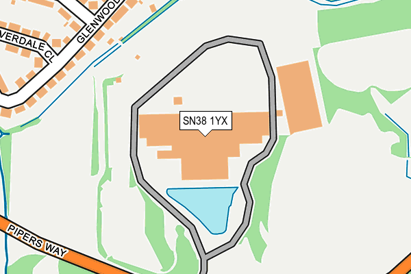
SN38 1YX is located in the Old Town electoral ward, within the unitary authority of Swindon and the English Parliamentary constituency of South Swindon. The Sub Integrated Care Board (ICB) Location is NHS Bath and North East Somerset, Swindon and Wiltshire ICB - 92 and the police force is Wiltshire. This postcode has been in use since December 1997.


GetTheData
Source: OS OpenMap – Local (Ordnance Survey)
Source: OS VectorMap District (Ordnance Survey)
Licence: Open Government Licence (requires attribution)
| Easting | 415584 |
| Northing | 182414 |
| Latitude | 51.540413 |
| Longitude | -1.776689 |
GetTheData
Source: Open Postcode Geo
Licence: Open Government Licence
| Country | England |
| Postcode District | SN38 |
➜ Where is Swindon? | |
GetTheData
Source: Land Registry Price Paid Data
Licence: Open Government Licence
Elevation or altitude of SN38 1YX as distance above sea level:
| Metres | Feet | |
|---|---|---|
| Elevation | 110m | 361ft |
Elevation is measured from the approximate centre of the postcode, to the nearest point on an OS contour line from OS Terrain 50, which has contour spacing of ten vertical metres.
➜ How high above sea level am I? Find the elevation of your current position using your device's GPS.
GetTheData
Source: Open Postcode Elevation
Licence: Open Government Licence
| Ward | Old Town |
| Constituency | South Swindon |
GetTheData
Source: ONS Postcode Database
Licence: Open Government Licence
| Nationwide House | Croft | 59m |
| Croft Campus (Pipers Way) | Croft | 229m |
| Croft Campus (Pipers Way) | Croft | 263m |
| Wroughton P&r | Croft | 413m |
| Tismeads Crescent South (Croft Road) | Old Town | 419m |
| Swindon Station | 2.9km |
GetTheData
Source: NaPTAN
Licence: Open Government Licence
GetTheData
Source: ONS Postcode Database
Licence: Open Government Licence


➜ Get more ratings from the Food Standards Agency
GetTheData
Source: Food Standards Agency
Licence: FSA terms & conditions
| Last Collection | |||
|---|---|---|---|
| Location | Mon-Fri | Sat | Distance |
| Tismead Cresent | 17:45 | 11:30 | 400m |
| Croft Road | 17:45 | 11:30 | 554m |
| North Wroughton | 17:00 | 11:30 | 755m |
GetTheData
Source: Dracos
Licence: Creative Commons Attribution-ShareAlike
The below table lists the International Territorial Level (ITL) codes (formerly Nomenclature of Territorial Units for Statistics (NUTS) codes) and Local Administrative Units (LAU) codes for SN38 1YX:
| ITL 1 Code | Name |
|---|---|
| TLK | South West (England) |
| ITL 2 Code | Name |
| TLK1 | Gloucestershire, Wiltshire and Bath/Bristol area |
| ITL 3 Code | Name |
| TLK14 | Swindon |
| LAU 1 Code | Name |
| E06000030 | Swindon |
GetTheData
Source: ONS Postcode Directory
Licence: Open Government Licence
The below table lists the Census Output Area (OA), Lower Layer Super Output Area (LSOA), and Middle Layer Super Output Area (MSOA) for SN38 1YX:
| Code | Name | |
|---|---|---|
| OA | E00078541 | |
| LSOA | E01015536 | Swindon 024D |
| MSOA | E02003235 | Swindon 024 |
GetTheData
Source: ONS Postcode Directory
Licence: Open Government Licence
| SN3 1TX | Pipers Way | 1m |
| SN1 4ED | Riverdale Close | 242m |
| SN1 4EB | Glenwood Close | 265m |
| SN1 4EF | Riverdale Close | 304m |
| SN1 4EE | Riverdale Close | 325m |
| SN1 4EA | Tismeads Crescent | 340m |
| SN1 4DR | Tismeads Crescent | 364m |
| SN1 4DP | Tismeads Crescent | 365m |
| SN1 4EG | Riverdale Walk | 409m |
| SN1 4DS | Croft Road | 417m |
GetTheData
Source: Open Postcode Geo; Land Registry Price Paid Data
Licence: Open Government Licence