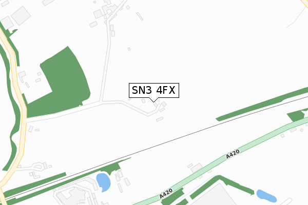
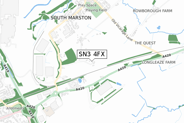
SN3 4FX is located in the St Margaret and South Marston electoral ward, within the unitary authority of Swindon and the English Parliamentary constituency of North Swindon. The Sub Integrated Care Board (ICB) Location is NHS Bath and North East Somerset, Swindon and Wiltshire ICB - 92 and the police force is Wiltshire. This postcode has been in use since April 2020.


GetTheData
Source: OS Open Zoomstack (Ordnance Survey)
Licence: Open Government Licence (requires attribution)
Attribution: Contains OS data © Crown copyright and database right 2025
Source: Open Postcode Geo
Licence: Open Government Licence (requires attribution)
Attribution: Contains OS data © Crown copyright and database right 2025; Contains Royal Mail data © Royal Mail copyright and database right 2025; Source: Office for National Statistics licensed under the Open Government Licence v.3.0
| Easting | 419416 |
| Northing | 187089 |
| Latitude | 51.582330 |
| Longitude | -1.721167 |
GetTheData
Source: Open Postcode Geo
Licence: Open Government Licence
| Country | England |
| Postcode District | SN3 |
➜ See where SN3 is on a map ➜ Where is South Marston? | |
GetTheData
Source: Land Registry Price Paid Data
Licence: Open Government Licence
| Ward | St Margaret And South Marston |
| Constituency | North Swindon |
GetTheData
Source: ONS Postcode Database
Licence: Open Government Licence
| Manor Park (Thornhill Road) | South Marston | 659m |
| Manor Park (Thornhill Road) | South Marston | 667m |
| Sainsburys (A420) | Stratton Park | 700m |
| Country Club (Old Vicarage Lane) | South Marston | 718m |
| Country Club (Old Vicarage Lane) | South Marston | 727m |
| Swindon Station | 4.8km |
GetTheData
Source: NaPTAN
Licence: Open Government Licence
GetTheData
Source: ONS Postcode Database
Licence: Open Government Licence


➜ Get more ratings from the Food Standards Agency
GetTheData
Source: Food Standards Agency
Licence: FSA terms & conditions
| Last Collection | |||
|---|---|---|---|
| Location | Mon-Fri | Sat | Distance |
| Carpenters Arms | 17:00 | 10:00 | 803m |
| Sywell Road | 17:30 | 12:00 | 1,530m |
| St Margarets Green | 17:45 | 12:45 | 1,537m |
GetTheData
Source: Dracos
Licence: Creative Commons Attribution-ShareAlike
The below table lists the International Territorial Level (ITL) codes (formerly Nomenclature of Territorial Units for Statistics (NUTS) codes) and Local Administrative Units (LAU) codes for SN3 4FX:
| ITL 1 Code | Name |
|---|---|
| TLK | South West (England) |
| ITL 2 Code | Name |
| TLK1 | Gloucestershire, Wiltshire and Bath/Bristol area |
| ITL 3 Code | Name |
| TLK14 | Swindon |
| LAU 1 Code | Name |
| E06000030 | Swindon |
GetTheData
Source: ONS Postcode Directory
Licence: Open Government Licence
The below table lists the Census Output Area (OA), Lower Layer Super Output Area (LSOA), and Middle Layer Super Output Area (MSOA) for SN3 4FX:
| Code | Name | |
|---|---|---|
| OA | E00078252 | |
| LSOA | E01015473 | Swindon 008A |
| MSOA | E02003219 | Swindon 008 |
GetTheData
Source: ONS Postcode Directory
Licence: Open Government Licence
| SN3 4RS | Shrivenham Road | 269m |
| SN3 4RU | Shrivenham Road | 352m |
| SN3 4RX | 385m | |
| SN3 4RP | Fuller Gardens | 473m |
| SN3 4WQ | Manor Meadows | 513m |
| SN3 4XX | Ash Gardens | 561m |
| SN3 4RR | Manor Park | 583m |
| SN3 4SS | Manor Cottages | 617m |
| SN3 4XA | Rawlings Close | 656m |
| SN3 4TB | Bell Gardens | 682m |
GetTheData
Source: Open Postcode Geo; Land Registry Price Paid Data
Licence: Open Government Licence