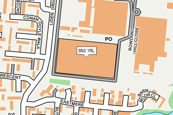
SN3 1RL is located in the Covingham and Dorcan electoral ward, within the unitary authority of Swindon and the English Parliamentary constituency of South Swindon. The Sub Integrated Care Board (ICB) Location is NHS Bath and North East Somerset, Swindon and Wiltshire ICB - 92 and the police force is Wiltshire. This postcode has been in use since January 1995.


GetTheData
Source: OS OpenMap – Local (Ordnance Survey)
Source: OS VectorMap District (Ordnance Survey)
Licence: Open Government Licence (requires attribution)
| Easting | 419111 |
| Northing | 183625 |
| Latitude | 51.551194 |
| Longitude | -1.725769 |
GetTheData
Source: Open Postcode Geo
Licence: Open Government Licence
| Country | England |
| Postcode District | SN3 |
➜ See where SN3 is on a map ➜ Where is Swindon? | |
GetTheData
Source: Land Registry Price Paid Data
Licence: Open Government Licence
Elevation or altitude of SN3 1RL as distance above sea level:
| Metres | Feet | |
|---|---|---|
| Elevation | 100m | 328ft |
Elevation is measured from the approximate centre of the postcode, to the nearest point on an OS contour line from OS Terrain 50, which has contour spacing of ten vertical metres.
➜ How high above sea level am I? Find the elevation of your current position using your device's GPS.
GetTheData
Source: Open Postcode Elevation
Licence: Open Government Licence
| Ward | Covingham And Dorcan |
| Constituency | South Swindon |
GetTheData
Source: ONS Postcode Database
Licence: Open Government Licence
| Austen Crescent (Liden Drive) | Liden | 183m |
| Wheatstone Road | Liden | 238m |
| Austen Crescent (Liden Drive) | Liden | 240m |
| Wheatstone Road (Liden Drive) | Liden | 273m |
| Faraday Road (Edison Road) | Liden | 373m |
| Swindon Station | 4.4km |
GetTheData
Source: NaPTAN
Licence: Open Government Licence
GetTheData
Source: ONS Postcode Database
Licence: Open Government Licence


➜ Get more ratings from the Food Standards Agency
GetTheData
Source: Food Standards Agency
Licence: FSA terms & conditions
| Last Collection | |||
|---|---|---|---|
| Location | Mon-Fri | Sat | Distance |
| Liden Post Office | 17:30 | 11:45 | 484m |
| White Edge Moor | 17:30 | 11:30 | 555m |
| Fair Lawn | 17:30 | 11:30 | 733m |
GetTheData
Source: Dracos
Licence: Creative Commons Attribution-ShareAlike
The below table lists the International Territorial Level (ITL) codes (formerly Nomenclature of Territorial Units for Statistics (NUTS) codes) and Local Administrative Units (LAU) codes for SN3 1RL:
| ITL 1 Code | Name |
|---|---|
| TLK | South West (England) |
| ITL 2 Code | Name |
| TLK1 | Gloucestershire, Wiltshire and Bath/Bristol area |
| ITL 3 Code | Name |
| TLK14 | Swindon |
| LAU 1 Code | Name |
| E06000030 | Swindon |
GetTheData
Source: ONS Postcode Directory
Licence: Open Government Licence
The below table lists the Census Output Area (OA), Lower Layer Super Output Area (LSOA), and Middle Layer Super Output Area (MSOA) for SN3 1RL:
| Code | Name | |
|---|---|---|
| OA | E00078332 | |
| LSOA | E01015488 | Swindon 023B |
| MSOA | E02003234 | Swindon 023 |
GetTheData
Source: ONS Postcode Directory
Licence: Open Government Licence
| SN3 6JY | Eastmere | 140m |
| SN3 6LG | Eastmere | 184m |
| SN3 6JB | Conan Doyle Walk | 216m |
| SN3 6LF | Buttermere | 224m |
| SN3 6JD | Conan Doyle Walk | 247m |
| SN3 6LA | Thirlmere | 249m |
| SN3 6LE | Grasmere | 251m |
| SN3 6JE | Austen Crescent | 276m |
| SN3 6JR | Mackenzie Close | 283m |
| SN3 6JA | Jacobs Walk | 307m |
GetTheData
Source: Open Postcode Geo; Land Registry Price Paid Data
Licence: Open Government Licence