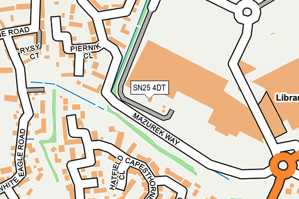
SN25 4DT is located in the Priory Vale electoral ward, within the unitary authority of Swindon and the English Parliamentary constituency of North Swindon. The Sub Integrated Care Board (ICB) Location is NHS Bath and North East Somerset, Swindon and Wiltshire ICB - 92 and the police force is Wiltshire. This postcode has been in use since September 2008.


GetTheData
Source: OS OpenMap – Local (Ordnance Survey)
Source: OS VectorMap District (Ordnance Survey)
Licence: Open Government Licence (requires attribution)
| Easting | 413441 |
| Northing | 188664 |
| Latitude | 51.596665 |
| Longitude | -1.807340 |
GetTheData
Source: Open Postcode Geo
Licence: Open Government Licence
| Country | England |
| Postcode District | SN25 |
➜ See where SN25 is on a map ➜ Where is Swindon? | |
GetTheData
Source: Land Registry Price Paid Data
Licence: Open Government Licence
Elevation or altitude of SN25 4DT as distance above sea level:
| Metres | Feet | |
|---|---|---|
| Elevation | 90m | 295ft |
Elevation is measured from the approximate centre of the postcode, to the nearest point on an OS contour line from OS Terrain 50, which has contour spacing of ten vertical metres.
➜ How high above sea level am I? Find the elevation of your current position using your device's GPS.
GetTheData
Source: Open Postcode Elevation
Licence: Open Government Licence
| Ward | Priory Vale |
| Constituency | North Swindon |
GetTheData
Source: ONS Postcode Database
Licence: Open Government Licence
| Asda Walmart (Orbital Shopping Park) | Haydon Wick | 71m |
| Asda Walmart (Orbital Shopping Park) | Haydon Wick | 76m |
| Asda Walmart (Orbital Shopping Park) | Haydon Wick | 83m |
| Asda Walmart (Orbital Shopping Park) | Haydon Wick | 88m |
| Asda Walmart (Lady Lane) | Haydon Wick | 123m |
| Swindon Station | 3.8km |
GetTheData
Source: NaPTAN
Licence: Open Government Licence
GetTheData
Source: ONS Postcode Database
Licence: Open Government Licence


➜ Get more ratings from the Food Standards Agency
GetTheData
Source: Food Standards Agency
Licence: FSA terms & conditions
| Last Collection | |||
|---|---|---|---|
| Location | Mon-Fri | Sat | Distance |
| Asda(Walmart) | 18:30 | 12:15 | 179m |
| Bramdean Close | 17:30 | 12:00 | 345m |
| Shepperton Way | 17:30 | 12:00 | 627m |
GetTheData
Source: Dracos
Licence: Creative Commons Attribution-ShareAlike
The below table lists the International Territorial Level (ITL) codes (formerly Nomenclature of Territorial Units for Statistics (NUTS) codes) and Local Administrative Units (LAU) codes for SN25 4DT:
| ITL 1 Code | Name |
|---|---|
| TLK | South West (England) |
| ITL 2 Code | Name |
| TLK1 | Gloucestershire, Wiltshire and Bath/Bristol area |
| ITL 3 Code | Name |
| TLK14 | Swindon |
| LAU 1 Code | Name |
| E06000030 | Swindon |
GetTheData
Source: ONS Postcode Directory
Licence: Open Government Licence
The below table lists the Census Output Area (OA), Lower Layer Super Output Area (LSOA), and Middle Layer Super Output Area (MSOA) for SN25 4DT:
| Code | Name | |
|---|---|---|
| OA | E00078243 | |
| LSOA | E01032710 | Swindon 028E |
| MSOA | E02006849 | Swindon 028 |
GetTheData
Source: ONS Postcode Directory
Licence: Open Government Licence
| SN25 1UW | Osterley Road | 144m |
| SN25 1UN | Osterley Road | 206m |
| SN25 1UX | Chilworth Close | 210m |
| SN25 1UU | Pencarrow Close | 211m |
| SN25 1UY | Hatfield Close | 230m |
| SN25 4ZA | Shipley Drive | 238m |
| SN25 4FJ | Coleridge Road | 244m |
| SN25 1UR | Capesthorne Drive | 262m |
| SN25 1QU | Charlock Path | 268m |
| SN25 4FN | Pope Close | 268m |
GetTheData
Source: Open Postcode Geo; Land Registry Price Paid Data
Licence: Open Government Licence