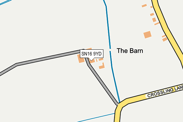
SN16 9YD is located in the Minety electoral ward, within the unitary authority of Wiltshire and the English Parliamentary constituency of North Wiltshire. The Sub Integrated Care Board (ICB) Location is NHS Bath and North East Somerset, Swindon and Wiltshire ICB - 92 and the police force is Wiltshire. This postcode has been in use since December 1999.


GetTheData
Source: OS OpenMap – Local (Ordnance Survey)
Source: OS VectorMap District (Ordnance Survey)
Licence: Open Government Licence (requires attribution)
| Easting | 401618 |
| Northing | 192308 |
| Latitude | 51.629583 |
| Longitude | -1.978021 |
GetTheData
Source: Open Postcode Geo
Licence: Open Government Licence
| Country | England |
| Postcode District | SN16 |
➜ See where SN16 is on a map | |
GetTheData
Source: Land Registry Price Paid Data
Licence: Open Government Licence
Elevation or altitude of SN16 9YD as distance above sea level:
| Metres | Feet | |
|---|---|---|
| Elevation | 90m | 295ft |
Elevation is measured from the approximate centre of the postcode, to the nearest point on an OS contour line from OS Terrain 50, which has contour spacing of ten vertical metres.
➜ How high above sea level am I? Find the elevation of your current position using your device's GPS.
GetTheData
Source: Open Postcode Elevation
Licence: Open Government Licence
| Ward | Minety |
| Constituency | North Wiltshire |
GetTheData
Source: ONS Postcode Database
Licence: Open Government Licence
| St. Leonards Row (Oaksey Road) | Upper Minety | 1,464m |
| St. Leonards Row (Oaksey Road) | Upper Minety | 1,467m |
| Village Bus Shelter (Crudwell Road) | Upper Minety | 1,681m |
| Village Bus Shelter (Crudwell Road) | Upper Minety | 1,689m |
GetTheData
Source: NaPTAN
Licence: Open Government Licence
GetTheData
Source: ONS Postcode Database
Licence: Open Government Licence


➜ Get more ratings from the Food Standards Agency
GetTheData
Source: Food Standards Agency
Licence: FSA terms & conditions
| Last Collection | |||
|---|---|---|---|
| Location | Mon-Fri | Sat | Distance |
| Upper Minety Post Office | 16:00 | 10:45 | 1,478m |
| Minety | 16:00 | 09:30 | 1,820m |
| Railway Station Minety | 16:00 | 07:00 | 2,411m |
GetTheData
Source: Dracos
Licence: Creative Commons Attribution-ShareAlike
The below table lists the International Territorial Level (ITL) codes (formerly Nomenclature of Territorial Units for Statistics (NUTS) codes) and Local Administrative Units (LAU) codes for SN16 9YD:
| ITL 1 Code | Name |
|---|---|
| TLK | South West (England) |
| ITL 2 Code | Name |
| TLK1 | Gloucestershire, Wiltshire and Bath/Bristol area |
| ITL 3 Code | Name |
| TLK15 | Wiltshire |
| LAU 1 Code | Name |
| E06000054 | Wiltshire |
GetTheData
Source: ONS Postcode Directory
Licence: Open Government Licence
The below table lists the Census Output Area (OA), Lower Layer Super Output Area (LSOA), and Middle Layer Super Output Area (MSOA) for SN16 9YD:
| Code | Name | |
|---|---|---|
| OA | E00162644 | |
| LSOA | E01031886 | Wiltshire 004A |
| MSOA | E02006647 | Wiltshire 004 |
GetTheData
Source: ONS Postcode Directory
Licence: Open Government Licence
| SN16 9QA | 250m | |
| SN16 9PZ | The Crossing | 613m |
| SN16 9QW | The Moor | 1031m |
| SN16 9PY | 1311m | |
| SN16 9QP | Ashton Road | 1364m |
| SN16 9PL | 1380m | |
| SN16 9SU | Tellings Orchard | 1442m |
| SN16 9QB | St Leonards Close | 1460m |
| SN16 9TW | 1464m | |
| SN16 9PT | 1477m |
GetTheData
Source: Open Postcode Geo; Land Registry Price Paid Data
Licence: Open Government Licence