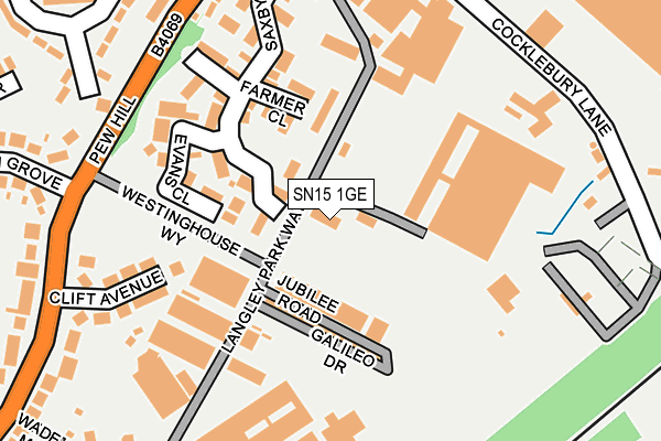
SN15 1GE is located in the Chippenham Monkton electoral ward, within the unitary authority of Wiltshire and the English Parliamentary constituency of Chippenham. The Sub Integrated Care Board (ICB) Location is NHS Bath and North East Somerset, Swindon and Wiltshire ICB - 92 and the police force is Wiltshire. This postcode has been in use since October 2002.


GetTheData
Source: OS OpenMap – Local (Ordnance Survey)
Source: OS VectorMap District (Ordnance Survey)
Licence: Open Government Licence (requires attribution)
| Easting | 392535 |
| Northing | 174406 |
| Latitude | 51.468570 |
| Longitude | -2.108854 |
GetTheData
Source: Open Postcode Geo
Licence: Open Government Licence
| Country | England |
| Postcode District | SN15 |
➜ See where SN15 is on a map ➜ Where is Chippenham? | |
GetTheData
Source: Land Registry Price Paid Data
Licence: Open Government Licence
Elevation or altitude of SN15 1GE as distance above sea level:
| Metres | Feet | |
|---|---|---|
| Elevation | 70m | 230ft |
Elevation is measured from the approximate centre of the postcode, to the nearest point on an OS contour line from OS Terrain 50, which has contour spacing of ten vertical metres.
➜ How high above sea level am I? Find the elevation of your current position using your device's GPS.
GetTheData
Source: Open Postcode Elevation
Licence: Open Government Licence
| Ward | Chippenham Monkton |
| Constituency | Chippenham |
GetTheData
Source: ONS Postcode Database
Licence: Open Government Licence
| Westinghouse Brake (Langley Road) | Chippenham | 372m |
| Maud Heath's Causeway (Birch Grove) | Barrow Green | 393m |
| Barrow Green | Chippenham | 460m |
| Hill Rise | Barrow Green | 596m |
| Cocklebury Road (Eastern Avenue) | Monkton Park | 656m |
| Chippenham Station | 0.8km |
GetTheData
Source: NaPTAN
Licence: Open Government Licence
GetTheData
Source: ONS Postcode Database
Licence: Open Government Licence


➜ Get more ratings from the Food Standards Agency
GetTheData
Source: Food Standards Agency
Licence: FSA terms & conditions
| Last Collection | |||
|---|---|---|---|
| Location | Mon-Fri | Sat | Distance |
| Langley Road | 18:15 | 12:30 | 425m |
| Barrows Green | 18:00 | 12:30 | 467m |
| Willowbank | 17:30 | 12:00 | 639m |
GetTheData
Source: Dracos
Licence: Creative Commons Attribution-ShareAlike
The below table lists the International Territorial Level (ITL) codes (formerly Nomenclature of Territorial Units for Statistics (NUTS) codes) and Local Administrative Units (LAU) codes for SN15 1GE:
| ITL 1 Code | Name |
|---|---|
| TLK | South West (England) |
| ITL 2 Code | Name |
| TLK1 | Gloucestershire, Wiltshire and Bath/Bristol area |
| ITL 3 Code | Name |
| TLK15 | Wiltshire |
| LAU 1 Code | Name |
| E06000054 | Wiltshire |
GetTheData
Source: ONS Postcode Directory
Licence: Open Government Licence
The below table lists the Census Output Area (OA), Lower Layer Super Output Area (LSOA), and Middle Layer Super Output Area (MSOA) for SN15 1GE:
| Code | Name | |
|---|---|---|
| OA | E00162782 | |
| LSOA | E01031915 | Wiltshire 009D |
| MSOA | E02006652 | Wiltshire 009 |
GetTheData
Source: ONS Postcode Directory
Licence: Open Government Licence
| SN15 1UE | Farmer Close | 133m |
| SN15 1UB | Saxby Road | 180m |
| SN15 1DN | Pew Hill | 208m |
| SN15 1UD | Evans Close | 218m |
| SN15 1UF | Odonnell Close | 231m |
| SN15 1DJ | Pew Hill | 254m |
| SN15 1DH | Pew Hill | 293m |
| SN15 1DA | Clift Avenue | 301m |
| SN15 1DL | Pew Hill | 318m |
| SN15 1DQ | Langley Road | 337m |
GetTheData
Source: Open Postcode Geo; Land Registry Price Paid Data
Licence: Open Government Licence