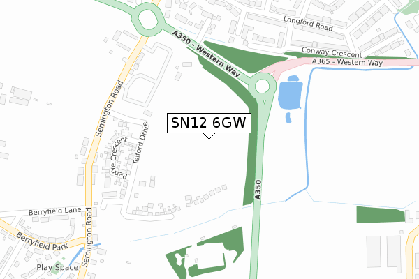
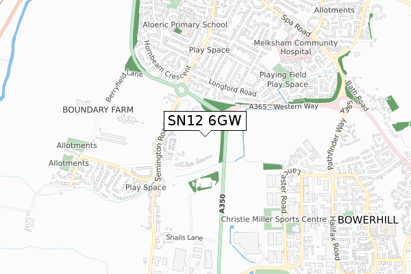
SN12 6GW maps, stats, and open data
SN12 6GW is located in the Melksham Without West & Rural electoral ward, within the unitary authority of Wiltshire and the English Parliamentary constituency of Chippenham. The Sub Integrated Care Board (ICB) Location is NHS Bath and North East Somerset, Swindon and Wiltshire ICB - 92 and the police force is Wiltshire. This postcode has been in use since April 2019.
SN12 6GW maps


Licence: Open Government Licence (requires attribution)
Attribution: Contains OS data © Crown copyright and database right 2025
Source: Open Postcode Geo
Licence: Open Government Licence (requires attribution)
Attribution: Contains OS data © Crown copyright and database right 2025; Contains Royal Mail data © Royal Mail copyright and database right 2025; Source: Office for National Statistics licensed under the Open Government Licence v.3.0
SN12 6GW geodata
| Easting | 390369 |
| Northing | 162599 |
| Latitude | 51.362371 |
| Longitude | -2.139711 |
Where is SN12 6GW?
| Country | England |
| Postcode District | SN12 |
Politics
| Ward | Melksham Without West & Rural |
|---|---|
| Constituency | Chippenham |
House Prices
Sales of detached houses in SN12 6GW
1, JESSOP CLOSE, MELKSHAM, SN12 6GW 2021 11 OCT £287,995 |
3, JESSOP CLOSE, MELKSHAM, SN12 6GW 2021 30 SEP £400,000 |
7, JESSOP CLOSE, MELKSHAM, SN12 6GW 2021 10 SEP £414,995 |
5, JESSOP CLOSE, MELKSHAM, SN12 6GW 2021 3 SEP £371,995 |
9, JESSOP CLOSE, MELKSHAM, SN12 6GW 2021 27 AUG £290,000 |
2, JESSOP CLOSE, MELKSHAM, SN12 6GW 2021 11 AUG £379,995 |
4, JESSOP CLOSE, MELKSHAM, SN12 6GW 2021 6 AUG £374,995 |
6, JESSOP CLOSE, MELKSHAM, SN12 6GW 2021 26 MAY £409,995 |
Licence: Contains HM Land Registry data © Crown copyright and database right 2025. This data is licensed under the Open Government Licence v3.0.
Transport
Nearest bus stops to SN12 6GW
| New Inn (Semington Road) | Berryfield | 313m |
| New Inn (Semington Road) | Berryfield | 324m |
| Playground (Berryfield Park) | Berryfield | 406m |
| Fire Station (Semington Road) | Melksham | 528m |
| Berryfield Park (Berryfield Lane) | Melksham | 540m |
Nearest railway stations to SN12 6GW
| Melksham Station | 2km |
Deprivation
55.7% of English postcodes are less deprived than SN12 6GW:Food Standards Agency
Three nearest food hygiene ratings to SN12 6GW (metres)


➜ Get more ratings from the Food Standards Agency
Nearest post box to SN12 6GW
| Last Collection | |||
|---|---|---|---|
| Location | Mon-Fri | Sat | Distance |
| Hornbeam Cresent | 17:45 | 12:30 | 498m |
| Sarum Avenue | 17:45 | 12:30 | 508m |
| Waveley Gardens | 17:45 | 12:30 | 610m |
SN12 6GW ITL and SN12 6GW LAU
The below table lists the International Territorial Level (ITL) codes (formerly Nomenclature of Territorial Units for Statistics (NUTS) codes) and Local Administrative Units (LAU) codes for SN12 6GW:
| ITL 1 Code | Name |
|---|---|
| TLK | South West (England) |
| ITL 2 Code | Name |
| TLK1 | Gloucestershire, Wiltshire and Bath/Bristol area |
| ITL 3 Code | Name |
| TLK15 | Wiltshire |
| LAU 1 Code | Name |
| E06000054 | Wiltshire |
SN12 6GW census areas
The below table lists the Census Output Area (OA), Lower Layer Super Output Area (LSOA), and Middle Layer Super Output Area (MSOA) for SN12 6GW:
| Code | Name | |
|---|---|---|
| OA | E00163576 | |
| LSOA | E01032070 | Wiltshire 021D |
| MSOA | E02006679 | Wiltshire 021 |
Nearest postcodes to SN12 6GW
| SN12 6DP | Semington Road | 223m |
| SN12 6DR | Semington Road | 250m |
| SN12 6EW | Lonsdale Gardens | 272m |
| SN12 6DN | Semington Road | 276m |
| SN12 6AY | Wardour Place | 277m |
| SN12 6AZ | Berkeley Close | 280m |
| SN12 6DL | Semington Road | 286m |
| SN12 6BA | Conway Crescent | 310m |
| SN12 6DJ | Radnor Place | 315m |
| SN12 6AR | Longford Road | 315m |