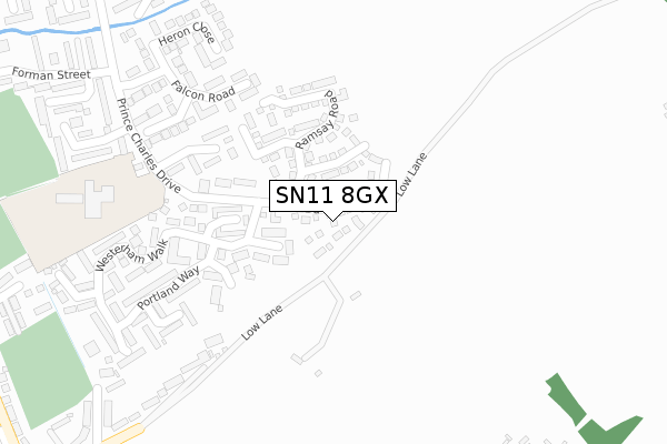
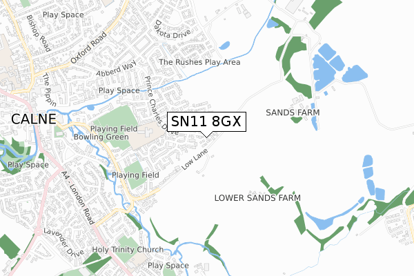
SN11 8GX is located in the Calne Central electoral ward, within the unitary authority of Wiltshire and the English Parliamentary constituency of North Wiltshire. The Sub Integrated Care Board (ICB) Location is NHS Bath and North East Somerset, Swindon and Wiltshire ICB - 92 and the police force is Wiltshire. This postcode has been in use since April 2018.


GetTheData
Source: OS Open Zoomstack (Ordnance Survey)
Licence: Open Government Licence (requires attribution)
Attribution: Contains OS data © Crown copyright and database right 2025
Source: Open Postcode Geo
Licence: Open Government Licence (requires attribution)
Attribution: Contains OS data © Crown copyright and database right 2025; Contains Royal Mail data © Royal Mail copyright and database right 2025; Source: Office for National Statistics licensed under the Open Government Licence v.3.0
| Easting | 400793 |
| Northing | 170855 |
| Latitude | 51.436690 |
| Longitude | -1.989974 |
GetTheData
Source: Open Postcode Geo
Licence: Open Government Licence
| Country | England |
| Postcode District | SN11 |
➜ See where SN11 is on a map ➜ Where is Calne? | |
GetTheData
Source: Land Registry Price Paid Data
Licence: Open Government Licence
| Ward | Calne Central |
| Constituency | North Wiltshire |
GetTheData
Source: ONS Postcode Database
Licence: Open Government Licence
15, CAVENDISH CLOSE, CALNE, SN11 8GX 2020 20 OCT £322,995 |
11, CAVENDISH CLOSE, CALNE, SN11 8GX 2020 25 SEP £305,000 |
16, CAVENDISH CLOSE, CALNE, SN11 8GX 2020 3 SEP £284,000 |
4, CAVENDISH CLOSE, CALNE, SN11 8GX 2020 31 JUL £322,745 |
10, CAVENDISH CLOSE, CALNE, SN11 8GX 2020 30 JUN £269,995 |
17, CAVENDISH CLOSE, CALNE, SN11 8GX 2020 30 APR £322,995 |
2, CAVENDISH CLOSE, CALNE, SN11 8GX 2018 29 MAR £289,995 |
GetTheData
Source: HM Land Registry Price Paid Data
Licence: Contains HM Land Registry data © Crown copyright and database right 2025. This data is licensed under the Open Government Licence v3.0.
| Saddleback Close (Anchor Road) | Calne | 574m |
| Shelburne Road | Calne | 759m |
| Shelburne Road (London Road) | Calne | 836m |
| Shelburne Road (London Road) | Calne | 843m |
| Mill Street | Calne | 888m |
GetTheData
Source: NaPTAN
Licence: Open Government Licence
| Percentage of properties with Next Generation Access | 100.0% |
| Percentage of properties with Superfast Broadband | 100.0% |
| Percentage of properties with Ultrafast Broadband | 100.0% |
| Percentage of properties with Full Fibre Broadband | 100.0% |
Superfast Broadband is between 30Mbps and 300Mbps
Ultrafast Broadband is > 300Mbps
| Percentage of properties unable to receive 2Mbps | 0.0% |
| Percentage of properties unable to receive 5Mbps | 0.0% |
| Percentage of properties unable to receive 10Mbps | 0.0% |
| Percentage of properties unable to receive 30Mbps | 0.0% |
GetTheData
Source: Ofcom
Licence: Ofcom Terms of Use (requires attribution)
GetTheData
Source: ONS Postcode Database
Licence: Open Government Licence


➜ Get more ratings from the Food Standards Agency
GetTheData
Source: Food Standards Agency
Licence: FSA terms & conditions
| Last Collection | |||
|---|---|---|---|
| Location | Mon-Fri | Sat | Distance |
| Highgrove Close | 17:45 | 12:15 | 189m |
| Wyvern Avenue | 17:45 | 12:15 | 533m |
| Anchor Road | 17:30 | 12:00 | 560m |
GetTheData
Source: Dracos
Licence: Creative Commons Attribution-ShareAlike
The below table lists the International Territorial Level (ITL) codes (formerly Nomenclature of Territorial Units for Statistics (NUTS) codes) and Local Administrative Units (LAU) codes for SN11 8GX:
| ITL 1 Code | Name |
|---|---|
| TLK | South West (England) |
| ITL 2 Code | Name |
| TLK1 | Gloucestershire, Wiltshire and Bath/Bristol area |
| ITL 3 Code | Name |
| TLK15 | Wiltshire |
| LAU 1 Code | Name |
| E06000054 | Wiltshire |
GetTheData
Source: ONS Postcode Directory
Licence: Open Government Licence
The below table lists the Census Output Area (OA), Lower Layer Super Output Area (LSOA), and Middle Layer Super Output Area (MSOA) for SN11 8GX:
| Code | Name | |
|---|---|---|
| OA | E00162722 | |
| LSOA | E01031902 | Wiltshire 016C |
| MSOA | E02006658 | Wiltshire 016 |
GetTheData
Source: ONS Postcode Directory
Licence: Open Government Licence
| SN11 8ND | Mallard Close | 71m |
| SN11 8NF | Highgrove Close | 178m |
| SN11 8NE | Highgrove Close | 182m |
| SN11 8LL | Cotswold Close | 184m |
| SN11 8NG | Tern Close | 224m |
| SN11 8LH | Portland Way | 252m |
| SN11 8LJ | Portland Way | 259m |
| SN11 8LN | Purbeck Place | 289m |
| SN11 8LP | Westerham Walk | 293m |
| SN11 8PN | Martin Way | 298m |
GetTheData
Source: Open Postcode Geo; Land Registry Price Paid Data
Licence: Open Government Licence