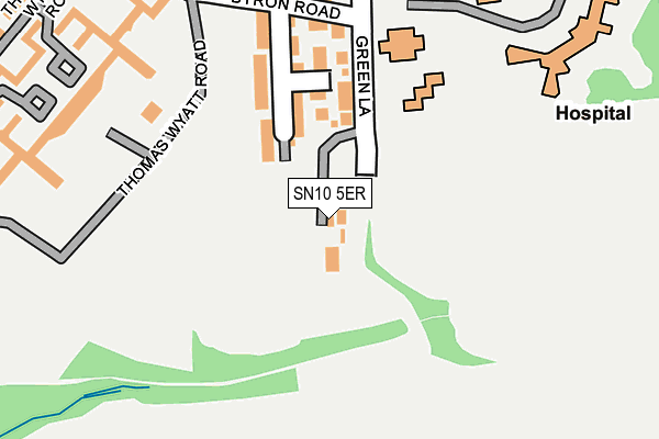
SN10 5ER is located in the Devizes South electoral ward, within the unitary authority of Wiltshire and the English Parliamentary constituency of Devizes. The Sub Integrated Care Board (ICB) Location is NHS Bath and North East Somerset, Swindon and Wiltshire ICB - 92 and the police force is Wiltshire. This postcode has been in use since August 2011.


GetTheData
Source: OS OpenMap – Local (Ordnance Survey)
Source: OS VectorMap District (Ordnance Survey)
Licence: Open Government Licence (requires attribution)
| Easting | 401163 |
| Northing | 159829 |
| Latitude | 51.337550 |
| Longitude | -1.984691 |
GetTheData
Source: Open Postcode Geo
Licence: Open Government Licence
| Country | England |
| Postcode District | SN10 |
➜ See where SN10 is on a map | |
GetTheData
Source: Land Registry Price Paid Data
Licence: Open Government Licence
Elevation or altitude of SN10 5ER as distance above sea level:
| Metres | Feet | |
|---|---|---|
| Elevation | 110m | 361ft |
Elevation is measured from the approximate centre of the postcode, to the nearest point on an OS contour line from OS Terrain 50, which has contour spacing of ten vertical metres.
➜ How high above sea level am I? Find the elevation of your current position using your device's GPS.
GetTheData
Source: Open Postcode Elevation
Licence: Open Government Licence
| Ward | Devizes South |
| Constituency | Devizes |
GetTheData
Source: ONS Postcode Database
Licence: Open Government Licence
| Green Lane Hospital (Marshall Road) | Nursteed | 339m |
| Green Lane Hospital (Marshall Road) | Nursteed | 344m |
| Heritage Park (Newman Road) | Devizes | 395m |
| Downlands School (Downslands Road) | Devizes | 557m |
| Wansdyke School (Wick Lane) | Devizes | 705m |
GetTheData
Source: NaPTAN
Licence: Open Government Licence
GetTheData
Source: ONS Postcode Database
Licence: Open Government Licence


➜ Get more ratings from the Food Standards Agency
GetTheData
Source: Food Standards Agency
Licence: FSA terms & conditions
| Last Collection | |||
|---|---|---|---|
| Location | Mon-Fri | Sat | Distance |
| Drews Park | 17:30 | 12:00 | 320m |
| Downlands Road | 17:30 | 12:30 | 763m |
| Edward Road | 17:30 | 12:30 | 993m |
GetTheData
Source: Dracos
Licence: Creative Commons Attribution-ShareAlike
The below table lists the International Territorial Level (ITL) codes (formerly Nomenclature of Territorial Units for Statistics (NUTS) codes) and Local Administrative Units (LAU) codes for SN10 5ER:
| ITL 1 Code | Name |
|---|---|
| TLK | South West (England) |
| ITL 2 Code | Name |
| TLK1 | Gloucestershire, Wiltshire and Bath/Bristol area |
| ITL 3 Code | Name |
| TLK15 | Wiltshire |
| LAU 1 Code | Name |
| E06000054 | Wiltshire |
GetTheData
Source: ONS Postcode Directory
Licence: Open Government Licence
The below table lists the Census Output Area (OA), Lower Layer Super Output Area (LSOA), and Middle Layer Super Output Area (MSOA) for SN10 5ER:
| Code | Name | |
|---|---|---|
| OA | E00166342 | |
| LSOA | E01032688 | Wiltshire 025E |
| MSOA | E02006637 | Wiltshire 025 |
GetTheData
Source: ONS Postcode Directory
Licence: Open Government Licence
| SN10 5FE | Thomas Wyatt Road | 237m |
| SN10 5NT | Byron Road | 242m |
| SN10 5FF | Thomas Wyatt Road | 252m |
| SN10 5FL | Thomas Wyatt Road | 262m |
| SN10 5FG | Thomas Wyatt Road | 273m |
| SN10 5FD | Thomas Wyatt Road | 281m |
| SN10 5LX | Newman Road | 301m |
| SN10 5BX | Green Lane | 303m |
| SN10 5FJ | Thomas Wyatt Road | 310m |
| SN10 5FQ | Thomas Wyatt Road | 322m |
GetTheData
Source: Open Postcode Geo; Land Registry Price Paid Data
Licence: Open Government Licence