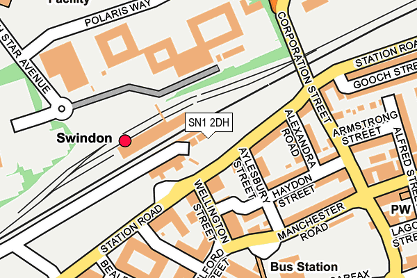
SN1 2DH is located in the Central electoral ward, within the unitary authority of Swindon and the English Parliamentary constituency of South Swindon. The Sub Integrated Care Board (ICB) Location is NHS Bath and North East Somerset, Swindon and Wiltshire ICB - 92 and the police force is Wiltshire. This postcode has been in use since November 2009.


GetTheData
Source: OS OpenMap – Local (Ordnance Survey)
Source: OS VectorMap District (Ordnance Survey)
Licence: Open Government Licence (requires attribution)
| Easting | 415041 |
| Northing | 185225 |
| Latitude | 51.565703 |
| Longitude | -1.784388 |
GetTheData
Source: Open Postcode Geo
Licence: Open Government Licence
| Country | England |
| Postcode District | SN1 |
➜ See where SN1 is on a map ➜ Where is Swindon? | |
GetTheData
Source: Land Registry Price Paid Data
Licence: Open Government Licence
Elevation or altitude of SN1 2DH as distance above sea level:
| Metres | Feet | |
|---|---|---|
| Elevation | 100m | 328ft |
Elevation is measured from the approximate centre of the postcode, to the nearest point on an OS contour line from OS Terrain 50, which has contour spacing of ten vertical metres.
➜ How high above sea level am I? Find the elevation of your current position using your device's GPS.
GetTheData
Source: Open Postcode Elevation
Licence: Open Government Licence
| Ward | Central |
| Constituency | South Swindon |
GetTheData
Source: ONS Postcode Database
Licence: Open Government Licence
| Rail Station (Station Road) | Swindon | 95m |
| Bus Station | Swindon | 164m |
| Armstrong Street (Corporation Street) | Swindon | 175m |
| Fleming Way | Swindon | 277m |
| Corporation Street | Swindon | 279m |
| Swindon Station | 0.1km |
GetTheData
Source: NaPTAN
Licence: Open Government Licence
GetTheData
Source: ONS Postcode Database
Licence: Open Government Licence


➜ Get more ratings from the Food Standards Agency
GetTheData
Source: Food Standards Agency
Licence: FSA terms & conditions
| Last Collection | |||
|---|---|---|---|
| Location | Mon-Fri | Sat | Distance |
| Swindon Station | 18:30 | 12:15 | 51m |
| Fleming Way | 18:30 | 12:00 | 300m |
| Manchester Road | 17:30 | 12:45 | 302m |
GetTheData
Source: Dracos
Licence: Creative Commons Attribution-ShareAlike
The below table lists the International Territorial Level (ITL) codes (formerly Nomenclature of Territorial Units for Statistics (NUTS) codes) and Local Administrative Units (LAU) codes for SN1 2DH:
| ITL 1 Code | Name |
|---|---|
| TLK | South West (England) |
| ITL 2 Code | Name |
| TLK1 | Gloucestershire, Wiltshire and Bath/Bristol area |
| ITL 3 Code | Name |
| TLK14 | Swindon |
| LAU 1 Code | Name |
| E06000030 | Swindon |
GetTheData
Source: ONS Postcode Directory
Licence: Open Government Licence
The below table lists the Census Output Area (OA), Lower Layer Super Output Area (LSOA), and Middle Layer Super Output Area (MSOA) for SN1 2DH:
| Code | Name | |
|---|---|---|
| OA | E00166489 | |
| LSOA | E01015476 | Swindon 015B |
| MSOA | E02003226 | Swindon 015 |
GetTheData
Source: ONS Postcode Directory
Licence: Open Government Licence
| SN1 1DH | Station Road | 100m |
| SN1 1EB | Wellington Street | 116m |
| SN1 1DR | Alexandra Road | 147m |
| SN1 1DT | Haydon Street | 149m |
| SN1 1HL | Milford Street | 165m |
| SN38 8AD | 183m | |
| SN1 1DS | Corporation Street | 185m |
| SN1 1DP | Corporation Street | 186m |
| SN1 1TU | Manchester Road | 189m |
| SN1 2AA | Armstrong Street | 231m |
GetTheData
Source: Open Postcode Geo; Land Registry Price Paid Data
Licence: Open Government Licence