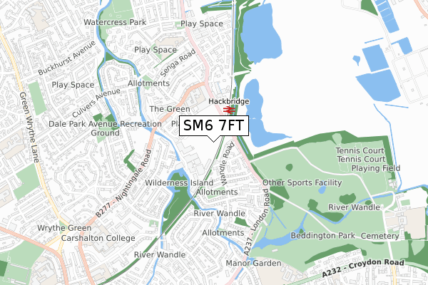
SM6 7FT is located in the Hackbridge electoral ward, within the London borough of Sutton and the English Parliamentary constituency of Carshalton and Wallington. The Sub Integrated Care Board (ICB) Location is NHS South West London ICB - 36L and the police force is Metropolitan Police. This postcode has been in use since February 2018.


GetTheData
Source: OS Open Zoomstack (Ordnance Survey)
Licence: Open Government Licence (requires attribution)
Attribution: Contains OS data © Crown copyright and database right 2025
Source: Open Postcode Geo
Licence: Open Government Licence (requires attribution)
Attribution: Contains OS data © Crown copyright and database right 2025; Contains Royal Mail data © Royal Mail copyright and database right 2025; Source: Office for National Statistics licensed under the Open Government Licence v.3.0
| Easting | 528505 |
| Northing | 165754 |
| Latitude | 51.376305 |
| Longitude | -0.155023 |
GetTheData
Source: Open Postcode Geo
Licence: Open Government Licence
| Country | England |
| Postcode District | SM6 |
➜ See where SM6 is on a map ➜ Where is London? | |
GetTheData
Source: Land Registry Price Paid Data
Licence: Open Government Licence
| Ward | Hackbridge |
| Constituency | Carshalton And Wallington |
GetTheData
Source: ONS Postcode Database
Licence: Open Government Licence
| Park Road (Sm6) | Hackbridge | 208m |
| Park Road (Sm6) | Hackbridge | 219m |
| Hackbridge Corner Hackbridge Station (London Road) | Hackbridge | 263m |
| Corbet Close | Hackbridge | 324m |
| Hackbridge Corner (Hackbridge Road) | Hackbridge | 352m |
| Beddington Lane Tram Stop (Off Beddington Lane) | Beddington Corner | 1,695m |
| Hackbridge Station | 0.2km |
| Carshalton Station | 1.2km |
| Wallington Station | 1.8km |
GetTheData
Source: NaPTAN
Licence: Open Government Licence
GetTheData
Source: ONS Postcode Database
Licence: Open Government Licence


➜ Get more ratings from the Food Standards Agency
GetTheData
Source: Food Standards Agency
Licence: FSA terms & conditions
| Last Collection | |||
|---|---|---|---|
| Location | Mon-Fri | Sat | Distance |
| London Road (218) | 18:00 | 12:00 | 179m |
| Hackbridge Tso | 19:00 | 12:00 | 363m |
| Clover Way (2) | 17:15 | 12:00 | 543m |
GetTheData
Source: Dracos
Licence: Creative Commons Attribution-ShareAlike
The below table lists the International Territorial Level (ITL) codes (formerly Nomenclature of Territorial Units for Statistics (NUTS) codes) and Local Administrative Units (LAU) codes for SM6 7FT:
| ITL 1 Code | Name |
|---|---|
| TLI | London |
| ITL 2 Code | Name |
| TLI6 | Outer London - South |
| ITL 3 Code | Name |
| TLI63 | Merton, Kingston upon Thames and Sutton |
| LAU 1 Code | Name |
| E09000029 | Sutton |
GetTheData
Source: ONS Postcode Directory
Licence: Open Government Licence
The below table lists the Census Output Area (OA), Lower Layer Super Output Area (LSOA), and Middle Layer Super Output Area (MSOA) for SM6 7FT:
| Code | Name | |
|---|---|---|
| OA | E00021104 | |
| LSOA | E01004188 | Sutton 004E |
| MSOA | E02000843 | Sutton 004 |
GetTheData
Source: ONS Postcode Directory
Licence: Open Government Licence
| SM6 7ET | Wandle Road | 74m |
| SM6 7GH | Centurion Court | 121m |
| SM6 7ER | Park Road | 140m |
| SM6 7EQ | Wandle Road | 162m |
| SM6 7EG | Greenacre Place | 188m |
| SM6 7AH | Restmor Way | 196m |
| SM6 7EA | London Road | 202m |
| SM6 7EP | Elmwood Close | 222m |
| SM6 7EF | Elmwood Close | 254m |
| SM5 2NE | Mill Close | 268m |
GetTheData
Source: Open Postcode Geo; Land Registry Price Paid Data
Licence: Open Government Licence