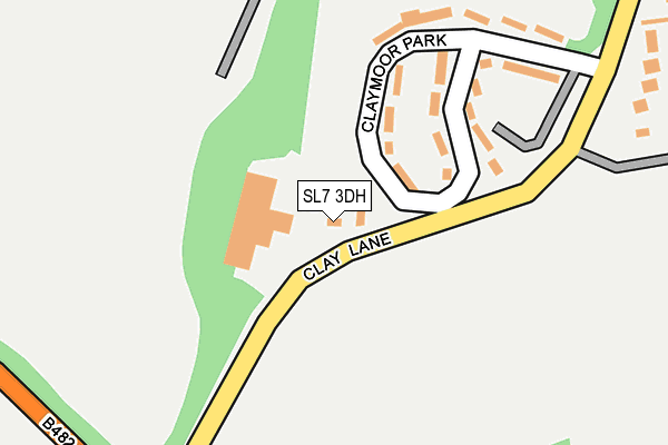
SL7 3DH is located in the Chiltern Villages electoral ward, within the unitary authority of Buckinghamshire and the English Parliamentary constituency of Wycombe. The Sub Integrated Care Board (ICB) Location is NHS Buckinghamshire, Oxfordshire and Berkshire West ICB - 14Y and the police force is Thames Valley. This postcode has been in use since January 1980.


GetTheData
Source: OS OpenMap – Local (Ordnance Survey)
Source: OS VectorMap District (Ordnance Survey)
Licence: Open Government Licence (requires attribution)
| Easting | 482973 |
| Northing | 190443 |
| Latitude | 51.606723 |
| Longitude | -0.803235 |
GetTheData
Source: Open Postcode Geo
Licence: Open Government Licence
| Country | England |
| Postcode District | SL7 |
➜ See where SL7 is on a map ➜ Where is Clayhill? | |
GetTheData
Source: Land Registry Price Paid Data
Licence: Open Government Licence
Elevation or altitude of SL7 3DH as distance above sea level:
| Metres | Feet | |
|---|---|---|
| Elevation | 140m | 459ft |
Elevation is measured from the approximate centre of the postcode, to the nearest point on an OS contour line from OS Terrain 50, which has contour spacing of ten vertical metres.
➜ How high above sea level am I? Find the elevation of your current position using your device's GPS.
GetTheData
Source: Open Postcode Elevation
Licence: Open Government Licence
| Ward | Chiltern Villages |
| Constituency | Wycombe |
GetTheData
Source: ONS Postcode Database
Licence: Open Government Licence
| Clayhill (Clay Lane) | Booker | 363m |
| Clayhill (Clay Lane) | Booker | 407m |
| Limmer Lane (Cressex Road) | Booker | 1,062m |
| Limmer Lane (Cressex Road) | Booker | 1,070m |
| Holmers Court (Holmers Farm Way) | Booker | 1,116m |
| Marlow Station | 4.7km |
| High Wycombe Station | 4.7km |
GetTheData
Source: NaPTAN
Licence: Open Government Licence
GetTheData
Source: ONS Postcode Database
Licence: Open Government Licence


➜ Get more ratings from the Food Standards Agency
GetTheData
Source: Food Standards Agency
Licence: FSA terms & conditions
| Last Collection | |||
|---|---|---|---|
| Location | Mon-Fri | Sat | Distance |
| Limmer Lane | 16:30 | 12:00 | 976m |
| Asda Stores | 16:45 | 12:00 | 1,718m |
| High Heavans Marlow Bottom | 16:30 | 09:15 | 1,768m |
GetTheData
Source: Dracos
Licence: Creative Commons Attribution-ShareAlike
The below table lists the International Territorial Level (ITL) codes (formerly Nomenclature of Territorial Units for Statistics (NUTS) codes) and Local Administrative Units (LAU) codes for SL7 3DH:
| ITL 1 Code | Name |
|---|---|
| TLJ | South East (England) |
| ITL 2 Code | Name |
| TLJ1 | Berkshire, Buckinghamshire and Oxfordshire |
| ITL 3 Code | Name |
| TLJ13 | Buckinghamshire |
| LAU 1 Code | Name |
| E06000060 | Buckinghamshire |
GetTheData
Source: ONS Postcode Directory
Licence: Open Government Licence
The below table lists the Census Output Area (OA), Lower Layer Super Output Area (LSOA), and Middle Layer Super Output Area (MSOA) for SL7 3DH:
| Code | Name | |
|---|---|---|
| OA | E00090182 | |
| LSOA | E01017877 | Wycombe 020D |
| MSOA | E02003715 | Wycombe 020 |
GetTheData
Source: ONS Postcode Directory
Licence: Open Government Licence
| SL7 3DL | Claymoor Park | 175m |
| SL7 3DJ | Clay Lane | 309m |
| SL7 3DQ | Marlow Road | 453m |
| SL7 3DU | Hazlewoode Cotts | 701m |
| HP12 4QQ | The Paddocks | 909m |
| HP12 4QX | Booker Place | 910m |
| HP12 4QJ | Linnet Close | 933m |
| HP12 4QL | Limmer Lane | 1011m |
| HP12 4UN | Glade View | 1043m |
| HP12 4QR | Limmer Lane | 1045m |
GetTheData
Source: Open Postcode Geo; Land Registry Price Paid Data
Licence: Open Government Licence