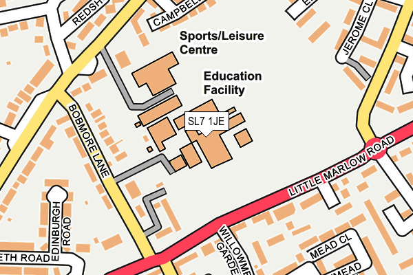
SL7 1JE is located in the Marlow electoral ward, within the unitary authority of Buckinghamshire and the English Parliamentary constituency of Beaconsfield. The Sub Integrated Care Board (ICB) Location is NHS Buckinghamshire, Oxfordshire and Berkshire West ICB - 14Y and the police force is Thames Valley. This postcode has been in use since January 1980.


GetTheData
Source: OS OpenMap – Local (Ordnance Survey)
Source: OS VectorMap District (Ordnance Survey)
Licence: Open Government Licence (requires attribution)
| Easting | 485668 |
| Northing | 187543 |
| Latitude | 51.580248 |
| Longitude | -0.765054 |
GetTheData
Source: Open Postcode Geo
Licence: Open Government Licence
| Country | England |
| Postcode District | SL7 |
➜ See where SL7 is on a map ➜ Where is Marlow? | |
GetTheData
Source: Land Registry Price Paid Data
Licence: Open Government Licence
Elevation or altitude of SL7 1JE as distance above sea level:
| Metres | Feet | |
|---|---|---|
| Elevation | 40m | 131ft |
Elevation is measured from the approximate centre of the postcode, to the nearest point on an OS contour line from OS Terrain 50, which has contour spacing of ten vertical metres.
➜ How high above sea level am I? Find the elevation of your current position using your device's GPS.
GetTheData
Source: Open Postcode Elevation
Licence: Open Government Licence
| Ward | Marlow |
| Constituency | Beaconsfield |
GetTheData
Source: ONS Postcode Database
Licence: Open Government Licence
| Britannia Inn (Bobmore Lane) | Marlow | 157m |
| Bobmore Lane (Little Marlow Road) | Marlow | 164m |
| Britannia Inn (Bobmore Lane) | Marlow | 170m |
| Gypsy Lane (Wycombe Road) | Marlow | 204m |
| Bobmore Lane (Little Marlow Road) | Marlow | 230m |
| Marlow Station | 1km |
| Bourne End Station | 3.8km |
| Cookham Station | 3.9km |
GetTheData
Source: NaPTAN
Licence: Open Government Licence
GetTheData
Source: ONS Postcode Database
Licence: Open Government Licence


➜ Get more ratings from the Food Standards Agency
GetTheData
Source: Food Standards Agency
Licence: FSA terms & conditions
| Last Collection | |||
|---|---|---|---|
| Location | Mon-Fri | Sat | Distance |
| Willowmead Gardens | 17:30 | 11:30 | 179m |
| Gypsey Lane | 16:15 | 11:45 | 244m |
| Newfield Gardens Post Office | 17:30 | 11:30 | 434m |
GetTheData
Source: Dracos
Licence: Creative Commons Attribution-ShareAlike
The below table lists the International Territorial Level (ITL) codes (formerly Nomenclature of Territorial Units for Statistics (NUTS) codes) and Local Administrative Units (LAU) codes for SL7 1JE:
| ITL 1 Code | Name |
|---|---|
| TLJ | South East (England) |
| ITL 2 Code | Name |
| TLJ1 | Berkshire, Buckinghamshire and Oxfordshire |
| ITL 3 Code | Name |
| TLJ13 | Buckinghamshire |
| LAU 1 Code | Name |
| E06000060 | Buckinghamshire |
GetTheData
Source: ONS Postcode Directory
Licence: Open Government Licence
The below table lists the Census Output Area (OA), Lower Layer Super Output Area (LSOA), and Middle Layer Super Output Area (MSOA) for SL7 1JE:
| Code | Name | |
|---|---|---|
| OA | E00090275 | |
| LSOA | E01017889 | Wycombe 022A |
| MSOA | E02003717 | Wycombe 022 |
GetTheData
Source: ONS Postcode Directory
Licence: Open Government Licence
| SL7 1GW | Denton Court | 124m |
| SL7 1JD | Bobmore Lane | 143m |
| SL7 1JB | Bobmore Lane | 145m |
| SL7 1HN | Little Marlow Road | 162m |
| SL7 1AP | Findlay Mews | 168m |
| SL7 3JD | Wycombe Road | 173m |
| SL7 1JF | Bobmore Lane | 179m |
| SL7 1UT | Newtown Road | 199m |
| SL7 3GZ | Campbell Road | 199m |
| SL7 1XL | Stanley Close | 218m |
GetTheData
Source: Open Postcode Geo; Land Registry Price Paid Data
Licence: Open Government Licence