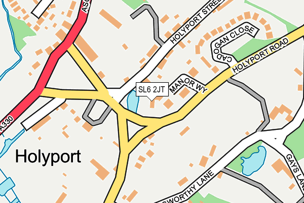
SL6 2JT lies on The Green in Holyport, Maidenhead. SL6 2JT is located in the Bray electoral ward, within the unitary authority of Windsor and Maidenhead and the English Parliamentary constituency of Maidenhead. The Sub Integrated Care Board (ICB) Location is NHS Frimley ICB - D4U1Y and the police force is Thames Valley. This postcode has been in use since January 1980.


GetTheData
Source: OS OpenMap – Local (Ordnance Survey)
Source: OS VectorMap District (Ordnance Survey)
Licence: Open Government Licence (requires attribution)
| Easting | 489314 |
| Northing | 177786 |
| Latitude | 51.491976 |
| Longitude | -0.714922 |
GetTheData
Source: Open Postcode Geo
Licence: Open Government Licence
| Street | The Green |
| Locality | Holyport |
| Town/City | Maidenhead |
| Country | England |
| Postcode District | SL6 |
➜ See where SL6 is on a map ➜ Where is Holyport? | |
GetTheData
Source: Land Registry Price Paid Data
Licence: Open Government Licence
Elevation or altitude of SL6 2JT as distance above sea level:
| Metres | Feet | |
|---|---|---|
| Elevation | 30m | 98ft |
Elevation is measured from the approximate centre of the postcode, to the nearest point on an OS contour line from OS Terrain 50, which has contour spacing of ten vertical metres.
➜ How high above sea level am I? Find the elevation of your current position using your device's GPS.
GetTheData
Source: Open Postcode Elevation
Licence: Open Government Licence
| Ward | Bray |
| Constituency | Maidenhead |
GetTheData
Source: ONS Postcode Database
Licence: Open Government Licence
2022 14 APR £1,610,000 |
2004 11 MAY £862,260 |
GetTheData
Source: HM Land Registry Price Paid Data
Licence: Contains HM Land Registry data © Crown copyright and database right 2025. This data is licensed under the Open Government Licence v3.0.
| Holyport Green (Moneyrow Green) | Moneyrow Green | 144m |
| Langworthy Lane (Moneyrow Green) | Moneyrow Green | 229m |
| Stroud Farm Corner (Holyport Road) | Holyport | 402m |
| Stroud Farm Corner (Holyport Road) | Holyport | 420m |
| Stroud Farm Shops (Stompits Road) | Holyport | 437m |
| Maidenhead Station | 3km |
| Taplow Station | 4.2km |
| Furze Platt Station | 4.7km |
GetTheData
Source: NaPTAN
Licence: Open Government Licence
GetTheData
Source: ONS Postcode Database
Licence: Open Government Licence


➜ Get more ratings from the Food Standards Agency
GetTheData
Source: Food Standards Agency
Licence: FSA terms & conditions
| Last Collection | |||
|---|---|---|---|
| Location | Mon-Fri | Sat | Distance |
| Ascot Road | 16:30 | 09:30 | 216m |
| Braywick Road | 17:30 | 11:30 | 1,623m |
| Bray Village Post Office | 17:30 | 11:30 | 1,900m |
GetTheData
Source: Dracos
Licence: Creative Commons Attribution-ShareAlike
The below table lists the International Territorial Level (ITL) codes (formerly Nomenclature of Territorial Units for Statistics (NUTS) codes) and Local Administrative Units (LAU) codes for SL6 2JT:
| ITL 1 Code | Name |
|---|---|
| TLJ | South East (England) |
| ITL 2 Code | Name |
| TLJ1 | Berkshire, Buckinghamshire and Oxfordshire |
| ITL 3 Code | Name |
| TLJ11 | Berkshire |
| LAU 1 Code | Name |
| E06000040 | Windsor and Maidenhead |
GetTheData
Source: ONS Postcode Directory
Licence: Open Government Licence
The below table lists the Census Output Area (OA), Lower Layer Super Output Area (LSOA), and Middle Layer Super Output Area (MSOA) for SL6 2JT:
| Code | Name | |
|---|---|---|
| OA | E00083517 | |
| LSOA | E01016543 | Windsor and Maidenhead 009E |
| MSOA | E02003429 | Windsor and Maidenhead 009 |
GetTheData
Source: ONS Postcode Directory
Licence: Open Government Licence
| SL6 2JP | Manor Way | 65m |
| SL6 2JW | Holyport Road | 87m |
| SL6 2JN | The Green | 101m |
| SL6 2JU | Holyport Street | 102m |
| SL6 2JR | Holyport Street | 150m |
| SL6 2JL | The Green | 152m |
| SL6 2JS | Cadogan Close | 210m |
| SL6 2HN | Langworthy Lane | 213m |
| SL6 2JA | The Green | 218m |
| SL6 2JJ | Pamela Row | 224m |
GetTheData
Source: Open Postcode Geo; Land Registry Price Paid Data
Licence: Open Government Licence