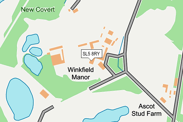
SL5 8RY is located in the Winkfield & Warfield East electoral ward, within the unitary authority of Bracknell Forest and the English Parliamentary constituency of Windsor. The Sub Integrated Care Board (ICB) Location is NHS Frimley ICB - D4U1Y and the police force is Thames Valley. This postcode has been in use since January 1980.


GetTheData
Source: OS OpenMap – Local (Ordnance Survey)
Source: OS VectorMap District (Ordnance Survey)
Licence: Open Government Licence (requires attribution)
| Easting | 491128 |
| Northing | 170385 |
| Latitude | 51.425158 |
| Longitude | -0.690688 |
GetTheData
Source: Open Postcode Geo
Licence: Open Government Licence
| Country | England |
| Postcode District | SL5 |
➜ See where SL5 is on a map | |
GetTheData
Source: Land Registry Price Paid Data
Licence: Open Government Licence
Elevation or altitude of SL5 8RY as distance above sea level:
| Metres | Feet | |
|---|---|---|
| Elevation | 70m | 230ft |
Elevation is measured from the approximate centre of the postcode, to the nearest point on an OS contour line from OS Terrain 50, which has contour spacing of ten vertical metres.
➜ How high above sea level am I? Find the elevation of your current position using your device's GPS.
GetTheData
Source: Open Postcode Elevation
Licence: Open Government Licence
| Ward | Winkfield & Warfield East |
| Constituency | Windsor |
GetTheData
Source: ONS Postcode Database
Licence: Open Government Licence
| Winkfield Manor (Forest Road) | Winkfield | 410m |
| Winkfield Manor (Forest Road) | Winkfield | 416m |
| Royal Hunt Public House (New Road) | North Ascot | 459m |
| Royal Hunt Public House (New Road) | North Ascot | 465m |
| Ascot Heath (Fernbank Road) | North Ascot | 492m |
| Ascot Station | 2.3km |
| Martins Heron Station | 3.1km |
| Bracknell Station | 4.4km |
GetTheData
Source: NaPTAN
Licence: Open Government Licence
| Percentage of properties with Next Generation Access | 100.0% |
| Percentage of properties with Superfast Broadband | 100.0% |
| Percentage of properties with Ultrafast Broadband | 0.0% |
| Percentage of properties with Full Fibre Broadband | 0.0% |
Superfast Broadband is between 30Mbps and 300Mbps
Ultrafast Broadband is > 300Mbps
| Percentage of properties unable to receive 2Mbps | 0.0% |
| Percentage of properties unable to receive 5Mbps | 0.0% |
| Percentage of properties unable to receive 10Mbps | 0.0% |
| Percentage of properties unable to receive 30Mbps | 0.0% |
GetTheData
Source: Ofcom
Licence: Ofcom Terms of Use (requires attribution)
GetTheData
Source: ONS Postcode Database
Licence: Open Government Licence


➜ Get more ratings from the Food Standards Agency
GetTheData
Source: Food Standards Agency
Licence: FSA terms & conditions
| Last Collection | |||
|---|---|---|---|
| Location | Mon-Fri | Sat | Distance |
| Brookside Post Office | 17:15 | 12:00 | 889m |
| Turners Farm Gainsborough Dri | 17:30 | 12:00 | 980m |
| Chavey Down Road | 16:15 | 09:00 | 1,457m |
GetTheData
Source: Dracos
Licence: Creative Commons Attribution-ShareAlike
The below table lists the International Territorial Level (ITL) codes (formerly Nomenclature of Territorial Units for Statistics (NUTS) codes) and Local Administrative Units (LAU) codes for SL5 8RY:
| ITL 1 Code | Name |
|---|---|
| TLJ | South East (England) |
| ITL 2 Code | Name |
| TLJ1 | Berkshire, Buckinghamshire and Oxfordshire |
| ITL 3 Code | Name |
| TLJ11 | Berkshire |
| LAU 1 Code | Name |
| E06000036 | Bracknell Forest |
GetTheData
Source: ONS Postcode Directory
Licence: Open Government Licence
The below table lists the Census Output Area (OA), Lower Layer Super Output Area (LSOA), and Middle Layer Super Output Area (MSOA) for SL5 8RY:
| Code | Name | |
|---|---|---|
| OA | E00081776 | |
| LSOA | E01016182 | Bracknell Forest 005C |
| MSOA | E02003356 | Bracknell Forest 005 |
GetTheData
Source: ONS Postcode Directory
Licence: Open Government Licence
| SL5 8PN | Rhododendron Walk | 271m |
| SL5 8PW | Rhododendron Walk | 312m |
| SL5 8PL | Rhododendron Close | 313m |
| SL5 8JH | Fernbank Road | 331m |
| SL5 8JU | Fernbank Road | 338m |
| SL5 8JF | Fernbank Road | 344m |
| SL5 8JX | Fernbank Road | 384m |
| SL5 8LU | Admiral Kepple Court | 395m |
| SL5 8QR | Lavender Row | 410m |
| SL5 8PS | New Road | 419m |
GetTheData
Source: Open Postcode Geo; Land Registry Price Paid Data
Licence: Open Government Licence