SL5 8RB maps, stats, and open data
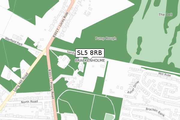
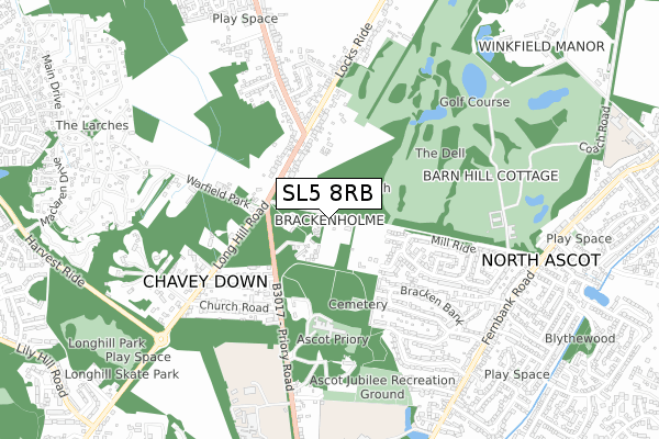
SL5 8RB lies on Sandy Lane in Chavey Down, Ascot. SL5 8RB is located in the Winkfield & Warfield East electoral ward, within the unitary authority of Bracknell Forest and the English Parliamentary constituency of Windsor. The Sub Integrated Care Board (ICB) Location is NHS Frimley ICB - D4U1Y and the police force is Thames Valley. This postcode has been in use since January 1980.
SL5 8RB maps


Licence: Open Government Licence (requires attribution)
Attribution: Contains OS data © Crown copyright and database right 2025
Source: Open Postcode Geo
Licence: Open Government Licence (requires attribution)
Attribution: Contains OS data © Crown copyright and database right 2025; Contains Royal Mail data © Royal Mail copyright and database right 2025; Source: Office for National Statistics licensed under the Open Government Licence v.3.0
SL5 8RB geodata
| Easting | 490109 |
| Northing | 169869 |
| Latitude | 51.420682 |
| Longitude | -0.705472 |
Where is SL5 8RB?
| Street | Sandy Lane |
| Locality | Chavey Down |
| Town/City | Ascot |
| Country | England |
| Postcode District | SL5 |
SL5 8RB Elevation
Elevation or altitude of SL5 8RB as distance above sea level:
| Metres | Feet | |
|---|---|---|
| Elevation | 90m | 295ft |
Elevation is measured from the approximate centre of the postcode, to the nearest point on an OS contour line from OS Terrain 50, which has contour spacing of ten vertical metres.
➜ How high above sea level am I? Find the elevation of your current position using your device's GPS.
Politics
| Ward | Winkfield & Warfield East |
|---|---|
| Constituency | Windsor |
Transport
Nearest bus stops to SL5 8RB
| Locks Ride | Chavey Down | 500m |
| Locks Ride | Chavey Down | 512m |
| Mobile Home Site (The Plateau) | Warfield Park | 594m |
| Church Road (Long Hill Road) | Chavey Down | 604m |
| Mushroom Castle Lane (Chavey Down Road) | Winkfield Row | 618m |
Nearest railway stations to SL5 8RB
| Martins Heron Station | 2km |
| Ascot Station | 2.6km |
| Bracknell Station | 3.3km |
Broadband
Broadband access in SL5 8RB (2020 data)
| Percentage of properties with Next Generation Access | 100.0% |
| Percentage of properties with Superfast Broadband | 100.0% |
| Percentage of properties with Ultrafast Broadband | 0.0% |
| Percentage of properties with Full Fibre Broadband | 0.0% |
Superfast Broadband is between 30Mbps and 300Mbps
Ultrafast Broadband is > 300Mbps
Broadband limitations in SL5 8RB (2020 data)
| Percentage of properties unable to receive 2Mbps | 0.0% |
| Percentage of properties unable to receive 5Mbps | 0.0% |
| Percentage of properties unable to receive 10Mbps | 0.0% |
| Percentage of properties unable to receive 30Mbps | 0.0% |
Deprivation
11.9% of English postcodes are less deprived than SL5 8RB:Food Standards Agency
Three nearest food hygiene ratings to SL5 8RB (metres)


➜ Get more ratings from the Food Standards Agency
Nearest post box to SL5 8RB
| Last Collection | |||
|---|---|---|---|
| Location | Mon-Fri | Sat | Distance |
| Chavey Down Road | 16:15 | 09:00 | 1,119m |
| Turners Farm Gainsborough Dri | 17:30 | 12:00 | 1,270m |
| Westmorland Drive | 17:15 | 11:45 | 1,388m |
SL5 8RB ITL and SL5 8RB LAU
The below table lists the International Territorial Level (ITL) codes (formerly Nomenclature of Territorial Units for Statistics (NUTS) codes) and Local Administrative Units (LAU) codes for SL5 8RB:
| ITL 1 Code | Name |
|---|---|
| TLJ | South East (England) |
| ITL 2 Code | Name |
| TLJ1 | Berkshire, Buckinghamshire and Oxfordshire |
| ITL 3 Code | Name |
| TLJ11 | Berkshire |
| LAU 1 Code | Name |
| E06000036 | Bracknell Forest |
SL5 8RB census areas
The below table lists the Census Output Area (OA), Lower Layer Super Output Area (LSOA), and Middle Layer Super Output Area (MSOA) for SL5 8RB:
| Code | Name | |
|---|---|---|
| OA | E00081782 | |
| LSOA | E01016181 | Bracknell Forest 005B |
| MSOA | E02003356 | Bracknell Forest 005 |
Nearest postcodes to SL5 8RB
| SL5 8QY | Locks Ride | 244m |
| SL5 8LH | The Grove | 256m |
| SL5 8LJ | Asher Drive | 275m |
| SL5 8RJ | Priory Road | 291m |
| SL5 8RA | Locks Ride | 301m |
| SL5 8RL | Priory Road | 323m |
| SL5 8RN | Goodrest Villas | 331m |
| SL5 8SA | Scotts Mews | 354m |
| SL5 8QL | Cannon Mews | 362m |
| SL5 8LL | Greenwood | 370m |