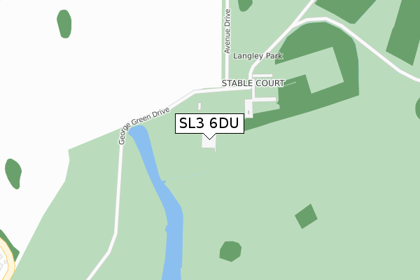
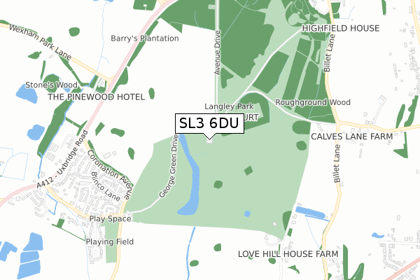
SL3 6DU is located in the Stoke Poges and Wexham electoral ward, within the unitary authority of Buckinghamshire and the English Parliamentary constituency of Beaconsfield. The Sub Integrated Care Board (ICB) Location is NHS Buckinghamshire, Oxfordshire and Berkshire West ICB - 14Y and the police force is Thames Valley. This postcode has been in use since February 2018.


GetTheData
Source: OS Open Zoomstack (Ordnance Survey)
Licence: Open Government Licence (requires attribution)
Attribution: Contains OS data © Crown copyright and database right 2025
Source: Open Postcode Geo
Licence: Open Government Licence (requires attribution)
Attribution: Contains OS data © Crown copyright and database right 2025; Contains Royal Mail data © Royal Mail copyright and database right 2025; Source: Office for National Statistics licensed under the Open Government Licence v.3.0
| Easting | 500909 |
| Northing | 181593 |
| Latitude | 51.524249 |
| Longitude | -0.546856 |
GetTheData
Source: Open Postcode Geo
Licence: Open Government Licence
| Country | England |
| Postcode District | SL3 |
➜ See where SL3 is on a map | |
GetTheData
Source: Land Registry Price Paid Data
Licence: Open Government Licence
| Ward | Stoke Poges And Wexham |
| Constituency | Beaconsfield |
GetTheData
Source: ONS Postcode Database
Licence: Open Government Licence
| Blinco Lane | George Green | 719m |
| Uxbridge Road | George Green | 1,032m |
| Uxbridge Road | George Green | 1,220m |
| Billet Lane (Langley Park Road) | Shreding Green | 1,282m |
| Billet Lane (Langley Park Road) | Shreding Green | 1,316m |
| Langley (Berks) Station | 1.8km |
| Iver Station | 3.3km |
| Slough Station | 3.4km |
GetTheData
Source: NaPTAN
Licence: Open Government Licence
| Percentage of properties with Next Generation Access | 100.0% |
| Percentage of properties with Superfast Broadband | 0.0% |
| Percentage of properties with Ultrafast Broadband | 0.0% |
| Percentage of properties with Full Fibre Broadband | 0.0% |
Superfast Broadband is between 30Mbps and 300Mbps
Ultrafast Broadband is > 300Mbps
| Percentage of properties unable to receive 2Mbps | 0.0% |
| Percentage of properties unable to receive 5Mbps | 0.0% |
| Percentage of properties unable to receive 10Mbps | 0.0% |
| Percentage of properties unable to receive 30Mbps | 100.0% |
GetTheData
Source: Ofcom
Licence: Ofcom Terms of Use (requires attribution)
GetTheData
Source: ONS Postcode Database
Licence: Open Government Licence


➜ Get more ratings from the Food Standards Agency
GetTheData
Source: Food Standards Agency
Licence: FSA terms & conditions
| Last Collection | |||
|---|---|---|---|
| Location | Mon-Fri | Sat | Distance |
| Alan Way | 17:45 | 10:30 | 756m |
| Rowley Farm | 17:15 | 10:30 | 1,282m |
| Shredding Green | 15:45 | 11:00 | 1,536m |
GetTheData
Source: Dracos
Licence: Creative Commons Attribution-ShareAlike
The below table lists the International Territorial Level (ITL) codes (formerly Nomenclature of Territorial Units for Statistics (NUTS) codes) and Local Administrative Units (LAU) codes for SL3 6DU:
| ITL 1 Code | Name |
|---|---|
| TLJ | South East (England) |
| ITL 2 Code | Name |
| TLJ1 | Berkshire, Buckinghamshire and Oxfordshire |
| ITL 3 Code | Name |
| TLJ13 | Buckinghamshire |
| LAU 1 Code | Name |
| E06000060 | Buckinghamshire |
GetTheData
Source: ONS Postcode Directory
Licence: Open Government Licence
The below table lists the Census Output Area (OA), Lower Layer Super Output Area (LSOA), and Middle Layer Super Output Area (MSOA) for SL3 6DU:
| Code | Name | |
|---|---|---|
| OA | E00089987 | |
| LSOA | E01017835 | South Bucks 005E |
| MSOA | E02003692 | South Bucks 005 |
GetTheData
Source: ONS Postcode Directory
Licence: Open Government Licence
| SL3 6DW | Langley Park | 154m |
| SL3 6RN | Azalea Way | 610m |
| SL3 6RL | Azalea Way | 627m |
| SL3 6RF | Coronation Avenue | 657m |
| SL3 6BL | George Green Drive | 658m |
| SL3 6RW | Diana Close | 660m |
| SL3 6RQ | Blinco Lane | 676m |
| SL3 6BP | Middle Green | 681m |
| SL3 6RG | Blinco Lane | 702m |
| SL3 6RA | Alan Way | 715m |
GetTheData
Source: Open Postcode Geo; Land Registry Price Paid Data
Licence: Open Government Licence