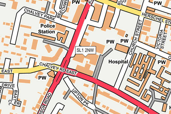
SL1 2NW is located in the Herschel Park electoral ward, within the unitary authority of Slough and the English Parliamentary constituency of Slough. The Sub Integrated Care Board (ICB) Location is NHS Frimley ICB - D4U1Y and the police force is Thames Valley. This postcode has been in use since May 2017.


GetTheData
Source: OS OpenMap – Local (Ordnance Survey)
Source: OS VectorMap District (Ordnance Survey)
Licence: Open Government Licence (requires attribution)
| Easting | 497507 |
| Northing | 179550 |
| Latitude | 51.506481 |
| Longitude | -0.596443 |
GetTheData
Source: Open Postcode Geo
Licence: Open Government Licence
| Country | England |
| Postcode District | SL1 |
➜ See where SL1 is on a map ➜ Where is Slough? | |
GetTheData
Source: Land Registry Price Paid Data
Licence: Open Government Licence
| Ward | Herschel Park |
| Constituency | Slough |
GetTheData
Source: ONS Postcode Database
Licence: Open Government Licence
| Landmark Place (Windsor Road) | Slough Town Centre | 138m |
| Landmark Place (Windsor Road) | Slough Town Centre | 158m |
| Albert Street (Windsor Road) | Chalvey | 194m |
| Albert Street (Windsor Road) | Chalvey | 204m |
| Landmark Place (Windsor Road) | Slough Town Centre | 262m |
| Slough Station | 0.7km |
| Windsor & Eton Riverside Station | 2.4km |
| Windsor & Eton Central Station | 2.8km |
GetTheData
Source: NaPTAN
Licence: Open Government Licence
| Percentage of properties with Next Generation Access | 100.0% |
| Percentage of properties with Superfast Broadband | 100.0% |
| Percentage of properties with Ultrafast Broadband | 100.0% |
| Percentage of properties with Full Fibre Broadband | 100.0% |
Superfast Broadband is between 30Mbps and 300Mbps
Ultrafast Broadband is > 300Mbps
| Median download speed | 16.9Mbps |
| Average download speed | 16.7Mbps |
| Maximum download speed | 17.67Mbps |
| Median upload speed | 1.2Mbps |
| Average upload speed | 1.1Mbps |
| Maximum upload speed | 1.17Mbps |
| Percentage of properties unable to receive 2Mbps | 0.0% |
| Percentage of properties unable to receive 5Mbps | 0.0% |
| Percentage of properties unable to receive 10Mbps | 0.0% |
| Percentage of properties unable to receive 30Mbps | 0.0% |
GetTheData
Source: Ofcom
Licence: Ofcom Terms of Use (requires attribution)
GetTheData
Source: ONS Postcode Database
Licence: Open Government Licence


➜ Get more ratings from the Food Standards Agency
GetTheData
Source: Food Standards Agency
Licence: FSA terms & conditions
| Last Collection | |||
|---|---|---|---|
| Location | Mon-Fri | Sat | Distance |
| Chalvey Gardens | 18:15 | 11:30 | 272m |
| Arbor Hill | 18:15 | 11:30 | 358m |
| Church Street | 18:30 | 13:00 | 375m |
GetTheData
Source: Dracos
Licence: Creative Commons Attribution-ShareAlike
The below table lists the International Territorial Level (ITL) codes (formerly Nomenclature of Territorial Units for Statistics (NUTS) codes) and Local Administrative Units (LAU) codes for SL1 2NW:
| ITL 1 Code | Name |
|---|---|
| TLJ | South East (England) |
| ITL 2 Code | Name |
| TLJ1 | Berkshire, Buckinghamshire and Oxfordshire |
| ITL 3 Code | Name |
| TLJ11 | Berkshire |
| LAU 1 Code | Name |
| E06000039 | Slough |
GetTheData
Source: ONS Postcode Directory
Licence: Open Government Licence
The below table lists the Census Output Area (OA), Lower Layer Super Output Area (LSOA), and Middle Layer Super Output Area (MSOA) for SL1 2NW:
| Code | Name | |
|---|---|---|
| OA | E00083365 | |
| LSOA | E01016512 | Slough 011B |
| MSOA | E02003417 | Slough 011 |
GetTheData
Source: ONS Postcode Directory
Licence: Open Government Licence
| SL1 2EL | Windsor Road | 81m |
| SL1 2DP | Upton Park | 95m |
| SL1 2EG | Aspects Court | 108m |
| SL1 2EZ | Aspects Court | 108m |
| SL1 2DD | Upton Park | 131m |
| SL1 2DN | Aspects Court | 135m |
| SL1 2HD | Chalvey Park | 153m |
| SL1 2JA | Windsor Road | 181m |
| SL1 2HS | Chalvey Park | 191m |
| SL1 1TH | Church Street | 192m |
GetTheData
Source: Open Postcode Geo; Land Registry Price Paid Data
Licence: Open Government Licence