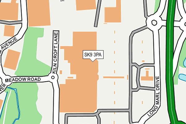
SK9 3PA is located in the Handforth electoral ward, within the unitary authority of Cheshire East and the English Parliamentary constituency of Tatton. The Sub Integrated Care Board (ICB) Location is NHS Cheshire and Merseyside ICB - 27D and the police force is Cheshire. This postcode has been in use since December 1995.


GetTheData
Source: OS OpenMap – Local (Ordnance Survey)
Source: OS VectorMap District (Ordnance Survey)
Licence: Open Government Licence (requires attribution)
| Easting | 386416 |
| Northing | 383750 |
| Latitude | 53.350477 |
| Longitude | -2.205525 |
GetTheData
Source: Open Postcode Geo
Licence: Open Government Licence
| Country | England |
| Postcode District | SK9 |
➜ See where SK9 is on a map ➜ Where is Handforth? | |
GetTheData
Source: Land Registry Price Paid Data
Licence: Open Government Licence
Elevation or altitude of SK9 3PA as distance above sea level:
| Metres | Feet | |
|---|---|---|
| Elevation | 80m | 262ft |
Elevation is measured from the approximate centre of the postcode, to the nearest point on an OS contour line from OS Terrain 50, which has contour spacing of ten vertical metres.
➜ How high above sea level am I? Find the elevation of your current position using your device's GPS.
GetTheData
Source: Open Postcode Elevation
Licence: Open Government Licence
| Ward | Handforth |
| Constituency | Tatton |
GetTheData
Source: ONS Postcode Database
Licence: Open Government Licence
| Shopping Centre (Grounds) | Handforth Dean | 164m |
| Frontline House (Epsom Avenue) | Handforth Dean | 228m |
| Earl Rd/Commercial Ave (Earl Rd) | Stanley Green | 455m |
| Ollerton Road (Spath Lane) | Handforth | 494m |
| Ollerton Road (Spath Lane) | Handforth | 504m |
| Handforth Station | 0.7km |
| Styal Station | 2.3km |
| Heald Green Station | 3km |
GetTheData
Source: NaPTAN
Licence: Open Government Licence
GetTheData
Source: ONS Postcode Database
Licence: Open Government Licence


➜ Get more ratings from the Food Standards Agency
GetTheData
Source: Food Standards Agency
Licence: FSA terms & conditions
| Last Collection | |||
|---|---|---|---|
| Location | Mon-Fri | Sat | Distance |
| Tesco Kiln Cross Lane | 17:00 | 12:00 | 102m |
| Commercial Road | 17:15 | 11:30 | 431m |
| Delamere Road | 17:15 | 11:45 | 448m |
GetTheData
Source: Dracos
Licence: Creative Commons Attribution-ShareAlike
The below table lists the International Territorial Level (ITL) codes (formerly Nomenclature of Territorial Units for Statistics (NUTS) codes) and Local Administrative Units (LAU) codes for SK9 3PA:
| ITL 1 Code | Name |
|---|---|
| TLD | North West (England) |
| ITL 2 Code | Name |
| TLD6 | Cheshire |
| ITL 3 Code | Name |
| TLD62 | Cheshire East |
| LAU 1 Code | Name |
| E06000049 | Cheshire East |
GetTheData
Source: ONS Postcode Directory
Licence: Open Government Licence
The below table lists the Census Output Area (OA), Lower Layer Super Output Area (LSOA), and Middle Layer Super Output Area (MSOA) for SK9 3PA:
| Code | Name | |
|---|---|---|
| OA | E00093830 | |
| LSOA | E01018593 | Cheshire East 004C |
| MSOA | E02003856 | Cheshire East 004 |
GetTheData
Source: ONS Postcode Directory
Licence: Open Government Licence
| SK9 3RN | Epsom Avenue | 308m |
| SK9 3RJ | Toft Way | 372m |
| SK9 3QJ | Gawsworth Way | 385m |
| SK9 3QH | Weaverham Way | 386m |
| SK9 3RB | Delamere Road | 408m |
| SK9 3RG | Marthall Way | 411m |
| SK9 3QQ | Frodsham Way | 412m |
| SK9 3ND | Lower Meadow Road | 412m |
| SK9 3QG | Heatley Way | 445m |
| SK9 3QE | Davenham Road | 446m |
GetTheData
Source: Open Postcode Geo; Land Registry Price Paid Data
Licence: Open Government Licence