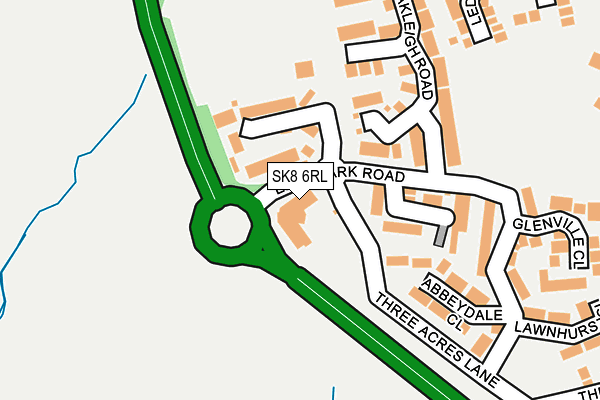
SK8 6RL is located in the Heald Green electoral ward, within the metropolitan district of Stockport and the English Parliamentary constituency of Cheadle. The Sub Integrated Care Board (ICB) Location is NHS Greater Manchester ICB - 01W and the police force is Greater Manchester. This postcode has been in use since March 2004.


GetTheData
Source: OS OpenMap – Local (Ordnance Survey)
Source: OS VectorMap District (Ordnance Survey)
Licence: Open Government Licence (requires attribution)
| Easting | 386257 |
| Northing | 385491 |
| Latitude | 53.366122 |
| Longitude | -2.207990 |
GetTheData
Source: Open Postcode Geo
Licence: Open Government Licence
| Country | England |
| Postcode District | SK8 |
➜ See where SK8 is on a map ➜ Where is Cheadle Hulme? | |
GetTheData
Source: Land Registry Price Paid Data
Licence: Open Government Licence
Elevation or altitude of SK8 6RL as distance above sea level:
| Metres | Feet | |
|---|---|---|
| Elevation | 70m | 230ft |
Elevation is measured from the approximate centre of the postcode, to the nearest point on an OS contour line from OS Terrain 50, which has contour spacing of ten vertical metres.
➜ How high above sea level am I? Find the elevation of your current position using your device's GPS.
GetTheData
Source: Open Postcode Elevation
Licence: Open Government Licence
| Ward | Heald Green |
| Constituency | Cheadle |
GetTheData
Source: ONS Postcode Database
Licence: Open Government Licence
| Wilmslow Rd/Long Ln Church (Wilmslow Rd) | Heald Green | 549m |
| Wilmslow Rd/Long Ln Church (Wilmslow Rd) | Heald Green | 560m |
| Wilmslow Rd/Griffin Ln (Wilmslow Rd) | Heald Green | 576m |
| Wilmslow Rd/Griffin Ln (Wilmslow Rd) | Heald Green | 585m |
| Wilmslow Rd/Danefield Ct (Wilmslow Rd) | Heald Green | 642m |
| Cheadle Hulme Station | 1.7km |
| Heald Green Station | 1.9km |
| Handforth Station | 2.2km |
GetTheData
Source: NaPTAN
Licence: Open Government Licence
| Median download speed | 79.9Mbps |
| Average download speed | 76.7Mbps |
| Maximum download speed | 80.00Mbps |
| Median upload speed | 20.0Mbps |
| Average upload speed | 20.0Mbps |
| Maximum upload speed | 20.00Mbps |
GetTheData
Source: Ofcom
Licence: Ofcom Terms of Use (requires attribution)
GetTheData
Source: ONS Postcode Database
Licence: Open Government Licence


➜ Get more ratings from the Food Standards Agency
GetTheData
Source: Food Standards Agency
Licence: FSA terms & conditions
| Last Collection | |||
|---|---|---|---|
| Location | Mon-Fri | Sat | Distance |
| Eden Park | 17:00 | 11:30 | 146m |
| Chedlee Drive | 17:30 | 11:30 | 480m |
| Dawson Road | 17:15 | 11:30 | 591m |
GetTheData
Source: Dracos
Licence: Creative Commons Attribution-ShareAlike
The below table lists the International Territorial Level (ITL) codes (formerly Nomenclature of Territorial Units for Statistics (NUTS) codes) and Local Administrative Units (LAU) codes for SK8 6RL:
| ITL 1 Code | Name |
|---|---|
| TLD | North West (England) |
| ITL 2 Code | Name |
| TLD3 | Greater Manchester |
| ITL 3 Code | Name |
| TLD35 | Greater Manchester South East |
| LAU 1 Code | Name |
| E08000007 | Stockport |
GetTheData
Source: ONS Postcode Directory
Licence: Open Government Licence
The below table lists the Census Output Area (OA), Lower Layer Super Output Area (LSOA), and Middle Layer Super Output Area (MSOA) for SK8 6RL:
| Code | Name | |
|---|---|---|
| OA | E00029604 | |
| LSOA | E01005848 | Stockport 040C |
| MSOA | E02001226 | Stockport 040 |
GetTheData
Source: ONS Postcode Directory
Licence: Open Government Licence
| SK8 6SX | Regency Gardens | 88m |
| SK8 6SU | Millwood Close | 109m |
| SK8 6RR | Bloomfield Close | 127m |
| SK8 6RD | Abbeydale Close | 174m |
| SK8 6SW | Greenlands Close | 204m |
| SK8 6RG | Eden Park Road | 227m |
| SK8 6SP | Oakleigh Road | 230m |
| SK8 6RP | Glenville Close | 271m |
| SK8 6SQ | Ledge Ley | 313m |
| SK8 6RH | Lawnhurst Close | 319m |
GetTheData
Source: Open Postcode Geo; Land Registry Price Paid Data
Licence: Open Government Licence