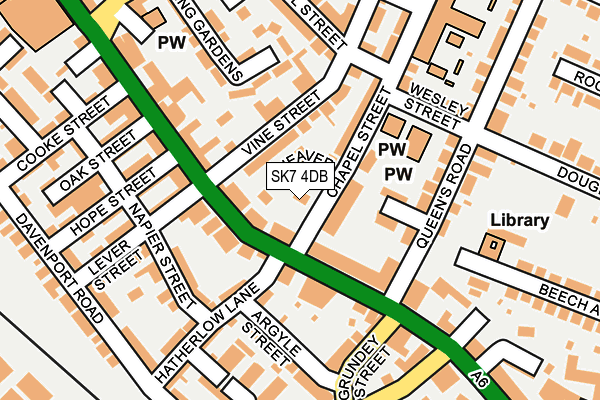
SK7 4DB is located in the Hazel Grove electoral ward, within the metropolitan district of Stockport and the English Parliamentary constituency of Hazel Grove. The Sub Integrated Care Board (ICB) Location is NHS Greater Manchester ICB - 01W and the police force is Greater Manchester. This postcode has been in use since July 2017.


GetTheData
Source: OS OpenMap – Local (Ordnance Survey)
Source: OS VectorMap District (Ordnance Survey)
Licence: Open Government Licence (requires attribution)
| Easting | 392056 |
| Northing | 387046 |
| Latitude | 53.380220 |
| Longitude | -2.120884 |
GetTheData
Source: Open Postcode Geo
Licence: Open Government Licence
| Country | England |
| Postcode District | SK7 |
➜ See where SK7 is on a map ➜ Where is Hazel Grove? | |
GetTheData
Source: Land Registry Price Paid Data
Licence: Open Government Licence
| Ward | Hazel Grove |
| Constituency | Hazel Grove |
GetTheData
Source: ONS Postcode Database
Licence: Open Government Licence
| Hatherlow Lnargyle St (Hatherlow Lae) | Hazel Grove | 96m |
| Hatherlow Lnargyle St (Hatherlow Lae) | Hazel Grove | 97m |
| London Rd/Queens Rd (London Rd) | Hazel Grove | 114m |
| London Rd/Queens Rd (London Rd) | Hazel Grove | 120m |
| Argyle St/Hatherlow Ln (Argyle St) | Hazel Grove | 157m |
| Hazel Grove Station | 0.3km |
| Woodsmoor Station | 1.6km |
| Davenport Station | 2.4km |
GetTheData
Source: NaPTAN
Licence: Open Government Licence
| Percentage of properties with Next Generation Access | 100.0% |
| Percentage of properties with Superfast Broadband | 100.0% |
| Percentage of properties with Ultrafast Broadband | 0.0% |
| Percentage of properties with Full Fibre Broadband | 0.0% |
Superfast Broadband is between 30Mbps and 300Mbps
Ultrafast Broadband is > 300Mbps
| Percentage of properties unable to receive 2Mbps | 0.0% |
| Percentage of properties unable to receive 5Mbps | 0.0% |
| Percentage of properties unable to receive 10Mbps | 0.0% |
| Percentage of properties unable to receive 30Mbps | 0.0% |
GetTheData
Source: Ofcom
Licence: Ofcom Terms of Use (requires attribution)
GetTheData
Source: ONS Postcode Database
Licence: Open Government Licence


➜ Get more ratings from the Food Standards Agency
GetTheData
Source: Food Standards Agency
Licence: FSA terms & conditions
| Last Collection | |||
|---|---|---|---|
| Location | Mon-Fri | Sat | Distance |
| Chapel Street | 18:00 | 11:00 | 145m |
| Short Street | 17:45 | 12:30 | 256m |
| Station Street | 17:40 | 11:45 | 259m |
GetTheData
Source: Dracos
Licence: Creative Commons Attribution-ShareAlike
The below table lists the International Territorial Level (ITL) codes (formerly Nomenclature of Territorial Units for Statistics (NUTS) codes) and Local Administrative Units (LAU) codes for SK7 4DB:
| ITL 1 Code | Name |
|---|---|
| TLD | North West (England) |
| ITL 2 Code | Name |
| TLD3 | Greater Manchester |
| ITL 3 Code | Name |
| TLD35 | Greater Manchester South East |
| LAU 1 Code | Name |
| E08000007 | Stockport |
GetTheData
Source: ONS Postcode Directory
Licence: Open Government Licence
The below table lists the Census Output Area (OA), Lower Layer Super Output Area (LSOA), and Middle Layer Super Output Area (MSOA) for SK7 4DB:
| Code | Name | |
|---|---|---|
| OA | E00029566 | |
| LSOA | E01005840 | Stockport 031D |
| MSOA | E02001217 | Stockport 031 |
GetTheData
Source: ONS Postcode Directory
Licence: Open Government Licence
| SK7 4HJ | London Road | 53m |
| SK7 4HT | Grove Court | 56m |
| SK7 4JS | Vine Street | 61m |
| SK7 4DQ | London Road | 81m |
| SK7 4HW | Chapel Street | 84m |
| SK7 4HS | London Road | 89m |
| SK7 4HY | Victoria Avenue | 89m |
| SK7 4DF | London Road | 90m |
| SK7 4GB | Vine Street | 110m |
| SK7 4HX | Queens Road | 128m |
GetTheData
Source: Open Postcode Geo; Land Registry Price Paid Data
Licence: Open Government Licence