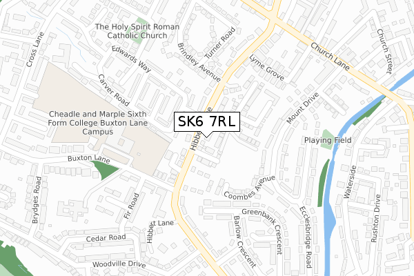
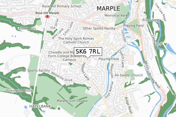
SK6 7RL is located in the Marple South & High Lane electoral ward, within the metropolitan district of Stockport and the English Parliamentary constituency of Hazel Grove. The Sub Integrated Care Board (ICB) Location is NHS Greater Manchester ICB - 01W and the police force is Greater Manchester. This postcode has been in use since October 2017.


GetTheData
Source: OS Open Zoomstack (Ordnance Survey)
Licence: Open Government Licence (requires attribution)
Attribution: Contains OS data © Crown copyright and database right 2024
Source: Open Postcode Geo
Licence: Open Government Licence (requires attribution)
Attribution: Contains OS data © Crown copyright and database right 2024; Contains Royal Mail data © Royal Mail copyright and database right 2024; Source: Office for National Statistics licensed under the Open Government Licence v.3.0
| Easting | 395592 |
| Northing | 388210 |
| Latitude | 53.390724 |
| Longitude | -2.067744 |
GetTheData
Source: Open Postcode Geo
Licence: Open Government Licence
| Country | England |
| Postcode District | SK6 |
➜ See where SK6 is on a map ➜ Where is Marple? | |
GetTheData
Source: Land Registry Price Paid Data
Licence: Open Government Licence
| Ward | Marple South & High Lane |
| Constituency | Hazel Grove |
GetTheData
Source: ONS Postcode Database
Licence: Open Government Licence
3, BOUCHER STREET, MARPLE, STOCKPORT, SK6 7RL 2018 12 OCT £479,750 |
7, BOUCHER STREET, MARPLE, STOCKPORT, SK6 7RL 2018 5 OCT £434,750 |
1, BOUCHER STREET, MARPLE, STOCKPORT, SK6 7RL 2018 31 AUG £478,950 |
5, BOUCHER STREET, MARPLE, STOCKPORT, SK6 7RL 2018 2 MAR £387,950 |
GetTheData
Source: HM Land Registry Price Paid Data
Licence: Contains HM Land Registry data © Crown copyright and database right 2024. This data is licensed under the Open Government Licence v3.0.
| Hibbert Ln/Cotefield Cl (Hibbert Ln) | Marple | 69m |
| Hibbert Ln/Cotefield Cl (Hibbert Ln) | Marple | 102m |
| Hibbert Ln/Cheadle & Marple College (Hibbert Ln) | Marple | 106m |
| Hibbert Ln/Cheadle & Marple College (Hibbert Ln) | Marple | 176m |
| Hibbert Ln/Brook Dr (Hibbert Ln) | Marple | 315m |
| Rose Hill Marple Station | 0.8km |
| Marple Station | 1.3km |
| Strines Station | 2.8km |
GetTheData
Source: NaPTAN
Licence: Open Government Licence
| Percentage of properties with Next Generation Access | 100.0% |
| Percentage of properties with Superfast Broadband | 100.0% |
| Percentage of properties with Ultrafast Broadband | 25.0% |
| Percentage of properties with Full Fibre Broadband | 0.0% |
Superfast Broadband is between 30Mbps and 300Mbps
Ultrafast Broadband is > 300Mbps
| Percentage of properties unable to receive 2Mbps | 0.0% |
| Percentage of properties unable to receive 5Mbps | 0.0% |
| Percentage of properties unable to receive 10Mbps | 0.0% |
| Percentage of properties unable to receive 30Mbps | 0.0% |
GetTheData
Source: Ofcom
Licence: Ofcom Terms of Use (requires attribution)
GetTheData
Source: ONS Postcode Database
Licence: Open Government Licence


➜ Get more ratings from the Food Standards Agency
GetTheData
Source: Food Standards Agency
Licence: FSA terms & conditions
| Last Collection | |||
|---|---|---|---|
| Location | Mon-Fri | Sat | Distance |
| Hibbert Lane | 18:00 | 11:30 | 144m |
| Mount Drive | 18:15 | 11:30 | 266m |
| Chapel Fields | 18:30 | 12:30 | 426m |
GetTheData
Source: Dracos
Licence: Creative Commons Attribution-ShareAlike
The below table lists the International Territorial Level (ITL) codes (formerly Nomenclature of Territorial Units for Statistics (NUTS) codes) and Local Administrative Units (LAU) codes for SK6 7RL:
| ITL 1 Code | Name |
|---|---|
| TLD | North West (England) |
| ITL 2 Code | Name |
| TLD3 | Greater Manchester |
| ITL 3 Code | Name |
| TLD35 | Greater Manchester South East |
| LAU 1 Code | Name |
| E08000007 | Stockport |
GetTheData
Source: ONS Postcode Directory
Licence: Open Government Licence
The below table lists the Census Output Area (OA), Lower Layer Super Output Area (LSOA), and Middle Layer Super Output Area (MSOA) for SK6 7RL:
| Code | Name | |
|---|---|---|
| OA | E00029783 | |
| LSOA | E01005878 | Stockport 020A |
| MSOA | E02001206 | Stockport 020 |
GetTheData
Source: ONS Postcode Directory
Licence: Open Government Licence
| SK6 7NP | Hibbert Lane | 45m |
| SK6 7BW | Coombes Avenue | 147m |
| SK6 7PU | Ash Grove | 160m |
| SK6 7PX | Edwards Way | 175m |
| SK6 7PS | Carver Road | 177m |
| SK6 7BA | Mount Drive | 194m |
| SK6 7NT | Hibbert Lane | 200m |
| SK6 7NW | Lyme Grove | 211m |
| SK6 7PT | Windsor Drive | 216m |
| SK6 7NZ | Hibbert Lane | 223m |
GetTheData
Source: Open Postcode Geo; Land Registry Price Paid Data
Licence: Open Government Licence