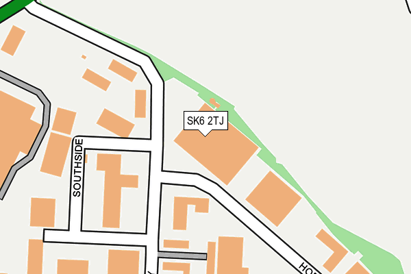
SK6 2TJ is located in the Bredbury & Woodley electoral ward, within the metropolitan district of Stockport and the English Parliamentary constituency of Hazel Grove. The Sub Integrated Care Board (ICB) Location is NHS Greater Manchester ICB - 01W and the police force is Greater Manchester. This postcode has been in use since June 2000.


GetTheData
Source: OS OpenMap – Local (Ordnance Survey)
Source: OS VectorMap District (Ordnance Survey)
Licence: Open Government Licence (requires attribution)
| Easting | 392479 |
| Northing | 392777 |
| Latitude | 53.431723 |
| Longitude | -2.114664 |
GetTheData
Source: Open Postcode Geo
Licence: Open Government Licence
| Country | England |
| Postcode District | SK6 |
➜ See where SK6 is on a map ➜ Where is Bredbury? | |
GetTheData
Source: Land Registry Price Paid Data
Licence: Open Government Licence
Elevation or altitude of SK6 2TJ as distance above sea level:
| Metres | Feet | |
|---|---|---|
| Elevation | 90m | 295ft |
Elevation is measured from the approximate centre of the postcode, to the nearest point on an OS contour line from OS Terrain 50, which has contour spacing of ten vertical metres.
➜ How high above sea level am I? Find the elevation of your current position using your device's GPS.
GetTheData
Source: Open Postcode Elevation
Licence: Open Government Licence
| Ward | Bredbury & Woodley |
| Constituency | Hazel Grove |
GetTheData
Source: ONS Postcode Database
Licence: Open Government Licence
| Ashton Rd/Bredbury Parkway (Ashton Rd) | Castle Hill | 342m |
| Ashton Rd/Stuart Rd (Ashton Rd) | Castle Hill | 419m |
| Ashton Rd/Horsfield Arms (Ashton Rd) | Castle Hill | 479m |
| Ashton Rd/Arden Arms (Ashton Rd) | Castle Hill | 519m |
| Ashton Rd/Arden Arms (Ashton Rd) | Castle Hill | 530m |
| Bredbury Station | 1km |
| Brinnington Station | 1.4km |
| Woodley Station | 1.4km |
GetTheData
Source: NaPTAN
Licence: Open Government Licence
GetTheData
Source: ONS Postcode Database
Licence: Open Government Licence


➜ Get more ratings from the Food Standards Agency
GetTheData
Source: Food Standards Agency
Licence: FSA terms & conditions
| Last Collection | |||
|---|---|---|---|
| Location | Mon-Fri | Sat | Distance |
| Brebury Park Way | 18:15 | 11:30 | 308m |
| Cromwell Road | 17:30 | 11:30 | 397m |
| Castle Hill | 16:00 | 11:30 | 547m |
GetTheData
Source: Dracos
Licence: Creative Commons Attribution-ShareAlike
The below table lists the International Territorial Level (ITL) codes (formerly Nomenclature of Territorial Units for Statistics (NUTS) codes) and Local Administrative Units (LAU) codes for SK6 2TJ:
| ITL 1 Code | Name |
|---|---|
| TLD | North West (England) |
| ITL 2 Code | Name |
| TLD3 | Greater Manchester |
| ITL 3 Code | Name |
| TLD35 | Greater Manchester South East |
| LAU 1 Code | Name |
| E08000007 | Stockport |
GetTheData
Source: ONS Postcode Directory
Licence: Open Government Licence
The below table lists the Census Output Area (OA), Lower Layer Super Output Area (LSOA), and Middle Layer Super Output Area (MSOA) for SK6 2TJ:
| Code | Name | |
|---|---|---|
| OA | E00029093 | |
| LSOA | E01005744 | Stockport 009B |
| MSOA | E02001195 | Stockport 009 |
GetTheData
Source: ONS Postcode Directory
Licence: Open Government Licence
| SK6 2SN | Bredbury Park Way | 166m |
| SK6 2SD | Latham Close | 387m |
| SK6 2SU | Horsfield Way | 392m |
| SK6 2RY | Castle Hill | 476m |
| SK6 2QN | Ashton Road | 497m |
| SK6 2SR | Stuart Road | 552m |
| SK6 1RY | Lowick Green | 581m |
| SK6 2TD | Horsfield Way | 590m |
| SK6 2RZ | Arden Road | 668m |
| SK6 2QT | Lingard Lane | 681m |
GetTheData
Source: Open Postcode Geo; Land Registry Price Paid Data
Licence: Open Government Licence