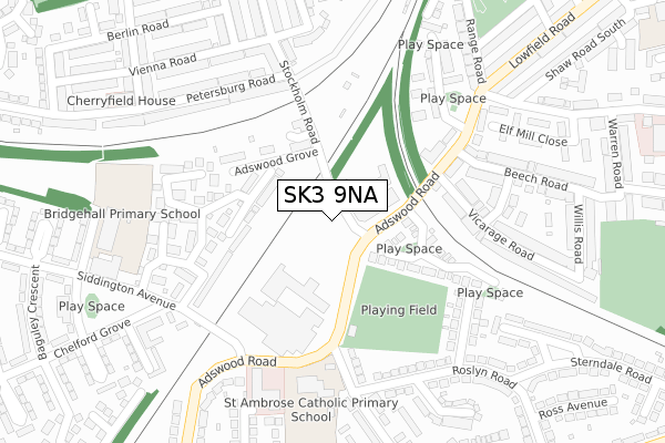
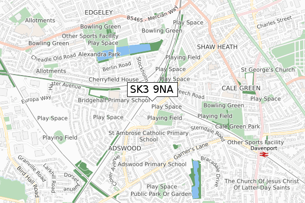
SK3 9NA is located in the Davenport & Cale Green electoral ward, within the metropolitan district of Stockport and the English Parliamentary constituency of Stockport. The Sub Integrated Care Board (ICB) Location is NHS Greater Manchester ICB - 01W and the police force is Greater Manchester. This postcode has been in use since September 2019.


GetTheData
Source: OS Open Zoomstack (Ordnance Survey)
Licence: Open Government Licence (requires attribution)
Attribution: Contains OS data © Crown copyright and database right 2024
Source: Open Postcode Geo
Licence: Open Government Licence (requires attribution)
Attribution: Contains OS data © Crown copyright and database right 2024; Contains Royal Mail data © Royal Mail copyright and database right 2024; Source: Office for National Statistics licensed under the Open Government Licence v.3.0
| Easting | 389050 |
| Northing | 388645 |
| Latitude | 53.394538 |
| Longitude | -2.166128 |
GetTheData
Source: Open Postcode Geo
Licence: Open Government Licence
| Country | England |
| Postcode District | SK3 |
➜ See where SK3 is on a map ➜ Where is Stockport? | |
GetTheData
Source: Land Registry Price Paid Data
Licence: Open Government Licence
| Ward | Davenport & Cale Green |
| Constituency | Stockport |
GetTheData
Source: ONS Postcode Database
Licence: Open Government Licence
| Stockholm Rd/Adswood Rd (Stockholm Rd) | Edgeley | 40m |
| Stockholm Rd/Adswood Rd (Stockholm Rd) | Edgeley | 56m |
| Adswood Rd/Siddington Ave (Adswood Rd) | Adswood | 201m |
| Adswood Rd/Siddington Ave (Adswood Rd) | Adswood | 216m |
| Adswood Rd/Range Rd (Adswood Rd) | Cale Green | 242m |
| Davenport Station | 1km |
| Stockport Station | 1.2km |
| Woodsmoor Station | 1.8km |
GetTheData
Source: NaPTAN
Licence: Open Government Licence
GetTheData
Source: ONS Postcode Database
Licence: Open Government Licence


➜ Get more ratings from the Food Standards Agency
GetTheData
Source: Food Standards Agency
Licence: FSA terms & conditions
| Last Collection | |||
|---|---|---|---|
| Location | Mon-Fri | Sat | Distance |
| Berlin Road | 17:30 | 11:45 | 401m |
| Bridge Hall Tso | 17:15 | 12:15 | 414m |
| Garners Lane | 17:30 | 12:00 | 477m |
GetTheData
Source: Dracos
Licence: Creative Commons Attribution-ShareAlike
The below table lists the International Territorial Level (ITL) codes (formerly Nomenclature of Territorial Units for Statistics (NUTS) codes) and Local Administrative Units (LAU) codes for SK3 9NA:
| ITL 1 Code | Name |
|---|---|
| TLD | North West (England) |
| ITL 2 Code | Name |
| TLD3 | Greater Manchester |
| ITL 3 Code | Name |
| TLD35 | Greater Manchester South East |
| LAU 1 Code | Name |
| E08000007 | Stockport |
GetTheData
Source: ONS Postcode Directory
Licence: Open Government Licence
The below table lists the Census Output Area (OA), Lower Layer Super Output Area (LSOA), and Middle Layer Super Output Area (MSOA) for SK3 9NA:
| Code | Name | |
|---|---|---|
| OA | E00029200 | |
| LSOA | E01005759 | Stockport 023A |
| MSOA | E02001209 | Stockport 023 |
GetTheData
Source: ONS Postcode Directory
Licence: Open Government Licence
| SK3 9QT | Stockholm Road | 56m |
| SK3 8GN | Newsham Road | 152m |
| SK3 8UN | Pintail Avenue | 165m |
| SK3 9PN | Stockholm Road | 179m |
| SK3 8HN | Vicarage Road | 189m |
| SK3 9QU | Adswood Grove | 193m |
| SK3 8HW | Adswood Road | 205m |
| SK3 8EN | Chelburn Court | 206m |
| SK3 8LJ | Shirley Grove | 219m |
| SK3 8US | Petrel Close | 227m |
GetTheData
Source: Open Postcode Geo; Land Registry Price Paid Data
Licence: Open Government Licence