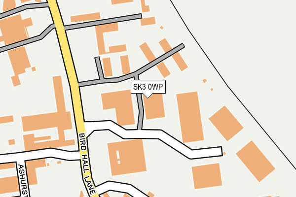
SK3 0WP is located in the Cheadle East & Cheadle Hulme North electoral ward, within the metropolitan district of Stockport and the English Parliamentary constituency of Stockport. The Sub Integrated Care Board (ICB) Location is NHS Greater Manchester ICB - 01W and the police force is Greater Manchester. This postcode has been in use since June 1997.


GetTheData
Source: OS OpenMap – Local (Ordnance Survey)
Source: OS VectorMap District (Ordnance Survey)
Licence: Open Government Licence (requires attribution)
| Easting | 387993 |
| Northing | 388401 |
| Latitude | 53.392305 |
| Longitude | -2.182014 |
GetTheData
Source: Open Postcode Geo
Licence: Open Government Licence
| Country | England |
| Postcode District | SK3 |
➜ See where SK3 is on a map ➜ Where is Stockport? | |
GetTheData
Source: Land Registry Price Paid Data
Licence: Open Government Licence
Elevation or altitude of SK3 0WP as distance above sea level:
| Metres | Feet | |
|---|---|---|
| Elevation | 60m | 197ft |
Elevation is measured from the approximate centre of the postcode, to the nearest point on an OS contour line from OS Terrain 50, which has contour spacing of ten vertical metres.
➜ How high above sea level am I? Find the elevation of your current position using your device's GPS.
GetTheData
Source: Open Postcode Elevation
Licence: Open Government Licence
| Ward | Cheadle East & Cheadle Hulme North |
| Constituency | Stockport |
GetTheData
Source: ONS Postcode Database
Licence: Open Government Licence
| Bird Hall Ln/Orion Business Park (Bird Hall Ln) | Adswood | 139m |
| Bird Hall Ln/Orion Business Pk (Bird Hall Ln) | Adswood | 203m |
| Bird Hall Rd/Beechurst Rd (Bird Hall Rd) | Adswood | 251m |
| Bird Hall Rd/Chatsworth Rd (Bird Hall Rd) | Adswood | 338m |
| Alvanley Cres/Rainow Rd (Alvanley Cres) | Adswood | 411m |
| Cheadle Hulme Station | 1.9km |
| Davenport Station | 1.9km |
| Stockport Station | 1.9km |
GetTheData
Source: NaPTAN
Licence: Open Government Licence
GetTheData
Source: ONS Postcode Database
Licence: Open Government Licence


➜ Get more ratings from the Food Standards Agency
GetTheData
Source: Food Standards Agency
Licence: FSA terms & conditions
| Last Collection | |||
|---|---|---|---|
| Location | Mon-Fri | Sat | Distance |
| Grosvenor Road | 17:30 | 11:30 | 497m |
| Bridge Hall Tso | 17:15 | 12:15 | 672m |
| Edgeley Road | 17:30 | 11:45 | 770m |
GetTheData
Source: Dracos
Licence: Creative Commons Attribution-ShareAlike
| Risk of SK3 0WP flooding from rivers and sea | Medium |
| ➜ SK3 0WP flood map | |
GetTheData
Source: Open Flood Risk by Postcode
Licence: Open Government Licence
The below table lists the International Territorial Level (ITL) codes (formerly Nomenclature of Territorial Units for Statistics (NUTS) codes) and Local Administrative Units (LAU) codes for SK3 0WP:
| ITL 1 Code | Name |
|---|---|
| TLD | North West (England) |
| ITL 2 Code | Name |
| TLD3 | Greater Manchester |
| ITL 3 Code | Name |
| TLD35 | Greater Manchester South East |
| LAU 1 Code | Name |
| E08000007 | Stockport |
GetTheData
Source: ONS Postcode Directory
Licence: Open Government Licence
The below table lists the Census Output Area (OA), Lower Layer Super Output Area (LSOA), and Middle Layer Super Output Area (MSOA) for SK3 0WP:
| Code | Name | |
|---|---|---|
| OA | E00029204 | |
| LSOA | E01005761 | Stockport 026A |
| MSOA | E02001212 | Stockport 026 |
GetTheData
Source: ONS Postcode Directory
Licence: Open Government Licence
| SK3 0UX | Hercules Office Park | 95m |
| SK3 0XN | Bird Hall Lane | 301m |
| SK8 5QH | Birdhall Road | 302m |
| SK8 5QG | Beechurst Road | 319m |
| SK8 5QL | Granville Road | 331m |
| SK8 5QE | Birdhall Road | 332m |
| SK8 5QW | Larkhill Road | 341m |
| SK8 5QP | Athlone Avenue | 349m |
| SK8 5QQ | Berwyn Avenue | 369m |
| SK8 5QF | Chatsworth Road | 377m |
GetTheData
Source: Open Postcode Geo; Land Registry Price Paid Data
Licence: Open Government Licence