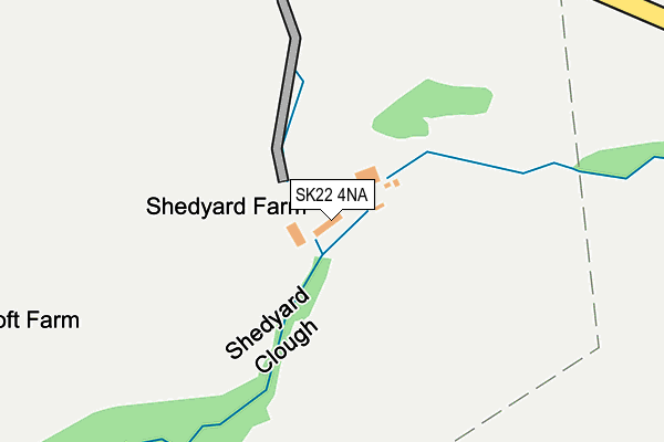
SK22 4NA is located in the New Mills East electoral ward, within the local authority district of High Peak and the English Parliamentary constituency of High Peak. The Sub Integrated Care Board (ICB) Location is NHS Derby and Derbyshire ICB - 15M and the police force is Derbyshire. This postcode has been in use since June 2017.


GetTheData
Source: OS OpenMap – Local (Ordnance Survey)
Source: OS VectorMap District (Ordnance Survey)
Licence: Open Government Licence (requires attribution)
| Easting | 401714 |
| Northing | 384573 |
| Latitude | 53.358049 |
| Longitude | -1.975709 |
GetTheData
Source: Open Postcode Geo
Licence: Open Government Licence
| Country | England |
| Postcode District | SK22 |
➜ See where SK22 is on a map | |
GetTheData
Source: Land Registry Price Paid Data
Licence: Open Government Licence
| Ward | New Mills East |
| Constituency | High Peak |
GetTheData
Source: ONS Postcode Database
Licence: Open Government Licence
| New Street Flats (New Street) | New Mills | 1,231m |
| Cale Road (Low Leighton Road) | New Mills | 1,315m |
| Park Road (Jubilee Street) | New Mills | 1,366m |
| Park Road (Jubilee Street) | New Mills | 1,373m |
| Marsh Lane (Low Leighton Road) | New Mills | 1,375m |
| Furness Vale Station | 1.4km |
| New Mills Central Station | 2.1km |
| New Mills Newtown Station | 2.2km |
GetTheData
Source: NaPTAN
Licence: Open Government Licence
| Percentage of properties with Next Generation Access | 100.0% |
| Percentage of properties with Superfast Broadband | 0.0% |
| Percentage of properties with Ultrafast Broadband | 0.0% |
| Percentage of properties with Full Fibre Broadband | 0.0% |
Superfast Broadband is between 30Mbps and 300Mbps
Ultrafast Broadband is > 300Mbps
| Percentage of properties unable to receive 2Mbps | 0.0% |
| Percentage of properties unable to receive 5Mbps | 0.0% |
| Percentage of properties unable to receive 10Mbps | 0.0% |
| Percentage of properties unable to receive 30Mbps | 100.0% |
GetTheData
Source: Ofcom
Licence: Ofcom Terms of Use (requires attribution)
GetTheData
Source: ONS Postcode Database
Licence: Open Government Licence


➜ Get more ratings from the Food Standards Agency
GetTheData
Source: Food Standards Agency
Licence: FSA terms & conditions
| Last Collection | |||
|---|---|---|---|
| Location | Mon-Fri | Sat | Distance |
| Goyt Road/ Jubilee Road | 17:30 | 11:45 | 1,304m |
| Long Side Road | 17:30 | 11:45 | 1,305m |
| Bank End Furness Vale | 17:15 | 09:15 | 1,433m |
GetTheData
Source: Dracos
Licence: Creative Commons Attribution-ShareAlike
The below table lists the International Territorial Level (ITL) codes (formerly Nomenclature of Territorial Units for Statistics (NUTS) codes) and Local Administrative Units (LAU) codes for SK22 4NA:
| ITL 1 Code | Name |
|---|---|
| TLF | East Midlands (England) |
| ITL 2 Code | Name |
| TLF1 | Derbyshire and Nottinghamshire |
| ITL 3 Code | Name |
| TLF13 | South and West Derbyshire |
| LAU 1 Code | Name |
| E07000037 | High Peak |
GetTheData
Source: ONS Postcode Directory
Licence: Open Government Licence
The below table lists the Census Output Area (OA), Lower Layer Super Output Area (LSOA), and Middle Layer Super Output Area (MSOA) for SK22 4NA:
| Code | Name | |
|---|---|---|
| OA | E00099898 | |
| LSOA | E01019744 | High Peak 006D |
| MSOA | E02004098 | High Peak 006 |
GetTheData
Source: ONS Postcode Directory
Licence: Open Government Licence
| SK23 7QF | 446m | |
| SK22 4QN | 458m | |
| SK23 7TD | Ladypit Road | 892m |
| SK22 4PR | Carr View | 924m |
| SK22 4LU | Laneside Road | 955m |
| SK23 7QE | Gowhole | 981m |
| SK23 7QG | Dolly Lane | 1029m |
| SK23 7SN | Goyt Valley Industrial Estate | 1083m |
| SK23 7UA | Calico Lane | 1092m |
| SK22 4QW | 1118m |
GetTheData
Source: Open Postcode Geo; Land Registry Price Paid Data
Licence: Open Government Licence