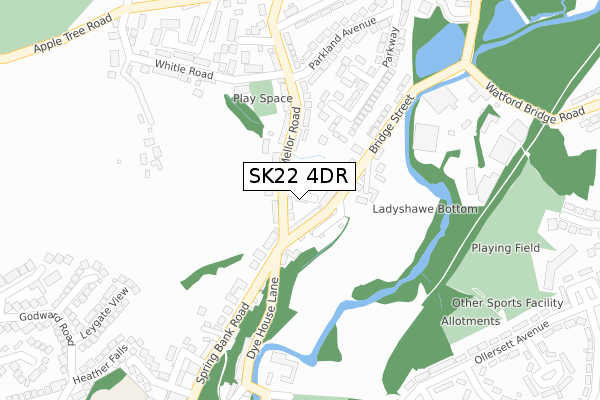
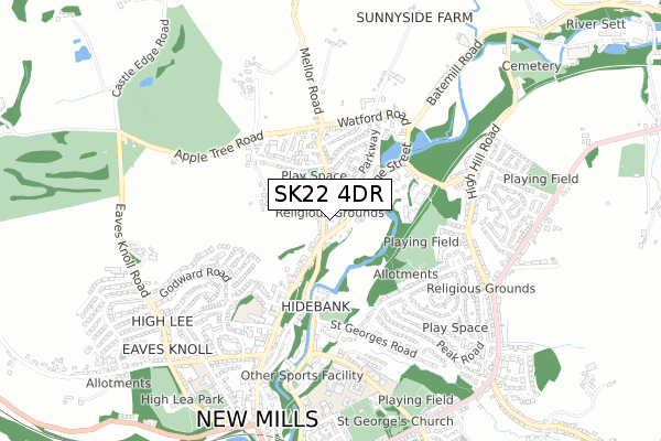
SK22 4DR lies on Stafford Street in New Mills, High Peak. SK22 4DR is located in the Sett electoral ward, within the local authority district of High Peak and the English Parliamentary constituency of High Peak. The Sub Integrated Care Board (ICB) Location is NHS Derby and Derbyshire ICB - 15M and the police force is Derbyshire. This postcode has been in use since December 1996.


GetTheData
Source: OS Open Zoomstack (Ordnance Survey)
Licence: Open Government Licence (requires attribution)
Attribution: Contains OS data © Crown copyright and database right 2025
Source: Open Postcode Geo
Licence: Open Government Licence (requires attribution)
Attribution: Contains OS data © Crown copyright and database right 2025; Contains Royal Mail data © Royal Mail copyright and database right 2025; Source: Office for National Statistics licensed under the Open Government Licence v.3.0
| Easting | 400256 |
| Northing | 386185 |
| Latitude | 53.372526 |
| Longitude | -1.997616 |
GetTheData
Source: Open Postcode Geo
Licence: Open Government Licence
| Street | Stafford Street |
| Locality | New Mills |
| Town/City | High Peak |
| Country | England |
| Postcode District | SK22 |
➜ See where SK22 is on a map ➜ Where is New Mills? | |
GetTheData
Source: Land Registry Price Paid Data
Licence: Open Government Licence
Elevation or altitude of SK22 4DR as distance above sea level:
| Metres | Feet | |
|---|---|---|
| Elevation | 160m | 525ft |
Elevation is measured from the approximate centre of the postcode, to the nearest point on an OS contour line from OS Terrain 50, which has contour spacing of ten vertical metres.
➜ How high above sea level am I? Find the elevation of your current position using your device's GPS.
GetTheData
Source: Open Postcode Elevation
Licence: Open Government Licence
| Ward | Sett |
| Constituency | High Peak |
GetTheData
Source: ONS Postcode Database
Licence: Open Government Licence
| Mellor Road | New Mills | 86m |
| White Hart (Spring Bank Road) | New Mills | 129m |
| White Hart (Spring Bank Road) | New Mills | 156m |
| Parkland Avenue Ne Bound (Parkland Avenue) | New Mills | 281m |
| Bridge Street | New Mills | 323m |
| New Mills Central Station | 1km |
| New Mills Newtown Station | 1.6km |
| Strines Station | 2.4km |
GetTheData
Source: NaPTAN
Licence: Open Government Licence
| Percentage of properties with Next Generation Access | 100.0% |
| Percentage of properties with Superfast Broadband | 100.0% |
| Percentage of properties with Ultrafast Broadband | 0.0% |
| Percentage of properties with Full Fibre Broadband | 0.0% |
Superfast Broadband is between 30Mbps and 300Mbps
Ultrafast Broadband is > 300Mbps
| Percentage of properties unable to receive 2Mbps | 0.0% |
| Percentage of properties unable to receive 5Mbps | 0.0% |
| Percentage of properties unable to receive 10Mbps | 0.0% |
| Percentage of properties unable to receive 30Mbps | 0.0% |
GetTheData
Source: Ofcom
Licence: Ofcom Terms of Use (requires attribution)
GetTheData
Source: ONS Postcode Database
Licence: Open Government Licence


➜ Get more ratings from the Food Standards Agency
GetTheData
Source: Food Standards Agency
Licence: FSA terms & conditions
| Last Collection | |||
|---|---|---|---|
| Location | Mon-Fri | Sat | Distance |
| Bridge Street | 17:45 | 11:45 | 95m |
| White Road | 16:45 | 11:45 | 293m |
| Ollersett Ave | 17:30 | 11:45 | 404m |
GetTheData
Source: Dracos
Licence: Creative Commons Attribution-ShareAlike
The below table lists the International Territorial Level (ITL) codes (formerly Nomenclature of Territorial Units for Statistics (NUTS) codes) and Local Administrative Units (LAU) codes for SK22 4DR:
| ITL 1 Code | Name |
|---|---|
| TLF | East Midlands (England) |
| ITL 2 Code | Name |
| TLF1 | Derbyshire and Nottinghamshire |
| ITL 3 Code | Name |
| TLF13 | South and West Derbyshire |
| LAU 1 Code | Name |
| E07000037 | High Peak |
GetTheData
Source: ONS Postcode Directory
Licence: Open Government Licence
The below table lists the Census Output Area (OA), Lower Layer Super Output Area (LSOA), and Middle Layer Super Output Area (MSOA) for SK22 4DR:
| Code | Name | |
|---|---|---|
| OA | E00099955 | |
| LSOA | E01019755 | High Peak 005D |
| MSOA | E02004097 | High Peak 005 |
GetTheData
Source: ONS Postcode Directory
Licence: Open Government Licence
| SK22 4DW | Mellor Road | 19m |
| SK22 4DJ | Bridge Street | 31m |
| SK22 4DP | Mellor Road | 119m |
| SK22 4DN | Bridge Street | 161m |
| SK22 4EU | Parkhill Close | 165m |
| SK22 4BH | Spring Bank | 170m |
| SK22 4DZ | Fernilee Close | 233m |
| SK22 4ET | Park View Rise | 242m |
| SK22 4EQ | 251m | |
| SK22 4BA | Dyehouse Lane | 259m |
GetTheData
Source: Open Postcode Geo; Land Registry Price Paid Data
Licence: Open Government Licence