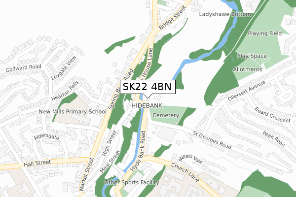
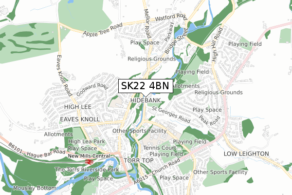
SK22 4BN lies on Salem Cottages in New Mills, High Peak. SK22 4BN is located in the New Mills East electoral ward, within the local authority district of High Peak and the English Parliamentary constituency of High Peak. The Sub Integrated Care Board (ICB) Location is NHS Derby and Derbyshire ICB - 15M and the police force is Derbyshire. This postcode has been in use since December 1996.


GetTheData
Source: OS Open Zoomstack (Ordnance Survey)
Licence: Open Government Licence (requires attribution)
Attribution: Contains OS data © Crown copyright and database right 2025
Source: Open Postcode Geo
Licence: Open Government Licence (requires attribution)
Attribution: Contains OS data © Crown copyright and database right 2025; Contains Royal Mail data © Royal Mail copyright and database right 2025; Source: Office for National Statistics licensed under the Open Government Licence v.3.0
| Easting | 400204 |
| Northing | 385884 |
| Latitude | 53.369836 |
| Longitude | -1.998397 |
GetTheData
Source: Open Postcode Geo
Licence: Open Government Licence
| Street | Salem Cottages |
| Locality | New Mills |
| Town/City | High Peak |
| Country | England |
| Postcode District | SK22 |
➜ See where SK22 is on a map ➜ Where is New Mills? | |
GetTheData
Source: Land Registry Price Paid Data
Licence: Open Government Licence
Elevation or altitude of SK22 4BN as distance above sea level:
| Metres | Feet | |
|---|---|---|
| Elevation | 150m | 492ft |
Elevation is measured from the approximate centre of the postcode, to the nearest point on an OS contour line from OS Terrain 50, which has contour spacing of ten vertical metres.
➜ How high above sea level am I? Find the elevation of your current position using your device's GPS.
GetTheData
Source: Open Postcode Elevation
Licence: Open Government Licence
| Ward | New Mills East |
| Constituency | High Peak |
GetTheData
Source: ONS Postcode Database
Licence: Open Government Licence
| White Hart (Spring Bank Road) | New Mills | 164m |
| White Hart (Spring Bank Road) | New Mills | 184m |
| Church Lane Clinic (Church Lane) | New Mills | 203m |
| Church Lane Clinic (Church Lane) | New Mills | 211m |
| Town Hall (Market Street) | New Mills | 220m |
| New Mills Central Station | 0.7km |
| New Mills Newtown Station | 1.3km |
| Furness Vale Station | 2.4km |
GetTheData
Source: NaPTAN
Licence: Open Government Licence
| Percentage of properties with Next Generation Access | 100.0% |
| Percentage of properties with Superfast Broadband | 100.0% |
| Percentage of properties with Ultrafast Broadband | 0.0% |
| Percentage of properties with Full Fibre Broadband | 0.0% |
Superfast Broadband is between 30Mbps and 300Mbps
Ultrafast Broadband is > 300Mbps
| Percentage of properties unable to receive 2Mbps | 0.0% |
| Percentage of properties unable to receive 5Mbps | 0.0% |
| Percentage of properties unable to receive 10Mbps | 0.0% |
| Percentage of properties unable to receive 30Mbps | 0.0% |
GetTheData
Source: Ofcom
Licence: Ofcom Terms of Use (requires attribution)
GetTheData
Source: ONS Postcode Database
Licence: Open Government Licence


➜ Get more ratings from the Food Standards Agency
GetTheData
Source: Food Standards Agency
Licence: FSA terms & conditions
| Last Collection | |||
|---|---|---|---|
| Location | Mon-Fri | Sat | Distance |
| Bridge Street | 17:45 | 11:45 | 211m |
| Spring Bank | 17:45 | 11:45 | 255m |
| Ollersett Ave | 17:30 | 11:45 | 348m |
GetTheData
Source: Dracos
Licence: Creative Commons Attribution-ShareAlike
| Risk of SK22 4BN flooding from rivers and sea | Medium |
| ➜ SK22 4BN flood map | |
GetTheData
Source: Open Flood Risk by Postcode
Licence: Open Government Licence
The below table lists the International Territorial Level (ITL) codes (formerly Nomenclature of Territorial Units for Statistics (NUTS) codes) and Local Administrative Units (LAU) codes for SK22 4BN:
| ITL 1 Code | Name |
|---|---|
| TLF | East Midlands (England) |
| ITL 2 Code | Name |
| TLF1 | Derbyshire and Nottinghamshire |
| ITL 3 Code | Name |
| TLF13 | South and West Derbyshire |
| LAU 1 Code | Name |
| E07000037 | High Peak |
GetTheData
Source: ONS Postcode Directory
Licence: Open Government Licence
The below table lists the Census Output Area (OA), Lower Layer Super Output Area (LSOA), and Middle Layer Super Output Area (MSOA) for SK22 4BN:
| Code | Name | |
|---|---|---|
| OA | E00099891 | |
| LSOA | E01019743 | High Peak 006C |
| MSOA | E02004098 | High Peak 006 |
GetTheData
Source: ONS Postcode Directory
Licence: Open Government Licence
| SK22 4BL | High Street | 55m |
| SK22 4BA | Dyehouse Lane | 67m |
| SK22 4BW | Hyde Bank Road | 112m |
| SK22 4BG | Off Spring Bank | 119m |
| SK22 4BQ | Spring Mount | 140m |
| SK22 4AZ | Spring Bank | 155m |
| SK22 4BR | High Street | 159m |
| SK22 4BD | Cresswell Street | 170m |
| SK22 4BE | Cresswell Avenue | 171m |
| SK22 4BH | Spring Bank | 172m |
GetTheData
Source: Open Postcode Geo; Land Registry Price Paid Data
Licence: Open Government Licence