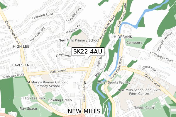
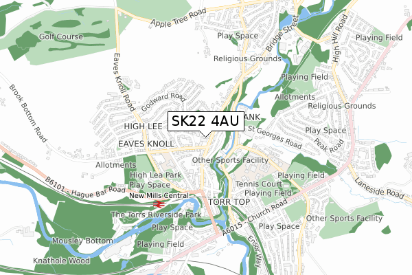
SK22 4AU is located in the New Mills West electoral ward, within the local authority district of High Peak and the English Parliamentary constituency of High Peak. The Sub Integrated Care Board (ICB) Location is NHS Derby and Derbyshire ICB - 15M and the police force is Derbyshire. This postcode has been in use since January 2018.


GetTheData
Source: OS Open Zoomstack (Ordnance Survey)
Licence: Open Government Licence (requires attribution)
Attribution: Contains OS data © Crown copyright and database right 2024
Source: Open Postcode Geo
Licence: Open Government Licence (requires attribution)
Attribution: Contains OS data © Crown copyright and database right 2024; Contains Royal Mail data © Royal Mail copyright and database right 2024; Source: Office for National Statistics licensed under the Open Government Licence v.3.0
| Easting | 399997 |
| Northing | 385737 |
| Latitude | 53.368515 |
| Longitude | -2.001508 |
GetTheData
Source: Open Postcode Geo
Licence: Open Government Licence
| Country | England |
| Postcode District | SK22 |
➜ See where SK22 is on a map ➜ Where is New Mills? | |
GetTheData
Source: Land Registry Price Paid Data
Licence: Open Government Licence
| Ward | New Mills West |
| Constituency | High Peak |
GetTheData
Source: ONS Postcode Database
Licence: Open Government Licence
| Town Hall (Market Street) | New Mills | 36m |
| Town Hall (Market Street) | New Mills | 41m |
| The Pool (Hyde Bank Road) | New Mills | 174m |
| The Pool (Hyde Bank Road) | New Mills | 185m |
| Church Lane Clinic (Church Lane) | New Mills | 233m |
| New Mills Central Station | 0.5km |
| New Mills Newtown Station | 1.1km |
| Strines Station | 2.3km |
GetTheData
Source: NaPTAN
Licence: Open Government Licence
GetTheData
Source: ONS Postcode Database
Licence: Open Government Licence


➜ Get more ratings from the Food Standards Agency
GetTheData
Source: Food Standards Agency
Licence: FSA terms & conditions
| Last Collection | |||
|---|---|---|---|
| Location | Mon-Fri | Sat | Distance |
| Spring Bank | 17:45 | 11:45 | 52m |
| Torr Top P.o. | 17:45 | 12:00 | 191m |
| High Lee Eaves, Knoll Road | 17:30 | 11:45 | 354m |
GetTheData
Source: Dracos
Licence: Creative Commons Attribution-ShareAlike
The below table lists the International Territorial Level (ITL) codes (formerly Nomenclature of Territorial Units for Statistics (NUTS) codes) and Local Administrative Units (LAU) codes for SK22 4AU:
| ITL 1 Code | Name |
|---|---|
| TLF | East Midlands (England) |
| ITL 2 Code | Name |
| TLF1 | Derbyshire and Nottinghamshire |
| ITL 3 Code | Name |
| TLF13 | South and West Derbyshire |
| LAU 1 Code | Name |
| E07000037 | High Peak |
GetTheData
Source: ONS Postcode Directory
Licence: Open Government Licence
The below table lists the Census Output Area (OA), Lower Layer Super Output Area (LSOA), and Middle Layer Super Output Area (MSOA) for SK22 4AU:
| Code | Name | |
|---|---|---|
| OA | E00099909 | |
| LSOA | E01019746 | High Peak 005A |
| MSOA | E02004097 | High Peak 005 |
GetTheData
Source: ONS Postcode Directory
Licence: Open Government Licence
| SK22 4AS | Spring Bank | 21m |
| SK22 4AY | Meadow Street | 34m |
| SK22 4AP | Cross Street | 66m |
| SK22 4AL | High Street | 86m |
| SK22 4AW | Church View | 96m |
| SK22 4DE | Market Street | 103m |
| SK22 4BR | High Street | 105m |
| SK22 4AH | Meal Street | 108m |
| SK22 4AZ | Spring Bank | 120m |
| SK22 4AE | Market Street | 128m |
GetTheData
Source: Open Postcode Geo; Land Registry Price Paid Data
Licence: Open Government Licence