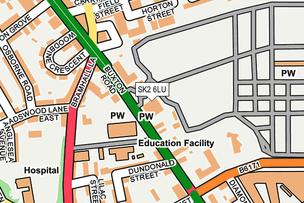
SK2 6LU is located in the Manor electoral ward, within the metropolitan district of Stockport and the English Parliamentary constituency of Stockport. The Sub Integrated Care Board (ICB) Location is NHS Greater Manchester ICB - 01W and the police force is Greater Manchester. This postcode has been in use since January 1980.


GetTheData
Source: OS OpenMap – Local (Ordnance Survey)
Source: OS VectorMap District (Ordnance Survey)
Licence: Open Government Licence (requires attribution)
| Easting | 390051 |
| Northing | 388988 |
| Latitude | 53.397625 |
| Longitude | -2.151087 |
GetTheData
Source: Open Postcode Geo
Licence: Open Government Licence
| Country | England |
| Postcode District | SK2 |
➜ See where SK2 is on a map ➜ Where is Stockport? | |
GetTheData
Source: Land Registry Price Paid Data
Licence: Open Government Licence
Elevation or altitude of SK2 6LU as distance above sea level:
| Metres | Feet | |
|---|---|---|
| Elevation | 80m | 262ft |
Elevation is measured from the approximate centre of the postcode, to the nearest point on an OS contour line from OS Terrain 50, which has contour spacing of ten vertical metres.
➜ How high above sea level am I? Find the elevation of your current position using your device's GPS.
GetTheData
Source: Open Postcode Elevation
Licence: Open Government Licence
| Ward | Manor |
| Constituency | Stockport |
GetTheData
Source: ONS Postcode Database
Licence: Open Government Licence
| Buxton Rd/Bramhall Ln (Wellington Rd S) | Heaviley | 39m |
| Buxton Rd/Bramhall Ln (Buxton Rd) | Heaviley | 57m |
| Bramhall Ln/The Blossoms (Bramhall Ln) | Heaviley | 135m |
| Buxton Rd/Nangreave Rd (Buxton Rd) | Heaviley | 148m |
| Nangreave Rd/Buxton Rd (Nangreave Rd) | Heaviley | 195m |
| Davenport Station | 0.8km |
| Stockport Station | 1.2km |
| Woodsmoor Station | 1.4km |
GetTheData
Source: NaPTAN
Licence: Open Government Licence
GetTheData
Source: ONS Postcode Database
Licence: Open Government Licence


➜ Get more ratings from the Food Standards Agency
GetTheData
Source: Food Standards Agency
Licence: FSA terms & conditions
| Last Collection | |||
|---|---|---|---|
| Location | Mon-Fri | Sat | Distance |
| Wellington Grove | 17:30 | 12:30 | 332m |
| Cale Green | 17:30 | 12:30 | 361m |
| Ward Street | 17:30 | 12:15 | 396m |
GetTheData
Source: Dracos
Licence: Creative Commons Attribution-ShareAlike
The below table lists the International Territorial Level (ITL) codes (formerly Nomenclature of Territorial Units for Statistics (NUTS) codes) and Local Administrative Units (LAU) codes for SK2 6LU:
| ITL 1 Code | Name |
|---|---|
| TLD | North West (England) |
| ITL 2 Code | Name |
| TLD3 | Greater Manchester |
| ITL 3 Code | Name |
| TLD35 | Greater Manchester South East |
| LAU 1 Code | Name |
| E08000007 | Stockport |
GetTheData
Source: ONS Postcode Directory
Licence: Open Government Licence
The below table lists the Census Output Area (OA), Lower Layer Super Output Area (LSOA), and Middle Layer Super Output Area (MSOA) for SK2 6LU:
| Code | Name | |
|---|---|---|
| OA | E00029736 | |
| LSOA | E01005877 | Stockport 019E |
| MSOA | E02001205 | Stockport 019 |
GetTheData
Source: ONS Postcode Directory
Licence: Open Government Licence
| SK2 6LS | Buxton Road | 67m |
| SK2 6NU | Buxton Road | 89m |
| SK2 6NB | Buxton Road | 137m |
| SK2 6HT | Bramhall Lane | 140m |
| SK1 3RB | Higher Hillgate | 156m |
| SK2 6HR | Bramhall Lane | 161m |
| SK2 6PA | Dundonald Street | 164m |
| SK2 6PB | Chatswood Avenue | 185m |
| SK2 6NT | Woodbine Crescent | 187m |
| SK2 6PE | Violet Street | 201m |
GetTheData
Source: Open Postcode Geo; Land Registry Price Paid Data
Licence: Open Government Licence