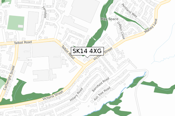
SK14 4XG is located in the Hyde Newton electoral ward, within the metropolitan district of Tameside and the English Parliamentary constituency of Stalybridge and Hyde. The Sub Integrated Care Board (ICB) Location is NHS Greater Manchester ICB - 01Y and the police force is Greater Manchester. This postcode has been in use since January 2018.


GetTheData
Source: OS Open Zoomstack (Ordnance Survey)
Licence: Open Government Licence (requires attribution)
Attribution: Contains OS data © Crown copyright and database right 2025
Source: Open Postcode Geo
Licence: Open Government Licence (requires attribution)
Attribution: Contains OS data © Crown copyright and database right 2025; Contains Royal Mail data © Royal Mail copyright and database right 2025; Source: Office for National Statistics licensed under the Open Government Licence v.3.0
| Easting | 396526 |
| Northing | 396327 |
| Latitude | 53.463691 |
| Longitude | -2.053794 |
GetTheData
Source: Open Postcode Geo
Licence: Open Government Licence
| Country | England |
| Postcode District | SK14 |
➜ See where SK14 is on a map ➜ Where is Hyde? | |
GetTheData
Source: Land Registry Price Paid Data
Licence: Open Government Licence
| Ward | Hyde Newton |
| Constituency | Stalybridge And Hyde |
GetTheData
Source: ONS Postcode Database
Licence: Open Government Licence
| Talbot Rd/Bay Horse (Talbot Rd) | Newton | 51m |
| Talbot Rd/Bay Horse (Talbot Rd) | Newton | 58m |
| Talbot Rd/Industrial Est (Talbot Rd) | Newton | 236m |
| Talbot Rd/Industrial Est (Talbot Rd) | Newton | 248m |
| Victoria St/Mallory Rd (Victoria St) | Newton | 341m |
| Newton for Hyde Station | 1.2km |
| Godley Station | 1.3km |
| Flowery Field Station | 1.8km |
GetTheData
Source: NaPTAN
Licence: Open Government Licence
GetTheData
Source: ONS Postcode Database
Licence: Open Government Licence


➜ Get more ratings from the Food Standards Agency
GetTheData
Source: Food Standards Agency
Licence: FSA terms & conditions
| Last Collection | |||
|---|---|---|---|
| Location | Mon-Fri | Sat | Distance |
| Bay Horse Talbot Road | 17:45 | 11:45 | 58m |
| Glyden Close | 17:45 | 11:30 | 217m |
| Welch Road | 17:45 | 11:30 | 685m |
GetTheData
Source: Dracos
Licence: Creative Commons Attribution-ShareAlike
The below table lists the International Territorial Level (ITL) codes (formerly Nomenclature of Territorial Units for Statistics (NUTS) codes) and Local Administrative Units (LAU) codes for SK14 4XG:
| ITL 1 Code | Name |
|---|---|
| TLD | North West (England) |
| ITL 2 Code | Name |
| TLD3 | Greater Manchester |
| ITL 3 Code | Name |
| TLD35 | Greater Manchester South East |
| LAU 1 Code | Name |
| E08000008 | Tameside |
GetTheData
Source: ONS Postcode Directory
Licence: Open Government Licence
The below table lists the Census Output Area (OA), Lower Layer Super Output Area (LSOA), and Middle Layer Super Output Area (MSOA) for SK14 4XG:
| Code | Name | |
|---|---|---|
| OA | E00030575 | |
| LSOA | E01006037 | Tameside 022C |
| MSOA | E02001250 | Tameside 022 |
GetTheData
Source: ONS Postcode Directory
Licence: Open Government Licence
| SK14 4ED | Victoria Street | 59m |
| SK14 4EQ | Talbot Road | 89m |
| SK14 4EF | Shaw Hall Avenue | 111m |
| SK14 4EB | Hillary Road | 136m |
| SK14 4UE | Matley Close | 167m |
| SK14 4UF | Jennings Close | 186m |
| SK14 4EN | Ash Tree Road | 193m |
| SK14 4EL | Barnfield Road | 194m |
| SK14 4EP | Ash Tree Road | 226m |
| SK14 4UN | Gylden Close | 245m |
GetTheData
Source: Open Postcode Geo; Land Registry Price Paid Data
Licence: Open Government Licence