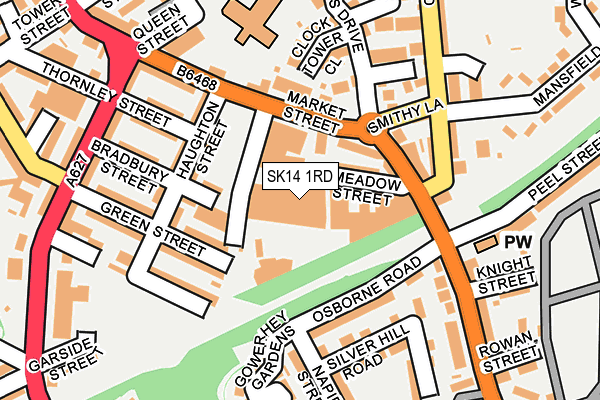
SK14 1RD is located in the Hyde Werneth electoral ward, within the metropolitan district of Tameside and the English Parliamentary constituency of Stalybridge and Hyde. The Sub Integrated Care Board (ICB) Location is NHS Greater Manchester ICB - 01Y and the police force is Greater Manchester. This postcode has been in use since July 1986.


GetTheData
Source: OS OpenMap – Local (Ordnance Survey)
Source: OS VectorMap District (Ordnance Survey)
Licence: Open Government Licence (requires attribution)
| Easting | 395262 |
| Northing | 394323 |
| Latitude | 53.445668 |
| Longitude | -2.072801 |
GetTheData
Source: Open Postcode Geo
Licence: Open Government Licence
| Country | England |
| Postcode District | SK14 |
➜ See where SK14 is on a map ➜ Where is Hyde? | |
GetTheData
Source: Land Registry Price Paid Data
Licence: Open Government Licence
Elevation or altitude of SK14 1RD as distance above sea level:
| Metres | Feet | |
|---|---|---|
| Elevation | 130m | 427ft |
Elevation is measured from the approximate centre of the postcode, to the nearest point on an OS contour line from OS Terrain 50, which has contour spacing of ten vertical metres.
➜ How high above sea level am I? Find the elevation of your current position using your device's GPS.
GetTheData
Source: Open Postcode Elevation
Licence: Open Government Licence
| Ward | Hyde Werneth |
| Constituency | Stalybridge And Hyde |
GetTheData
Source: ONS Postcode Database
Licence: Open Government Licence
| Market St/Ring O'bells (Stockport Rd) | Hyde | 93m |
| Market St/Ring O'bells (Market St) | Hyde | 100m |
| Stockport Rd/Clarkes Arms (Stockport Rd) | Hyde | 159m |
| Mansfield Rd/Lumn Rd (Mansfield Rd) | Backbower | 244m |
| Dowson Rd/Grosvenor Rd (Dowson Rd) | Hyde | 250m |
| Hyde Central Station | 1.1km |
| Newton for Hyde Station | 1.3km |
| Godley Station | 1.4km |
GetTheData
Source: NaPTAN
Licence: Open Government Licence
| Median download speed | 19.6Mbps |
| Average download speed | 18.7Mbps |
| Maximum download speed | 40.00Mbps |
| Median upload speed | 1.2Mbps |
| Average upload speed | 3.9Mbps |
| Maximum upload speed | 11.39Mbps |
GetTheData
Source: Ofcom
Licence: Ofcom Terms of Use (requires attribution)
GetTheData
Source: ONS Postcode Database
Licence: Open Government Licence


➜ Get more ratings from the Food Standards Agency
GetTheData
Source: Food Standards Agency
Licence: FSA terms & conditions
| Last Collection | |||
|---|---|---|---|
| Location | Mon-Fri | Sat | Distance |
| Grosvenor Road | 17:45 | 11:45 | 293m |
| Church Street | 18:30 | 11:45 | 319m |
| Lumm Road | 17:45 | 11:30 | 510m |
GetTheData
Source: Dracos
Licence: Creative Commons Attribution-ShareAlike
The below table lists the International Territorial Level (ITL) codes (formerly Nomenclature of Territorial Units for Statistics (NUTS) codes) and Local Administrative Units (LAU) codes for SK14 1RD:
| ITL 1 Code | Name |
|---|---|
| TLD | North West (England) |
| ITL 2 Code | Name |
| TLD3 | Greater Manchester |
| ITL 3 Code | Name |
| TLD35 | Greater Manchester South East |
| LAU 1 Code | Name |
| E08000008 | Tameside |
GetTheData
Source: ONS Postcode Directory
Licence: Open Government Licence
The below table lists the Census Output Area (OA), Lower Layer Super Output Area (LSOA), and Middle Layer Super Output Area (MSOA) for SK14 1RD:
| Code | Name | |
|---|---|---|
| OA | E00030595 | |
| LSOA | E01006041 | Tameside 028F |
| MSOA | E02001256 | Tameside 028 |
GetTheData
Source: ONS Postcode Directory
Licence: Open Government Licence
| SK14 1QZ | Dawson Street | 65m |
| SK14 1QR | Haughton Street | 93m |
| SK14 1RA | Meadow Street | 96m |
| SK14 1QW | Haughton Street | 98m |
| SK14 1RE | Meadow Street | 99m |
| SK14 1RJ | Market Street | 108m |
| SK14 1QP | Bradbury Street | 118m |
| SK14 1QX | Green Street | 125m |
| SK14 1QY | Markland Street | 125m |
| SK14 1QN | Thornley Street | 135m |
GetTheData
Source: Open Postcode Geo; Land Registry Price Paid Data
Licence: Open Government Licence