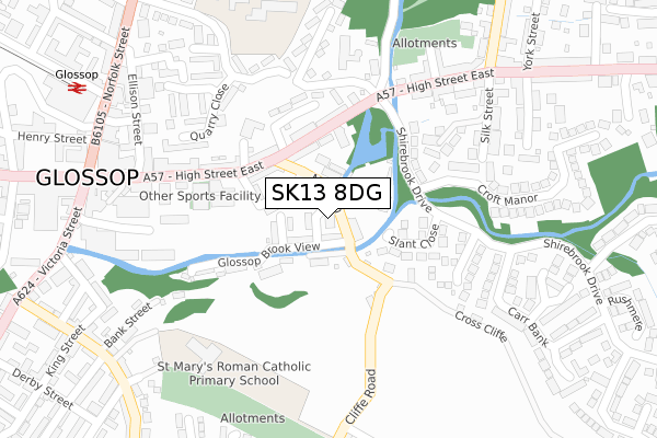
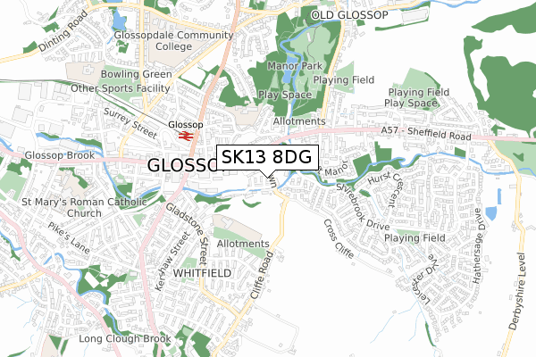
SK13 8DG is located in the Howard Town electoral ward, within the local authority district of High Peak and the English Parliamentary constituency of High Peak. The Sub Integrated Care Board (ICB) Location is NHS Derby and Derbyshire ICB - 15M and the police force is Derbyshire. This postcode has been in use since July 2018.


GetTheData
Source: OS Open Zoomstack (Ordnance Survey)
Licence: Open Government Licence (requires attribution)
Attribution: Contains OS data © Crown copyright and database right 2025
Source: Open Postcode Geo
Licence: Open Government Licence (requires attribution)
Attribution: Contains OS data © Crown copyright and database right 2025; Contains Royal Mail data © Royal Mail copyright and database right 2025; Source: Office for National Statistics licensed under the Open Government Licence v.3.0
| Easting | 403861 |
| Northing | 393995 |
| Latitude | 53.442729 |
| Longitude | -1.943337 |
GetTheData
Source: Open Postcode Geo
Licence: Open Government Licence
| Country | England |
| Postcode District | SK13 |
➜ See where SK13 is on a map ➜ Where is Glossop? | |
GetTheData
Source: Land Registry Price Paid Data
Licence: Open Government Licence
| Ward | Howard Town |
| Constituency | High Peak |
GetTheData
Source: ONS Postcode Database
Licence: Open Government Licence
| Regency Close (High Street East) | Glossop | 121m |
| Croft Manor (Shirebrook Drive) | Glossop | 134m |
| Regency Close (High Street East) | Glossop | 147m |
| Howard Arms (High Street East) | Glossop | 327m |
| Commercial Inn (Manor Park Road) | Glossop | 344m |
| Glossop Station | 0.4km |
| Dinting Station | 1.9km |
| Hadfield Station | 2.5km |
GetTheData
Source: NaPTAN
Licence: Open Government Licence
| Percentage of properties with Next Generation Access | 100.0% |
| Percentage of properties with Superfast Broadband | 100.0% |
| Percentage of properties with Ultrafast Broadband | 0.0% |
| Percentage of properties with Full Fibre Broadband | 0.0% |
Superfast Broadband is between 30Mbps and 300Mbps
Ultrafast Broadband is > 300Mbps
| Median download speed | 30.3Mbps |
| Average download speed | 28.2Mbps |
| Maximum download speed | 40.00Mbps |
| Median upload speed | 5.5Mbps |
| Average upload speed | 5.5Mbps |
| Maximum upload speed | 10.00Mbps |
| Percentage of properties unable to receive 2Mbps | 0.0% |
| Percentage of properties unable to receive 5Mbps | 0.0% |
| Percentage of properties unable to receive 10Mbps | 0.0% |
| Percentage of properties unable to receive 30Mbps | 0.0% |
GetTheData
Source: Ofcom
Licence: Ofcom Terms of Use (requires attribution)
GetTheData
Source: ONS Postcode Database
Licence: Open Government Licence


➜ Get more ratings from the Food Standards Agency
GetTheData
Source: Food Standards Agency
Licence: FSA terms & conditions
| Last Collection | |||
|---|---|---|---|
| Location | Mon-Fri | Sat | Distance |
| St Marys Road | 18:15 | 11:45 | 265m |
| 4 Victoria Street | 18:00 | 12:00 | 391m |
| Co-op Norfolk St | 18:00 | 12:30 | 408m |
GetTheData
Source: Dracos
Licence: Creative Commons Attribution-ShareAlike
| Risk of SK13 8DG flooding from rivers and sea | Low |
| ➜ SK13 8DG flood map | |
GetTheData
Source: Open Flood Risk by Postcode
Licence: Open Government Licence
The below table lists the International Territorial Level (ITL) codes (formerly Nomenclature of Territorial Units for Statistics (NUTS) codes) and Local Administrative Units (LAU) codes for SK13 8DG:
| ITL 1 Code | Name |
|---|---|
| TLF | East Midlands (England) |
| ITL 2 Code | Name |
| TLF1 | Derbyshire and Nottinghamshire |
| ITL 3 Code | Name |
| TLF13 | South and West Derbyshire |
| LAU 1 Code | Name |
| E07000037 | High Peak |
GetTheData
Source: ONS Postcode Directory
Licence: Open Government Licence
The below table lists the Census Output Area (OA), Lower Layer Super Output Area (LSOA), and Middle Layer Super Output Area (MSOA) for SK13 8DG:
| Code | Name | |
|---|---|---|
| OA | E00099874 | |
| LSOA | E01019739 | High Peak 003B |
| MSOA | E02004095 | High Peak 003 |
GetTheData
Source: ONS Postcode Directory
Licence: Open Government Licence
| SK13 8PX | Milltown | 67m |
| SK13 8PY | Lower Bank | 69m |
| SK13 8PT | Mill Street | 108m |
| SK13 8QA | High Street East | 135m |
| SK13 8TD | Slant Close | 144m |
| SK13 8GE | High Street East | 148m |
| SK13 8PS | Manor Street | 159m |
| SK13 8QD | Regent Street | 183m |
| SK13 8TE | Cross Rise | 201m |
| SK13 8PN | High Street East | 229m |
GetTheData
Source: Open Postcode Geo; Land Registry Price Paid Data
Licence: Open Government Licence