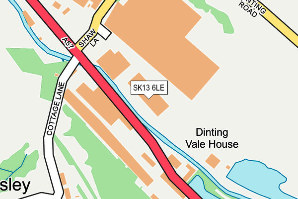
SK13 6LE is located in the Hadfield South electoral ward, within the local authority district of High Peak and the English Parliamentary constituency of High Peak. The Sub Integrated Care Board (ICB) Location is NHS Derby and Derbyshire ICB - 15M and the police force is Derbyshire. This postcode has been in use since December 1997.


GetTheData
Source: OS OpenMap – Local (Ordnance Survey)
Source: OS VectorMap District (Ordnance Survey)
Licence: Open Government Licence (requires attribution)
| Easting | 401551 |
| Northing | 394841 |
| Latitude | 53.450328 |
| Longitude | -1.978113 |
GetTheData
Source: Open Postcode Geo
Licence: Open Government Licence
| Country | England |
| Postcode District | SK13 |
➜ See where SK13 is on a map ➜ Where is Hadfield? | |
GetTheData
Source: Land Registry Price Paid Data
Licence: Open Government Licence
Elevation or altitude of SK13 6LE as distance above sea level:
| Metres | Feet | |
|---|---|---|
| Elevation | 130m | 427ft |
Elevation is measured from the approximate centre of the postcode, to the nearest point on an OS contour line from OS Terrain 50, which has contour spacing of ten vertical metres.
➜ How high above sea level am I? Find the elevation of your current position using your device's GPS.
GetTheData
Source: Open Postcode Elevation
Licence: Open Government Licence
| Ward | Hadfield South |
| Constituency | High Peak |
GetTheData
Source: ONS Postcode Database
Licence: Open Government Licence
| Works (Dinting Vale) | Dinting Vale | 81m |
| Works (Dinting Vale) | Dinting Vale | 138m |
| Industrial Estate (Shaw Lane) | Dinting Vale | 181m |
| Industrial Estate (Shaw Lane) | Dinting Vale | 197m |
| Cottage Lane (Brookfield) | Brookfield | 217m |
| Dinting Station | 0.5km |
| Hadfield Station | 1.4km |
| Glossop Station | 2km |
GetTheData
Source: NaPTAN
Licence: Open Government Licence
GetTheData
Source: ONS Postcode Database
Licence: Open Government Licence


➜ Get more ratings from the Food Standards Agency
GetTheData
Source: Food Standards Agency
Licence: FSA terms & conditions
| Last Collection | |||
|---|---|---|---|
| Location | Mon-Fri | Sat | Distance |
| Shaw Lane | 18:30 | 11:45 | 177m |
| Gamesley Tso | 17:00 | 12:00 | 518m |
| Green Lane | 17:45 | 11:30 | 754m |
GetTheData
Source: Dracos
Licence: Creative Commons Attribution-ShareAlike
| Risk of SK13 6LE flooding from rivers and sea | Medium |
| ➜ SK13 6LE flood map | |
GetTheData
Source: Open Flood Risk by Postcode
Licence: Open Government Licence
The below table lists the International Territorial Level (ITL) codes (formerly Nomenclature of Territorial Units for Statistics (NUTS) codes) and Local Administrative Units (LAU) codes for SK13 6LE:
| ITL 1 Code | Name |
|---|---|
| TLF | East Midlands (England) |
| ITL 2 Code | Name |
| TLF1 | Derbyshire and Nottinghamshire |
| ITL 3 Code | Name |
| TLF13 | South and West Derbyshire |
| LAU 1 Code | Name |
| E07000037 | High Peak |
GetTheData
Source: ONS Postcode Directory
Licence: Open Government Licence
The below table lists the Census Output Area (OA), Lower Layer Super Output Area (LSOA), and Middle Layer Super Output Area (MSOA) for SK13 6LE:
| Code | Name | |
|---|---|---|
| OA | E00099845 | |
| LSOA | E01019732 | High Peak 002E |
| MSOA | E02004094 | High Peak 002 |
GetTheData
Source: ONS Postcode Directory
Licence: Open Government Licence
| SK13 6EF | Shaw Lane | 256m |
| SK13 7EH | Cottage Lane | 282m |
| SK13 6EE | Shaw Lane | 296m |
| SK13 7UU | Dinting Road | 317m |
| SK13 6EP | Bonsall Fold | 340m |
| SK13 2BJ | Shawfield Road | 342m |
| SK13 2BS | The Sycamores | 349m |
| SK13 2BW | Beechfield Road | 356m |
| SK13 6ET | Rowsley Green | 366m |
| SK13 6EX | Rowsley Close | 385m |
GetTheData
Source: Open Postcode Geo; Land Registry Price Paid Data
Licence: Open Government Licence