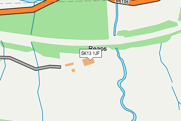
SK13 1JF is in Torside, Glossop. SK13 1JF is located in the St John's electoral ward, within the local authority district of High Peak and the English Parliamentary constituency of High Peak. The Sub Integrated Care Board (ICB) Location is NHS Derby and Derbyshire ICB - 15M and the police force is Derbyshire. This postcode has been in use since December 1997.


GetTheData
Source: OS OpenMap – Local (Ordnance Survey)
Source: OS VectorMap District (Ordnance Survey)
Licence: Open Government Licence (requires attribution)
| Easting | 406262 |
| Northing | 397915 |
| Latitude | 53.477941 |
| Longitude | -1.907115 |
GetTheData
Source: Open Postcode Geo
Licence: Open Government Licence
| Locality | Torside |
| Town/City | Glossop |
| Country | England |
| Postcode District | SK13 |
➜ See where SK13 is on a map | |
GetTheData
Source: Land Registry Price Paid Data
Licence: Open Government Licence
Elevation or altitude of SK13 1JF as distance above sea level:
| Metres | Feet | |
|---|---|---|
| Elevation | 240m | 787ft |
Elevation is measured from the approximate centre of the postcode, to the nearest point on an OS contour line from OS Terrain 50, which has contour spacing of ten vertical metres.
➜ How high above sea level am I? Find the elevation of your current position using your device's GPS.
GetTheData
Source: Open Postcode Elevation
Licence: Open Government Licence
| Ward | St John's |
| Constituency | High Peak |
GetTheData
Source: ONS Postcode Database
Licence: Open Government Licence
| Visitor Centre (B6105) | Torside | 662m |
| Visitor Centre (B6105) | Torside | 663m |
| Woodhead Road | Crowden | 1,551m |
| Woodhead Road | Crowden | 1,557m |
| Hadfield Station | 4.3km |
| Glossop Station | 4.6km |
| Dinting Station | 5.3km |
GetTheData
Source: NaPTAN
Licence: Open Government Licence
GetTheData
Source: ONS Postcode Database
Licence: Open Government Licence

➜ Get more ratings from the Food Standards Agency
GetTheData
Source: Food Standards Agency
Licence: FSA terms & conditions
| Last Collection | |||
|---|---|---|---|
| Location | Mon-Fri | Sat | Distance |
| Padfield Temple Street | 17:45 | 12:00 | 3,591m |
| Manor Park Road | 17:45 | 11:45 | 3,788m |
| Padfield Wall Platt St | 17:45 | 12:00 | 3,823m |
GetTheData
Source: Dracos
Licence: Creative Commons Attribution-ShareAlike
The below table lists the International Territorial Level (ITL) codes (formerly Nomenclature of Territorial Units for Statistics (NUTS) codes) and Local Administrative Units (LAU) codes for SK13 1JF:
| ITL 1 Code | Name |
|---|---|
| TLF | East Midlands (England) |
| ITL 2 Code | Name |
| TLF1 | Derbyshire and Nottinghamshire |
| ITL 3 Code | Name |
| TLF13 | South and West Derbyshire |
| LAU 1 Code | Name |
| E07000037 | High Peak |
GetTheData
Source: ONS Postcode Directory
Licence: Open Government Licence
The below table lists the Census Output Area (OA), Lower Layer Super Output Area (LSOA), and Middle Layer Super Output Area (MSOA) for SK13 1JF:
| Code | Name | |
|---|---|---|
| OA | E00099945 | |
| LSOA | E01019754 | High Peak 004C |
| MSOA | E02004096 | High Peak 004 |
GetTheData
Source: ONS Postcode Directory
Licence: Open Government Licence
| SK13 1HY | Woodhead Road | 936m |
| SK13 1HZ | 1653m | |
| SK13 1HU | Woodhead Road | 1881m |
| SK13 7QR | Blackshaw Clough | 3048m |
| SK13 7QE | Woodhead Road | 3317m |
| SK13 7ST | Hawkshead Road | 3377m |
| SK13 7SF | Charles Lane | 3377m |
| SK13 7TP | Highstones Gardens | 3436m |
| SK13 7GB | Hawkshead Fold | 3440m |
| SK13 7SS | Hope Street | 3448m |
GetTheData
Source: Open Postcode Geo; Land Registry Price Paid Data
Licence: Open Government Licence