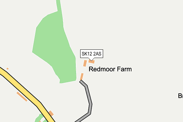
SK12 2AS lies on Redmoor Lane in Disley, Stockport. SK12 2AS is located in the Disley electoral ward, within the unitary authority of Cheshire East and the English Parliamentary constituency of Macclesfield. The Sub Integrated Care Board (ICB) Location is NHS Cheshire and Merseyside ICB - 27D and the police force is Cheshire. This postcode has been in use since July 2017.


GetTheData
Source: OS OpenMap – Local (Ordnance Survey)
Source: OS VectorMap District (Ordnance Survey)
Licence: Open Government Licence (requires attribution)
| Easting | 399153 |
| Northing | 383629 |
| Latitude | 53.349566 |
| Longitude | -2.014186 |
GetTheData
Source: Open Postcode Geo
Licence: Open Government Licence
| Street | Redmoor Lane |
| Locality | Disley |
| Town/City | Stockport |
| Country | England |
| Postcode District | SK12 |
➜ See where SK12 is on a map | |
GetTheData
Source: Land Registry Price Paid Data
Licence: Open Government Licence
| Ward | Disley |
| Constituency | Macclesfield |
GetTheData
Source: ONS Postcode Database
Licence: Open Government Licence
| Swan Hotel (Buxton Road) | Newtown | 944m |
| Peveril Gardens (Buxton Road) | Newtown | 950m |
| Swan Hotel (Buxton Road) | Newtown | 956m |
| Peveril Gardens (Buxton Road) | Newtown | 962m |
| Overdale Road (Buxton Road) | Newtown | 1,049m |
| New Mills Newtown Station | 1.2km |
| Furness Vale Station | 1.7km |
| New Mills Central Station | 1.8km |
GetTheData
Source: NaPTAN
Licence: Open Government Licence
| Percentage of properties with Next Generation Access | 100.0% |
| Percentage of properties with Superfast Broadband | 0.0% |
| Percentage of properties with Ultrafast Broadband | 0.0% |
| Percentage of properties with Full Fibre Broadband | 0.0% |
Superfast Broadband is between 30Mbps and 300Mbps
Ultrafast Broadband is > 300Mbps
| Percentage of properties unable to receive 2Mbps | 0.0% |
| Percentage of properties unable to receive 5Mbps | 0.0% |
| Percentage of properties unable to receive 10Mbps | 0.0% |
| Percentage of properties unable to receive 30Mbps | 100.0% |
GetTheData
Source: Ofcom
Licence: Ofcom Terms of Use (requires attribution)
GetTheData
Source: ONS Postcode Database
Licence: Open Government Licence


➜ Get more ratings from the Food Standards Agency
GetTheData
Source: Food Standards Agency
Licence: FSA terms & conditions
| Last Collection | |||
|---|---|---|---|
| Location | Mon-Fri | Sat | Distance |
| Buxton Road | 17:30 | 08:30 | 753m |
| Overdale Road | 17:15 | 08:30 | 1,071m |
| Corks Lane | 17:30 | 09:00 | 1,140m |
GetTheData
Source: Dracos
Licence: Creative Commons Attribution-ShareAlike
The below table lists the International Territorial Level (ITL) codes (formerly Nomenclature of Territorial Units for Statistics (NUTS) codes) and Local Administrative Units (LAU) codes for SK12 2AS:
| ITL 1 Code | Name |
|---|---|
| TLD | North West (England) |
| ITL 2 Code | Name |
| TLD6 | Cheshire |
| ITL 3 Code | Name |
| TLD62 | Cheshire East |
| LAU 1 Code | Name |
| E06000049 | Cheshire East |
GetTheData
Source: ONS Postcode Directory
Licence: Open Government Licence
The below table lists the Census Output Area (OA), Lower Layer Super Output Area (LSOA), and Middle Layer Super Output Area (MSOA) for SK12 2AS:
| Code | Name | |
|---|---|---|
| OA | E00093787 | |
| LSOA | E01018586 | Cheshire East 001B |
| MSOA | E02003853 | Cheshire East 001 |
GetTheData
Source: ONS Postcode Directory
Licence: Open Government Licence
| SK12 2AR | Buxton Old Road | 522m |
| SK12 2BZ | Ward Lane | 592m |
| SK22 3LL | Redmoor Lane | 694m |
| SK12 2AZ | Corks Lane | 757m |
| SK12 2AY | Buxton Old Road | 816m |
| SK22 3JX | Woodbourne Road | 839m |
| SK12 2PY | Buxton Road | 927m |
| SK12 2RA | Buxton Road | 962m |
| SK12 2RH | Buxton Road | 970m |
| SK12 2RF | Oak Avenue | 994m |
GetTheData
Source: Open Postcode Geo; Land Registry Price Paid Data
Licence: Open Government Licence