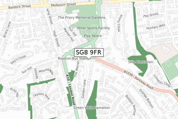
SG8 9FR is located in the Royston Heath electoral ward, within the local authority district of North Hertfordshire and the English Parliamentary constituency of North East Hertfordshire. The Sub Integrated Care Board (ICB) Location is NHS Cambridgeshire and Peterborough ICB - 06H and the police force is Hertfordshire. This postcode has been in use since April 2019.


GetTheData
Source: OS Open Zoomstack (Ordnance Survey)
Licence: Open Government Licence (requires attribution)
Attribution: Contains OS data © Crown copyright and database right 2024
Source: Open Postcode Geo
Licence: Open Government Licence (requires attribution)
Attribution: Contains OS data © Crown copyright and database right 2024; Contains Royal Mail data © Royal Mail copyright and database right 2024; Source: Office for National Statistics licensed under the Open Government Licence v.3.0
| Easting | 535835 |
| Northing | 240405 |
| Latitude | 52.045413 |
| Longitude | -0.020697 |
GetTheData
Source: Open Postcode Geo
Licence: Open Government Licence
| Country | England |
| Postcode District | SG8 |
➜ See where SG8 is on a map ➜ Where is Royston? | |
GetTheData
Source: Land Registry Price Paid Data
Licence: Open Government Licence
| Ward | Royston Heath |
| Constituency | North East Hertfordshire |
GetTheData
Source: ONS Postcode Database
Licence: Open Government Licence
| Recreation Ground (Priory Lane) | Royston | 253m |
| Town Hall (Melbourn Street) | Royston | 315m |
| Town Hall (Melbourn Street) | Royston | 325m |
| Hollies Close (Newmarket Road) | Royston | 397m |
| Morrisons (Baldock Street) | Royston | 432m |
| Royston Station | 1km |
GetTheData
Source: NaPTAN
Licence: Open Government Licence
GetTheData
Source: ONS Postcode Database
Licence: Open Government Licence


➜ Get more ratings from the Food Standards Agency
GetTheData
Source: Food Standards Agency
Licence: FSA terms & conditions
| Last Collection | |||
|---|---|---|---|
| Location | Mon-Fri | Sat | Distance |
| Barkway Street | 17:30 | 11:45 | 102m |
| Martins Newsagents | 18:00 | 12:30 | 271m |
| Layston Park | 18:00 | 12:00 | 274m |
GetTheData
Source: Dracos
Licence: Creative Commons Attribution-ShareAlike
The below table lists the International Territorial Level (ITL) codes (formerly Nomenclature of Territorial Units for Statistics (NUTS) codes) and Local Administrative Units (LAU) codes for SG8 9FR:
| ITL 1 Code | Name |
|---|---|
| TLH | East |
| ITL 2 Code | Name |
| TLH2 | Bedfordshire and Hertfordshire |
| ITL 3 Code | Name |
| TLH23 | Hertfordshire CC |
| LAU 1 Code | Name |
| E07000099 | North Hertfordshire |
GetTheData
Source: ONS Postcode Directory
Licence: Open Government Licence
The below table lists the Census Output Area (OA), Lower Layer Super Output Area (LSOA), and Middle Layer Super Output Area (MSOA) for SG8 9FR:
| Code | Name | |
|---|---|---|
| OA | E00120126 | |
| LSOA | E01023654 | North Hertfordshire 002A |
| MSOA | E02004910 | North Hertfordshire 002 |
GetTheData
Source: ONS Postcode Directory
Licence: Open Government Licence
| SG8 9EE | Barkway Street | 36m |
| SG8 9EW | Lawns Court | 40m |
| SG8 9JU | Market Hill | 69m |
| SG8 9DU | Priory Lane | 74m |
| SG8 9DZ | Prince Andrews Close | 96m |
| SG8 9EH | Garden Lane | 138m |
| SG8 9EG | The Warren | 142m |
| SG8 9EA | Barkway Road | 147m |
| SG8 9EJ | London Road | 155m |
| SG8 9EF | Turpins Ride | 157m |
GetTheData
Source: Open Postcode Geo; Land Registry Price Paid Data
Licence: Open Government Licence