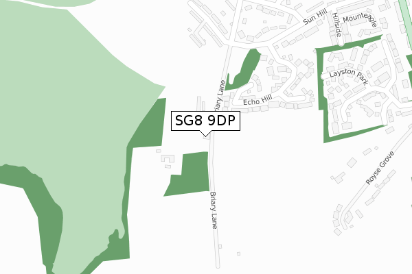
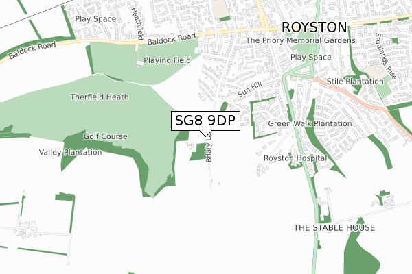
SG8 9DP lies on Briary Lane in Royston. SG8 9DP is located in the Royston Heath electoral ward, within the local authority district of North Hertfordshire and the English Parliamentary constituency of North East Hertfordshire. The Sub Integrated Care Board (ICB) Location is NHS Cambridgeshire and Peterborough ICB - 06H and the police force is Hertfordshire. This postcode has been in use since January 1980.


GetTheData
Source: OS Open Zoomstack (Ordnance Survey)
Licence: Open Government Licence (requires attribution)
Attribution: Contains OS data © Crown copyright and database right 2025
Source: Open Postcode Geo
Licence: Open Government Licence (requires attribution)
Attribution: Contains OS data © Crown copyright and database right 2025; Contains Royal Mail data © Royal Mail copyright and database right 2025; Source: Office for National Statistics licensed under the Open Government Licence v.3.0
| Easting | 535219 |
| Northing | 240052 |
| Latitude | 52.042392 |
| Longitude | -0.029813 |
GetTheData
Source: Open Postcode Geo
Licence: Open Government Licence
| Street | Briary Lane |
| Town/City | Royston |
| Country | England |
| Postcode District | SG8 |
➜ See where SG8 is on a map ➜ Where is Royston? | |
GetTheData
Source: Land Registry Price Paid Data
Licence: Open Government Licence
Elevation or altitude of SG8 9DP as distance above sea level:
| Metres | Feet | |
|---|---|---|
| Elevation | 100m | 328ft |
Elevation is measured from the approximate centre of the postcode, to the nearest point on an OS contour line from OS Terrain 50, which has contour spacing of ten vertical metres.
➜ How high above sea level am I? Find the elevation of your current position using your device's GPS.
GetTheData
Source: Open Postcode Elevation
Licence: Open Government Licence
| Ward | Royston Heath |
| Constituency | North East Hertfordshire |
GetTheData
Source: ONS Postcode Database
Licence: Open Government Licence
HEATHSIDE, WICKER HALL, ROYSTON, SG8 9DP 2007 26 JUL £740,000 |
2, WICKER HALL, BRIARY LANE, ROYSTON, SG8 9DP 2003 20 AUG £249,995 |
GetTheData
Source: HM Land Registry Price Paid Data
Licence: Contains HM Land Registry data © Crown copyright and database right 2025. This data is licensed under the Open Government Licence v3.0.
| Golf Club (Baldock Road) | Royston | 617m |
| Golf Club (Baldock Road) | Royston | 629m |
| Fire Station (Baldock Street) | Royston | 658m |
| Morrisons (Baldock Street) | Royston | 714m |
| Town Hall (Melbourn Street) | Royston | 857m |
| Royston Station | 1.2km |
GetTheData
Source: NaPTAN
Licence: Open Government Licence
| Percentage of properties with Next Generation Access | 100.0% |
| Percentage of properties with Superfast Broadband | 100.0% |
| Percentage of properties with Ultrafast Broadband | 0.0% |
| Percentage of properties with Full Fibre Broadband | 0.0% |
Superfast Broadband is between 30Mbps and 300Mbps
Ultrafast Broadband is > 300Mbps
| Percentage of properties unable to receive 2Mbps | 0.0% |
| Percentage of properties unable to receive 5Mbps | 0.0% |
| Percentage of properties unable to receive 10Mbps | 0.0% |
| Percentage of properties unable to receive 30Mbps | 0.0% |
GetTheData
Source: Ofcom
Licence: Ofcom Terms of Use (requires attribution)
GetTheData
Source: ONS Postcode Database
Licence: Open Government Licence


➜ Get more ratings from the Food Standards Agency
GetTheData
Source: Food Standards Agency
Licence: FSA terms & conditions
| Last Collection | |||
|---|---|---|---|
| Location | Mon-Fri | Sat | Distance |
| Coronation Avenue | 18:00 | 11:45 | 358m |
| Layston Park | 18:00 | 12:00 | 528m |
| Baldock Road | 18:00 | 11:45 | 633m |
GetTheData
Source: Dracos
Licence: Creative Commons Attribution-ShareAlike
The below table lists the International Territorial Level (ITL) codes (formerly Nomenclature of Territorial Units for Statistics (NUTS) codes) and Local Administrative Units (LAU) codes for SG8 9DP:
| ITL 1 Code | Name |
|---|---|
| TLH | East |
| ITL 2 Code | Name |
| TLH2 | Bedfordshire and Hertfordshire |
| ITL 3 Code | Name |
| TLH23 | Hertfordshire CC |
| LAU 1 Code | Name |
| E07000099 | North Hertfordshire |
GetTheData
Source: ONS Postcode Directory
Licence: Open Government Licence
The below table lists the Census Output Area (OA), Lower Layer Super Output Area (LSOA), and Middle Layer Super Output Area (MSOA) for SG8 9DP:
| Code | Name | |
|---|---|---|
| OA | E00120127 | |
| LSOA | E01023655 | North Hertfordshire 002B |
| MSOA | E02004910 | North Hertfordshire 002 |
GetTheData
Source: ONS Postcode Directory
Licence: Open Government Licence
| SG8 9BJ | The Dell | 185m |
| SG8 9BB | Echo Hill | 203m |
| SG8 9DN | Stake Piece Road | 271m |
| SG8 9BZ | Briary Lane | 295m |
| SG8 9AX | Sun Hill | 329m |
| SG8 9DJ | Coronation Avenue | 344m |
| SG8 9DG | Lankester Road | 367m |
| SG8 9DT | Layston Park | 380m |
| SG8 9DS | Layston Park | 383m |
| SG8 9AY | Hillside | 405m |
GetTheData
Source: Open Postcode Geo; Land Registry Price Paid Data
Licence: Open Government Licence