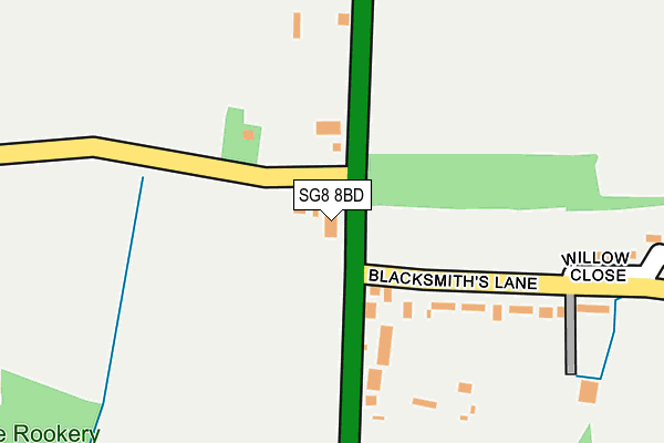
SG8 8BD is located in the Ermine electoral ward, within the local authority district of North Hertfordshire and the English Parliamentary constituency of North East Hertfordshire. The Sub Integrated Care Board (ICB) Location is NHS Cambridgeshire and Peterborough ICB - 06H and the police force is Hertfordshire. This postcode has been in use since January 1980.


GetTheData
Source: OS OpenMap – Local (Ordnance Survey)
Source: OS VectorMap District (Ordnance Survey)
Licence: Open Government Licence (requires attribution)
| Easting | 535667 |
| Northing | 236357 |
| Latitude | 52.009081 |
| Longitude | -0.024749 |
GetTheData
Source: Open Postcode Geo
Licence: Open Government Licence
| Country | England |
| Postcode District | SG8 |
➜ See where SG8 is on a map ➜ Where is Reed? | |
GetTheData
Source: Land Registry Price Paid Data
Licence: Open Government Licence
Elevation or altitude of SG8 8BD as distance above sea level:
| Metres | Feet | |
|---|---|---|
| Elevation | 150m | 492ft |
Elevation is measured from the approximate centre of the postcode, to the nearest point on an OS contour line from OS Terrain 50, which has contour spacing of ten vertical metres.
➜ How high above sea level am I? Find the elevation of your current position using your device's GPS.
GetTheData
Source: Open Postcode Elevation
Licence: Open Government Licence
| Ward | Ermine |
| Constituency | North East Hertfordshire |
GetTheData
Source: ONS Postcode Database
Licence: Open Government Licence
| Silver Ball Cafe (Ermine Street) | Reed | 14m |
| Silver Ball Cafe (Ermine Street) | Reed | 83m |
| Village Hall (Blacksmiths Lane) | Reed | 366m |
| Village Hall (Blacksmiths Lane) | Reed | 369m |
| Brickyard Lane | Reed | 470m |
| Royston Station | 4.9km |
GetTheData
Source: NaPTAN
Licence: Open Government Licence
GetTheData
Source: ONS Postcode Database
Licence: Open Government Licence


➜ Get more ratings from the Food Standards Agency
GetTheData
Source: Food Standards Agency
Licence: FSA terms & conditions
| Last Collection | |||
|---|---|---|---|
| Location | Mon-Fri | Sat | Distance |
| London Road | 16:45 | 10:15 | 48m |
| Village Hall | 16:45 | 10:15 | 378m |
| Jackson Lane | 16:00 | 10:00 | 759m |
GetTheData
Source: Dracos
Licence: Creative Commons Attribution-ShareAlike
The below table lists the International Territorial Level (ITL) codes (formerly Nomenclature of Territorial Units for Statistics (NUTS) codes) and Local Administrative Units (LAU) codes for SG8 8BD:
| ITL 1 Code | Name |
|---|---|
| TLH | East |
| ITL 2 Code | Name |
| TLH2 | Bedfordshire and Hertfordshire |
| ITL 3 Code | Name |
| TLH23 | Hertfordshire CC |
| LAU 1 Code | Name |
| E07000099 | North Hertfordshire |
GetTheData
Source: ONS Postcode Directory
Licence: Open Government Licence
The below table lists the Census Output Area (OA), Lower Layer Super Output Area (LSOA), and Middle Layer Super Output Area (MSOA) for SG8 8BD:
| Code | Name | |
|---|---|---|
| OA | E00119850 | |
| LSOA | E01023598 | North Hertfordshire 005D |
| MSOA | E02004913 | North Hertfordshire 005 |
GetTheData
Source: ONS Postcode Directory
Licence: Open Government Licence
| SG8 8BB | London Road | 165m |
| SG8 8AX | Blacksmiths Lane | 192m |
| SG8 8BA | Willow Close | 272m |
| SG8 8AY | Blacksmiths Lane | 441m |
| SG8 8AU | Blacksmiths Lane | 444m |
| SG8 8AS | Church Lane | 481m |
| SG8 8BG | Brickyard Lane | 494m |
| SG8 8BE | Brickyard Lane | 504m |
| SG8 8AA | Mill Corner | 508m |
| SG8 8AR | Church Lane | 552m |
GetTheData
Source: Open Postcode Geo; Land Registry Price Paid Data
Licence: Open Government Licence