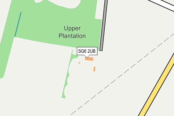
SG6 2UB is located in the Chesfield electoral ward, within the local authority district of North Hertfordshire and the English Parliamentary constituency of Hitchin and Harpenden. The Sub Integrated Care Board (ICB) Location is NHS Hertfordshire and West Essex ICB - 06K and the police force is Hertfordshire. This postcode has been in use since November 2002.


GetTheData
Source: OS OpenMap – Local (Ordnance Survey)
Source: OS VectorMap District (Ordnance Survey)
Licence: Open Government Licence (requires attribution)
| Easting | 521458 |
| Northing | 229425 |
| Latitude | 51.950066 |
| Longitude | -0.234138 |
GetTheData
Source: Open Postcode Geo
Licence: Open Government Licence
| Country | England |
| Postcode District | SG6 |
➜ See where SG6 is on a map | |
GetTheData
Source: Land Registry Price Paid Data
Licence: Open Government Licence
Elevation or altitude of SG6 2UB as distance above sea level:
| Metres | Feet | |
|---|---|---|
| Elevation | 90m | 295ft |
Elevation is measured from the approximate centre of the postcode, to the nearest point on an OS contour line from OS Terrain 50, which has contour spacing of ten vertical metres.
➜ How high above sea level am I? Find the elevation of your current position using your device's GPS.
GetTheData
Source: Open Postcode Elevation
Licence: Open Government Licence
| Ward | Chesfield |
| Constituency | Hitchin And Harpenden |
GetTheData
Source: ONS Postcode Database
Licence: Open Government Licence
| Thatchers End (Kingswood Avenue) | Purwell | 710m |
| Church Green (Arch Road) | Great Wymondley | 855m |
| Church Green (Arch Road) | Great Wymondley | 916m |
| Fairfield Way (Wilshere Crescent) | Purwell | 969m |
| Mill Close (Purwell Lane) | Purwell | 987m |
| Hitchin Station | 2km |
| Letchworth Station | 3.3km |
| Baldock Station | 5.7km |
GetTheData
Source: NaPTAN
Licence: Open Government Licence
GetTheData
Source: ONS Postcode Database
Licence: Open Government Licence


➜ Get more ratings from the Food Standards Agency
GetTheData
Source: Food Standards Agency
Licence: FSA terms & conditions
| Last Collection | |||
|---|---|---|---|
| Location | Mon-Fri | Sat | Distance |
| Great Wymondly | 17:00 | 11:15 | 770m |
| Fairfield Way | 17:30 | 12:00 | 940m |
| Tennyson Avenue | 17:30 | 12:00 | 1,073m |
GetTheData
Source: Dracos
Licence: Creative Commons Attribution-ShareAlike
The below table lists the International Territorial Level (ITL) codes (formerly Nomenclature of Territorial Units for Statistics (NUTS) codes) and Local Administrative Units (LAU) codes for SG6 2UB:
| ITL 1 Code | Name |
|---|---|
| TLH | East |
| ITL 2 Code | Name |
| TLH2 | Bedfordshire and Hertfordshire |
| ITL 3 Code | Name |
| TLH23 | Hertfordshire CC |
| LAU 1 Code | Name |
| E07000099 | North Hertfordshire |
GetTheData
Source: ONS Postcode Directory
Licence: Open Government Licence
The below table lists the Census Output Area (OA), Lower Layer Super Output Area (LSOA), and Middle Layer Super Output Area (MSOA) for SG6 2UB:
| Code | Name | |
|---|---|---|
| OA | E00119860 | |
| LSOA | E01023600 | North Hertfordshire 005F |
| MSOA | E02004913 | North Hertfordshire 005 |
GetTheData
Source: ONS Postcode Directory
Licence: Open Government Licence
| SG4 0NT | Kingswood Avenue | 738m |
| SG4 0NZ | Kingswood Avenue | 786m |
| SG4 7ET | 786m | |
| SG4 7EX | Graveley Road | 796m |
| SG4 0PD | Thatchers End | 860m |
| SG4 7HA | Church Green | 862m |
| SG4 0NG | Purwell Lane | 866m |
| SG4 0PG | Wilshere Crescent | 890m |
| SG4 7ES | 927m | |
| SG4 0PA | Kingswood Avenue | 944m |
GetTheData
Source: Open Postcode Geo; Land Registry Price Paid Data
Licence: Open Government Licence