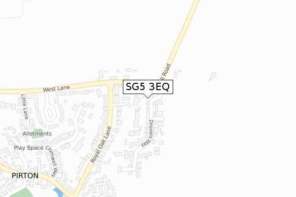
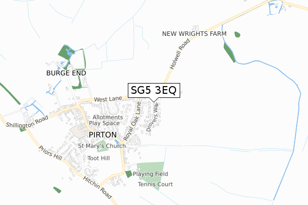
SG5 3EQ is located in the Hitchwood, Offa and Hoo electoral ward, within the local authority district of North Hertfordshire and the English Parliamentary constituency of Hitchin and Harpenden. The Sub Integrated Care Board (ICB) Location is NHS Hertfordshire and West Essex ICB - 06K and the police force is Hertfordshire. This postcode has been in use since October 2019.


GetTheData
Source: OS Open Zoomstack (Ordnance Survey)
Licence: Open Government Licence (requires attribution)
Attribution: Contains OS data © Crown copyright and database right 2024
Source: Open Postcode Geo
Licence: Open Government Licence (requires attribution)
Attribution: Contains OS data © Crown copyright and database right 2024; Contains Royal Mail data © Royal Mail copyright and database right 2024; Source: Office for National Statistics licensed under the Open Government Licence v.3.0
| Easting | 515090 |
| Northing | 231885 |
| Latitude | 51.973535 |
| Longitude | -0.325901 |
GetTheData
Source: Open Postcode Geo
Licence: Open Government Licence
| Country | England |
| Postcode District | SG5 |
➜ See where SG5 is on a map ➜ Where is Pirton? | |
GetTheData
Source: Land Registry Price Paid Data
Licence: Open Government Licence
| Ward | Hitchwood, Offa And Hoo |
| Constituency | Hitchin And Harpenden |
GetTheData
Source: ONS Postcode Database
Licence: Open Government Licence
2022 8 SEP £765,000 |
24, DROVERS WAY, PIRTON, HITCHIN, SG5 3EQ 2021 21 AUG £679,950 |
1, DROVERS WAY, PIRTON, HITCHIN, SG5 3EQ 2021 30 JUN £924,950 |
29, DROVERS WAY, PIRTON, HITCHIN, SG5 3EQ 2021 16 JUN £881,950 |
31, DROVERS WAY, PIRTON, HITCHIN, SG5 3EQ 2021 28 MAY £889,950 |
27, DROVERS WAY, PIRTON, HITCHIN, SG5 3EQ 2021 6 MAY £899,950 |
84, DROVERS WAY, PIRTON, HITCHIN, SG5 3EQ 2021 29 MAR £880,000 |
80, DROVERS WAY, PIRTON, HITCHIN, SG5 3EQ 2021 26 MAR £894,950 |
82, DROVERS WAY, PIRTON, HITCHIN, SG5 3EQ 2021 20 JAN £899,950 |
78, DROVERS WAY, PIRTON, HITCHIN, SG5 3EQ 2020 30 OCT £899,950 |
GetTheData
Source: HM Land Registry Price Paid Data
Licence: Contains HM Land Registry data © Crown copyright and database right 2024. This data is licensed under the Open Government Licence v3.0.
| Royal Oak Lane (Holwell Road) | Pirton | 211m |
| Royal Oak Lane (Holwell Road) | Pirton | 219m |
| High Street (Royal Oak Lane) | Pirton | 235m |
| High Street (Royal Oak Lane) | Pirton | 238m |
| Post Office (High Street) | Pirton | 334m |
| Hitchin Station | 4.8km |
GetTheData
Source: NaPTAN
Licence: Open Government Licence
GetTheData
Source: ONS Postcode Database
Licence: Open Government Licence


➜ Get more ratings from the Food Standards Agency
GetTheData
Source: Food Standards Agency
Licence: FSA terms & conditions
| Last Collection | |||
|---|---|---|---|
| Location | Mon-Fri | Sat | Distance |
| West Lane | 17:00 | 09:45 | 269m |
| Pirton | 17:00 | 09:45 | 312m |
| Pirton | 17:00 | 09:45 | 312m |
GetTheData
Source: Dracos
Licence: Creative Commons Attribution-ShareAlike
The below table lists the International Territorial Level (ITL) codes (formerly Nomenclature of Territorial Units for Statistics (NUTS) codes) and Local Administrative Units (LAU) codes for SG5 3EQ:
| ITL 1 Code | Name |
|---|---|
| TLH | East |
| ITL 2 Code | Name |
| TLH2 | Bedfordshire and Hertfordshire |
| ITL 3 Code | Name |
| TLH23 | Hertfordshire CC |
| LAU 1 Code | Name |
| E07000099 | North Hertfordshire |
GetTheData
Source: ONS Postcode Directory
Licence: Open Government Licence
The below table lists the Census Output Area (OA), Lower Layer Super Output Area (LSOA), and Middle Layer Super Output Area (MSOA) for SG5 3EQ:
| Code | Name | |
|---|---|---|
| OA | E00120122 | |
| LSOA | E01023653 | North Hertfordshire 014F |
| MSOA | E02004922 | North Hertfordshire 014 |
GetTheData
Source: ONS Postcode Directory
Licence: Open Government Licence
| SG5 3QT | Royal Oak Lane | 126m |
| SG5 3QU | Holwell Road | 202m |
| SG5 3QY | Elm Tree Farm Close | 204m |
| SG5 3RE | Bunyan Close | 231m |
| SG5 3QS | Hambridge Way | 236m |
| SG5 3PU | High Street | 284m |
| SG5 3RA | West Lane | 299m |
| SG5 3RD | Cromwell Way | 304m |
| SG5 3PT | High Street | 339m |
| SG5 3RB | Davis Crescent | 341m |
GetTheData
Source: Open Postcode Geo; Land Registry Price Paid Data
Licence: Open Government Licence