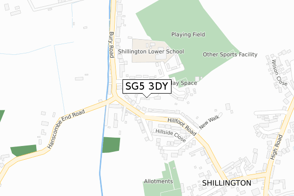
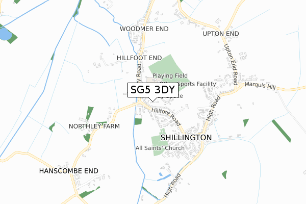
SG5 3DY is located in the Meppershall & Shillington electoral ward, within the unitary authority of Central Bedfordshire and the English Parliamentary constituency of Mid Bedfordshire. The Sub Integrated Care Board (ICB) Location is NHS Bedfordshire, Luton and Milton Keynes ICB - M1J4Y and the police force is Bedfordshire. This postcode has been in use since January 2018.


GetTheData
Source: OS Open Zoomstack (Ordnance Survey)
Licence: Open Government Licence (requires attribution)
Attribution: Contains OS data © Crown copyright and database right 2024
Source: Open Postcode Geo
Licence: Open Government Licence (requires attribution)
Attribution: Contains OS data © Crown copyright and database right 2024; Contains Royal Mail data © Royal Mail copyright and database right 2024; Source: Office for National Statistics licensed under the Open Government Licence v.3.0
| Easting | 512286 |
| Northing | 234307 |
| Latitude | 51.995875 |
| Longitude | -0.365913 |
GetTheData
Source: Open Postcode Geo
Licence: Open Government Licence
| Country | England |
| Postcode District | SG5 |
➜ See where SG5 is on a map ➜ Where is Shillington? | |
GetTheData
Source: Land Registry Price Paid Data
Licence: Open Government Licence
| Ward | Meppershall & Shillington |
| Constituency | Mid Bedfordshire |
GetTheData
Source: ONS Postcode Database
Licence: Open Government Licence
| Hillside Road (Hillfoot Road) | Shillington | 59m |
| Hillside Road (Hillfoot Road) | Shillington | 73m |
| Hillfoot End (Bury Road) | Shillington | 114m |
| Hillfoot End (Bury Road) | Shillington | 124m |
| Bells Close (Hillfoot Road) | Shillington | 225m |
GetTheData
Source: NaPTAN
Licence: Open Government Licence
| Percentage of properties with Next Generation Access | 100.0% |
| Percentage of properties with Superfast Broadband | 100.0% |
| Percentage of properties with Ultrafast Broadband | 0.0% |
| Percentage of properties with Full Fibre Broadband | 0.0% |
Superfast Broadband is between 30Mbps and 300Mbps
Ultrafast Broadband is > 300Mbps
| Median download speed | 40.0Mbps |
| Average download speed | 45.9Mbps |
| Maximum download speed | 80.00Mbps |
| Median upload speed | 10.0Mbps |
| Average upload speed | 10.7Mbps |
| Maximum upload speed | 20.00Mbps |
| Percentage of properties unable to receive 2Mbps | 0.0% |
| Percentage of properties unable to receive 5Mbps | 0.0% |
| Percentage of properties unable to receive 10Mbps | 0.0% |
| Percentage of properties unable to receive 30Mbps | 0.0% |
GetTheData
Source: Ofcom
Licence: Ofcom Terms of Use (requires attribution)
GetTheData
Source: ONS Postcode Database
Licence: Open Government Licence


➜ Get more ratings from the Food Standards Agency
GetTheData
Source: Food Standards Agency
Licence: FSA terms & conditions
| Last Collection | |||
|---|---|---|---|
| Location | Mon-Fri | Sat | Distance |
| Hillfoot End | 16:30 | 09:15 | 70m |
| Shillington | 16:45 | 09:30 | 464m |
| Woodmer Close | 16:30 | 09:15 | 618m |
GetTheData
Source: Dracos
Licence: Creative Commons Attribution-ShareAlike
The below table lists the International Territorial Level (ITL) codes (formerly Nomenclature of Territorial Units for Statistics (NUTS) codes) and Local Administrative Units (LAU) codes for SG5 3DY:
| ITL 1 Code | Name |
|---|---|
| TLH | East |
| ITL 2 Code | Name |
| TLH2 | Bedfordshire and Hertfordshire |
| ITL 3 Code | Name |
| TLH25 | Central Bedfordshire |
| LAU 1 Code | Name |
| E06000056 | Central Bedfordshire |
GetTheData
Source: ONS Postcode Directory
Licence: Open Government Licence
The below table lists the Census Output Area (OA), Lower Layer Super Output Area (LSOA), and Middle Layer Super Output Area (MSOA) for SG5 3DY:
| Code | Name | |
|---|---|---|
| OA | E00088083 | |
| LSOA | E01017444 | Central Bedfordshire 011F |
| MSOA | E02003609 | Central Bedfordshire 011 |
GetTheData
Source: ONS Postcode Directory
Licence: Open Government Licence
| SG5 3NS | Hillfoot Road | 74m |
| SG5 3NX | Greenfields | 76m |
| SG5 3NR | Hillfoot Road | 102m |
| SG5 3NU | Bury Road | 105m |
| SG5 3NN | Hillside Close | 120m |
| SG5 3NL | Church View Avenue | 177m |
| SG5 3NP | New Walk | 280m |
| SG5 3NH | Hillfoot Road | 284m |
| SG5 3NY | Bury Road | 292m |
| SG5 3NJ | Hillfoot Road | 302m |
GetTheData
Source: Open Postcode Geo; Land Registry Price Paid Data
Licence: Open Government Licence