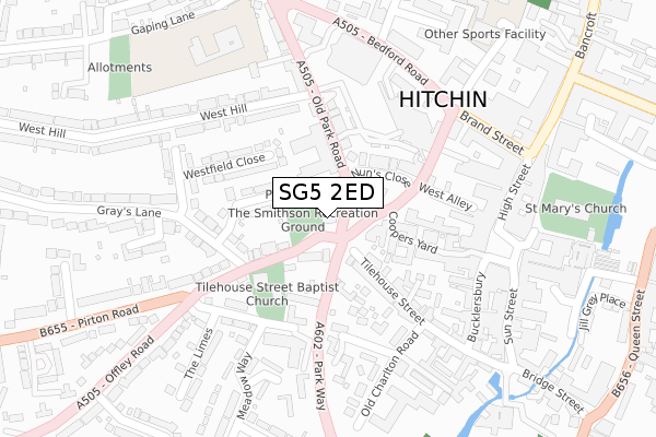
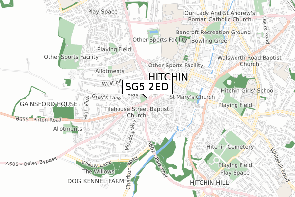
SG5 2ED is located in the Hitchin Priory electoral ward, within the local authority district of North Hertfordshire and the English Parliamentary constituency of Hitchin and Harpenden. The Sub Integrated Care Board (ICB) Location is NHS Hertfordshire and West Essex ICB - 06K and the police force is Hertfordshire. This postcode has been in use since March 2019.


GetTheData
Source: OS Open Zoomstack (Ordnance Survey)
Licence: Open Government Licence (requires attribution)
Attribution: Contains OS data © Crown copyright and database right 2025
Source: Open Postcode Geo
Licence: Open Government Licence (requires attribution)
Attribution: Contains OS data © Crown copyright and database right 2025; Contains Royal Mail data © Royal Mail copyright and database right 2025; Source: Office for National Statistics licensed under the Open Government Licence v.3.0
| Easting | 518127 |
| Northing | 229104 |
| Latitude | 51.947905 |
| Longitude | -0.282668 |
GetTheData
Source: Open Postcode Geo
Licence: Open Government Licence
| Country | England |
| Postcode District | SG5 |
➜ See where SG5 is on a map ➜ Where is Hitchin? | |
GetTheData
Source: Land Registry Price Paid Data
Licence: Open Government Licence
| Ward | Hitchin Priory |
| Constituency | Hitchin And Harpenden |
GetTheData
Source: ONS Postcode Database
Licence: Open Government Licence
| West Hill (Old Park Road) | Hitchin | 224m |
| Grammar School Walk (Bedford Road) | Hitchin | 264m |
| Waitrose (Bedford Road) | Hitchin | 312m |
| Bancroft | Hitchin | 373m |
| Moormead Close (Offley Road) | Hitchin | 373m |
| Hitchin Station | 1.5km |
| Letchworth Station | 5.1km |
GetTheData
Source: NaPTAN
Licence: Open Government Licence
| Percentage of properties with Next Generation Access | 100.0% |
| Percentage of properties with Superfast Broadband | 100.0% |
| Percentage of properties with Ultrafast Broadband | 100.0% |
| Percentage of properties with Full Fibre Broadband | 100.0% |
Superfast Broadband is between 30Mbps and 300Mbps
Ultrafast Broadband is > 300Mbps
| Percentage of properties unable to receive 2Mbps | 0.0% |
| Percentage of properties unable to receive 5Mbps | 0.0% |
| Percentage of properties unable to receive 10Mbps | 0.0% |
| Percentage of properties unable to receive 30Mbps | 0.0% |
GetTheData
Source: Ofcom
Licence: Ofcom Terms of Use (requires attribution)
GetTheData
Source: ONS Postcode Database
Licence: Open Government Licence


➜ Get more ratings from the Food Standards Agency
GetTheData
Source: Food Standards Agency
Licence: FSA terms & conditions
| Last Collection | |||
|---|---|---|---|
| Location | Mon-Fri | Sat | Distance |
| The Limes | 17:00 | 12:00 | 216m |
| Charlton Road | 17:30 | 12:00 | 248m |
| Brand Street | 18:30 | 12:00 | 263m |
GetTheData
Source: Dracos
Licence: Creative Commons Attribution-ShareAlike
The below table lists the International Territorial Level (ITL) codes (formerly Nomenclature of Territorial Units for Statistics (NUTS) codes) and Local Administrative Units (LAU) codes for SG5 2ED:
| ITL 1 Code | Name |
|---|---|
| TLH | East |
| ITL 2 Code | Name |
| TLH2 | Bedfordshire and Hertfordshire |
| ITL 3 Code | Name |
| TLH23 | Hertfordshire CC |
| LAU 1 Code | Name |
| E07000099 | North Hertfordshire |
GetTheData
Source: ONS Postcode Directory
Licence: Open Government Licence
The below table lists the Census Output Area (OA), Lower Layer Super Output Area (LSOA), and Middle Layer Super Output Area (MSOA) for SG5 2ED:
| Code | Name | |
|---|---|---|
| OA | E00119931 | |
| LSOA | E01023615 | North Hertfordshire 012E |
| MSOA | E02004920 | North Hertfordshire 012 |
GetTheData
Source: ONS Postcode Directory
Licence: Open Government Licence
| SG5 2EE | Upper Tilehouse Street | 95m |
| SG5 1AU | Coopers Yard | 106m |
| SG5 2JR | Old Park Road | 110m |
| SG5 2DH | Coopers Alley | 110m |
| SG5 2TS | The Chapmans | 117m |
| SG5 1EP | Nuns Close | 117m |
| SG5 2HB | Winston Close | 118m |
| SG5 2HA | Grays Lane | 137m |
| SG5 1EJ | Paynes Park | 138m |
| SG5 2DY | Tilehouse Street | 146m |
GetTheData
Source: Open Postcode Geo; Land Registry Price Paid Data
Licence: Open Government Licence