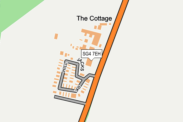
SG4 7EH is located in the Chesfield electoral ward, within the local authority district of North Hertfordshire and the English Parliamentary constituency of Hitchin and Harpenden. The Sub Integrated Care Board (ICB) Location is NHS Hertfordshire and West Essex ICB - 06K and the police force is Hertfordshire. This postcode has been in use since January 1980.


GetTheData
Source: OS OpenMap – Local (Ordnance Survey)
Source: OS VectorMap District (Ordnance Survey)
Licence: Open Government Licence (requires attribution)
| Easting | 523310 |
| Northing | 229091 |
| Latitude | 51.946665 |
| Longitude | -0.207300 |
GetTheData
Source: Open Postcode Geo
Licence: Open Government Licence
| Country | England |
| Postcode District | SG4 |
➜ See where SG4 is on a map | |
GetTheData
Source: Land Registry Price Paid Data
Licence: Open Government Licence
Elevation or altitude of SG4 7EH as distance above sea level:
| Metres | Feet | |
|---|---|---|
| Elevation | 120m | 394ft |
Elevation is measured from the approximate centre of the postcode, to the nearest point on an OS contour line from OS Terrain 50, which has contour spacing of ten vertical metres.
➜ How high above sea level am I? Find the elevation of your current position using your device's GPS.
GetTheData
Source: Open Postcode Elevation
Licence: Open Government Licence
| Ward | Chesfield |
| Constituency | Hitchin And Harpenden |
GetTheData
Source: ONS Postcode Database
Licence: Open Government Licence
| Jack's Hill Caravan Park (B197) | Graveley | 72m |
| Jack's Hill Caravan Park (B197) | Graveley | 103m |
| The Waggon And Horses Ph (High Street) | Graveley | 1,272m |
| The Waggon And Horses Ph (High Street) | Graveley | 1,328m |
| Hitchin Station | 3.9km |
| Letchworth Station | 4km |
GetTheData
Source: NaPTAN
Licence: Open Government Licence
GetTheData
Source: ONS Postcode Database
Licence: Open Government Licence


➜ Get more ratings from the Food Standards Agency
GetTheData
Source: Food Standards Agency
Licence: FSA terms & conditions
| Last Collection | |||
|---|---|---|---|
| Location | Mon-Fri | Sat | Distance |
| Jacks Hill | 16:30 | 09:45 | 90m |
| High Street | 16:30 | 09:45 | 1,245m |
| Ashwell Common | 16:30 | 09:40 | 1,397m |
GetTheData
Source: Dracos
Licence: Creative Commons Attribution-ShareAlike
The below table lists the International Territorial Level (ITL) codes (formerly Nomenclature of Territorial Units for Statistics (NUTS) codes) and Local Administrative Units (LAU) codes for SG4 7EH:
| ITL 1 Code | Name |
|---|---|
| TLH | East |
| ITL 2 Code | Name |
| TLH2 | Bedfordshire and Hertfordshire |
| ITL 3 Code | Name |
| TLH23 | Hertfordshire CC |
| LAU 1 Code | Name |
| E07000099 | North Hertfordshire |
GetTheData
Source: ONS Postcode Directory
Licence: Open Government Licence
The below table lists the Census Output Area (OA), Lower Layer Super Output Area (LSOA), and Middle Layer Super Output Area (MSOA) for SG4 7EH:
| Code | Name | |
|---|---|---|
| OA | E00119854 | |
| LSOA | E01033026 | North Hertfordshire 005J |
| MSOA | E02004913 | North Hertfordshire 005 |
GetTheData
Source: ONS Postcode Directory
Licence: Open Government Licence
| SG4 7EQ | Jacks Hill | 474m |
| SG6 2AJ | 876m | |
| SG6 2DP | Roxley Manor | 880m |
| SG4 7LT | 1069m | |
| SG4 7LA | High Street | 1114m |
| SG4 7LR | Church Lane | 1136m |
| SG4 7LS | Church Lane | 1178m |
| SG4 7LN | Oak Lane | 1229m |
| SG4 7LU | Church Lane | 1257m |
| SG4 7LB | High Street | 1274m |
GetTheData
Source: Open Postcode Geo; Land Registry Price Paid Data
Licence: Open Government Licence