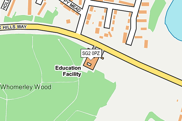
SG2 0PZ is located in the Bedwell electoral ward, within the local authority district of Stevenage and the English Parliamentary constituency of Stevenage. The Sub Integrated Care Board (ICB) Location is NHS Hertfordshire and West Essex ICB - 06K and the police force is Hertfordshire. This postcode has been in use since January 1980.


GetTheData
Source: OS OpenMap – Local (Ordnance Survey)
Source: OS VectorMap District (Ordnance Survey)
Licence: Open Government Licence (requires attribution)
| Easting | 524940 |
| Northing | 223753 |
| Latitude | 51.898325 |
| Longitude | -0.185557 |
GetTheData
Source: Open Postcode Geo
Licence: Open Government Licence
| Country | England |
| Postcode District | SG2 |
➜ See where SG2 is on a map ➜ Where is Stevenage? | |
GetTheData
Source: Land Registry Price Paid Data
Licence: Open Government Licence
Elevation or altitude of SG2 0PZ as distance above sea level:
| Metres | Feet | |
|---|---|---|
| Elevation | 100m | 328ft |
Elevation is measured from the approximate centre of the postcode, to the nearest point on an OS contour line from OS Terrain 50, which has contour spacing of ten vertical metres.
➜ How high above sea level am I? Find the elevation of your current position using your device's GPS.
GetTheData
Source: Open Postcode Elevation
Licence: Open Government Licence
| Ward | Bedwell |
| Constituency | Stevenage |
GetTheData
Source: ONS Postcode Database
Licence: Open Government Licence
| Colestrete Close (Colestrete) | Bedwell | 239m |
| Colestrete Close (Colestrete) | Bedwell | 289m |
| Peartree Way (Valley Way) | Shephall | 393m |
| Colestrete (Bedwell Crescent) | Bedwell | 430m |
| Peartree Way (Valley Way) | Shephall | 430m |
| Stevenage Station | 1.5km |
| Knebworth Station | 3.5km |
| Watton-at-Stone Station | 6.5km |
GetTheData
Source: NaPTAN
Licence: Open Government Licence
GetTheData
Source: ONS Postcode Database
Licence: Open Government Licence


➜ Get more ratings from the Food Standards Agency
GetTheData
Source: Food Standards Agency
Licence: FSA terms & conditions
| Last Collection | |||
|---|---|---|---|
| Location | Mon-Fri | Sat | Distance |
| Colestrete | 17:30 | 12:00 | 236m |
| Bedwell Crescent | 17:30 | 12:00 | 478m |
| Rockingham Way | 18:45 | 12:00 | 486m |
GetTheData
Source: Dracos
Licence: Creative Commons Attribution-ShareAlike
The below table lists the International Territorial Level (ITL) codes (formerly Nomenclature of Territorial Units for Statistics (NUTS) codes) and Local Administrative Units (LAU) codes for SG2 0PZ:
| ITL 1 Code | Name |
|---|---|
| TLH | East |
| ITL 2 Code | Name |
| TLH2 | Bedfordshire and Hertfordshire |
| ITL 3 Code | Name |
| TLH23 | Hertfordshire CC |
| LAU 1 Code | Name |
| E07000243 | Stevenage |
GetTheData
Source: ONS Postcode Directory
Licence: Open Government Licence
The below table lists the Census Output Area (OA), Lower Layer Super Output Area (LSOA), and Middle Layer Super Output Area (MSOA) for SG2 0PZ:
| Code | Name | |
|---|---|---|
| OA | E00120647 | |
| LSOA | E01023756 | Stevenage 008B |
| MSOA | E02004951 | Stevenage 008 |
GetTheData
Source: ONS Postcode Directory
Licence: Open Government Licence
| SG1 1RJ | Twinwoods | 144m |
| SG1 1RA | Colestrete | 149m |
| SG1 1RE | Colestrete | 152m |
| SG1 1RR | Shephall View | 203m |
| SG1 1QZ | Poppy Mead | 211m |
| SG1 1RH | The Hawthorns | 211m |
| SG1 1RD | Colestrete | 275m |
| SG1 1RP | Shephall View | 299m |
| SG1 1QY | Ramsdell | 303m |
| SG1 1RF | Colestrete Close | 337m |
GetTheData
Source: Open Postcode Geo; Land Registry Price Paid Data
Licence: Open Government Licence