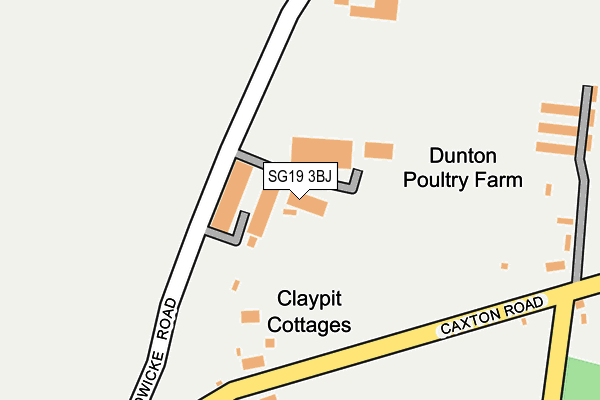
SG19 3BJ is located in the Great Paxton electoral ward, within the local authority district of Huntingdonshire and the English Parliamentary constituency of Huntingdon. The Sub Integrated Care Board (ICB) Location is NHS Cambridgeshire and Peterborough ICB - 06H and the police force is Cambridgeshire. This postcode has been in use since January 1980.


GetTheData
Source: OS OpenMap – Local (Ordnance Survey)
Source: OS VectorMap District (Ordnance Survey)
Licence: Open Government Licence (requires attribution)
| Easting | 527662 |
| Northing | 256593 |
| Latitude | 52.192805 |
| Longitude | -0.133765 |
GetTheData
Source: Open Postcode Geo
Licence: Open Government Licence
| Country | England |
| Postcode District | SG19 |
➜ See where SG19 is on a map | |
GetTheData
Source: Land Registry Price Paid Data
Licence: Open Government Licence
Elevation or altitude of SG19 3BJ as distance above sea level:
| Metres | Feet | |
|---|---|---|
| Elevation | 60m | 197ft |
Elevation is measured from the approximate centre of the postcode, to the nearest point on an OS contour line from OS Terrain 50, which has contour spacing of ten vertical metres.
➜ How high above sea level am I? Find the elevation of your current position using your device's GPS.
GetTheData
Source: Open Postcode Elevation
Licence: Open Government Licence
| Ward | Great Paxton |
| Constituency | Huntingdon |
GetTheData
Source: ONS Postcode Database
Licence: Open Government Licence
| Eltisley Road (Fox Street) | Great Gransden | 841m |
| Eltisley Road (Fox Street) | Great Gransden | 847m |
| Crow Tree Street (Little Gransden Lane) | Great Gransden | 1,155m |
| Crow Tree Street (Little Gransden Lane) | Great Gransden | 1,161m |
| Primrose Walk (Primrose Hill) | Little Gransden | 1,271m |
GetTheData
Source: NaPTAN
Licence: Open Government Licence
| Median download speed | 21.2Mbps |
| Average download speed | 22.9Mbps |
| Maximum download speed | 44.00Mbps |
| Median upload speed | 1.1Mbps |
| Average upload speed | 3.8Mbps |
| Maximum upload speed | 10.00Mbps |
GetTheData
Source: Ofcom
Licence: Ofcom Terms of Use (requires attribution)
GetTheData
Source: ONS Postcode Database
Licence: Open Government Licence


➜ Get more ratings from the Food Standards Agency
GetTheData
Source: Food Standards Agency
Licence: FSA terms & conditions
| Last Collection | |||
|---|---|---|---|
| Location | Mon-Fri | Sat | Distance |
| Great Gransden | 16:05 | 09:00 | 852m |
| Little Gransden | 16:05 | 09:30 | 1,484m |
| Grandsen Road | 17:30 | 10:30 | 3,112m |
GetTheData
Source: Dracos
Licence: Creative Commons Attribution-ShareAlike
The below table lists the International Territorial Level (ITL) codes (formerly Nomenclature of Territorial Units for Statistics (NUTS) codes) and Local Administrative Units (LAU) codes for SG19 3BJ:
| ITL 1 Code | Name |
|---|---|
| TLH | East |
| ITL 2 Code | Name |
| TLH1 | East Anglia |
| ITL 3 Code | Name |
| TLH12 | Cambridgeshire CC |
| LAU 1 Code | Name |
| E07000011 | Huntingdonshire |
GetTheData
Source: ONS Postcode Directory
Licence: Open Government Licence
The below table lists the Census Output Area (OA), Lower Layer Super Output Area (LSOA), and Middle Layer Super Output Area (MSOA) for SG19 3BJ:
| Code | Name | |
|---|---|---|
| OA | E00091500 | |
| LSOA | E01018136 | Huntingdonshire 018B |
| MSOA | E02003770 | Huntingdonshire 018 |
GetTheData
Source: ONS Postcode Directory
Licence: Open Government Licence
| SG19 3BG | Caxton Road | 171m |
| SG19 3RL | Audley Close | 669m |
| SG19 3AW | Caxton Road | 680m |
| SG19 3RJ | Audley Close | 707m |
| SG19 3AN | Winchfield | 709m |
| SG19 3QS | Williams Close | 748m |
| SG19 3AR | Eltisley Road | 758m |
| SG19 3RD | Lavender Barns | 771m |
| SG19 3AQ | Sand Road | 772m |
| SG19 3AP | Mandene Gardens | 803m |
GetTheData
Source: Open Postcode Geo; Land Registry Price Paid Data
Licence: Open Government Licence