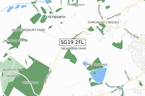
SG19 2FL is located in the Gamlingay electoral ward, within the local authority district of South Cambridgeshire and the English Parliamentary constituency of South Cambridgeshire. The Sub Integrated Care Board (ICB) Location is NHS Cambridgeshire and Peterborough ICB - 06H and the police force is Cambridgeshire. This postcode has been in use since April 2019.


GetTheData
Source: OS Open Zoomstack (Ordnance Survey)
Licence: Open Government Licence (requires attribution)
Attribution: Contains OS data © Crown copyright and database right 2025
Source: Open Postcode Geo
Licence: Open Government Licence (requires attribution)
Attribution: Contains OS data © Crown copyright and database right 2025; Contains Royal Mail data © Royal Mail copyright and database right 2025; Source: Office for National Statistics licensed under the Open Government Licence v.3.0
| Easting | 522141 |
| Northing | 252532 |
| Latitude | 52.157574 |
| Longitude | -0.215930 |
GetTheData
Source: Open Postcode Geo
Licence: Open Government Licence
| Country | England |
| Postcode District | SG19 |
➜ See where SG19 is on a map | |
GetTheData
Source: Land Registry Price Paid Data
Licence: Open Government Licence
| Ward | Gamlingay |
| Constituency | South Cambridgeshire |
GetTheData
Source: ONS Postcode Database
Licence: Open Government Licence
| The Cinques | Gamlingay Cinques | 700m |
| The Cinques | Gamlingay Cinques | 705m |
| Rowan Gardens (Green Acres) | Gamlingay | 1,118m |
| Beechside (Green Acres) | Gamlingay | 1,124m |
| Rowan Gardens (Green Acres) | Gamlingay | 1,124m |
| Sandy Station | 5.8km |
GetTheData
Source: NaPTAN
Licence: Open Government Licence
GetTheData
Source: ONS Postcode Database
Licence: Open Government Licence


➜ Get more ratings from the Food Standards Agency
GetTheData
Source: Food Standards Agency
Licence: FSA terms & conditions
| Last Collection | |||
|---|---|---|---|
| Location | Mon-Fri | Sat | Distance |
| The Cinques | 16:30 | 10:00 | 689m |
| The Heath | 16:30 | 10:00 | 1,043m |
| Cherry Grove | 16:30 | 10:15 | 1,119m |
GetTheData
Source: Dracos
Licence: Creative Commons Attribution-ShareAlike
The below table lists the International Territorial Level (ITL) codes (formerly Nomenclature of Territorial Units for Statistics (NUTS) codes) and Local Administrative Units (LAU) codes for SG19 2FL:
| ITL 1 Code | Name |
|---|---|
| TLH | East |
| ITL 2 Code | Name |
| TLH1 | East Anglia |
| ITL 3 Code | Name |
| TLH12 | Cambridgeshire CC |
| LAU 1 Code | Name |
| E07000012 | South Cambridgeshire |
GetTheData
Source: ONS Postcode Directory
Licence: Open Government Licence
The below table lists the Census Output Area (OA), Lower Layer Super Output Area (LSOA), and Middle Layer Super Output Area (MSOA) for SG19 2FL:
| Code | Name | |
|---|---|---|
| OA | E00092039 | |
| LSOA | E01018246 | South Cambridgeshire 013B |
| MSOA | E02003787 | South Cambridgeshire 013 |
GetTheData
Source: ONS Postcode Directory
Licence: Open Government Licence
| SG19 2HY | Drove Road | 416m |
| SG19 2HT | Drove Road | 535m |
| SG19 3NU | The Cinques | 668m |
| SG19 2JE | Heath Road | 877m |
| SG19 2JD | Heath Road | 888m |
| SG19 3NT | North Lane | 949m |
| SG19 3NS | East Lane | 1006m |
| SG19 3LH | Heath Road | 1024m |
| SG19 3DQ | Stubbs Oak | 1027m |
| SG19 3NH | Elizabeth Way | 1040m |
GetTheData
Source: Open Postcode Geo; Land Registry Price Paid Data
Licence: Open Government Licence