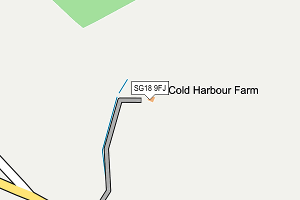
SG18 9FJ is located in the Clifton, Henlow & Langford electoral ward, within the unitary authority of Central Bedfordshire and the English Parliamentary constituency of North East Bedfordshire. The Sub Integrated Care Board (ICB) Location is NHS Bedfordshire, Luton and Milton Keynes ICB - M1J4Y and the police force is Bedfordshire. This postcode has been in use since June 2017.


GetTheData
Source: OS OpenMap – Local (Ordnance Survey)
Source: OS VectorMap District (Ordnance Survey)
Licence: Open Government Licence (requires attribution)
| Easting | 518482 |
| Northing | 241089 |
| Latitude | 52.055538 |
| Longitude | -0.273365 |
GetTheData
Source: Open Postcode Geo
Licence: Open Government Licence
| Country | England |
| Postcode District | SG18 |
➜ See where SG18 is on a map ➜ Where is Langford? | |
GetTheData
Source: Land Registry Price Paid Data
Licence: Open Government Licence
| Ward | Clifton, Henlow & Langford |
| Constituency | North East Bedfordshire |
GetTheData
Source: ONS Postcode Database
Licence: Open Government Licence
4, WRESTLERS GROVE, LANGFORD, BIGGLESWADE, SG18 9FJ 2019 8 MAR £855,000 |
1, WRESTLERS GROVE, LANGFORD, BIGGLESWADE, SG18 9FJ 2018 22 JUN £785,000 |
2, WRESTLERS GROVE, LANGFORD, BIGGLESWADE, SG18 9FJ 2018 24 MAY £895,000 |
3, WRESTLERS GROVE, LANGFORD, BIGGLESWADE, SG18 9FJ 2018 30 APR £825,000 |
GetTheData
Source: HM Land Registry Price Paid Data
Licence: Contains HM Land Registry data © Crown copyright and database right 2025. This data is licensed under the Open Government Licence v3.0.
| Pound Close (Church Street) | Langford | 77m |
| Pound Close (Church Street) | Langford | 163m |
| Prospect Road (Station Road) | Langford | 222m |
| Prospect Road (Station Road) | Langford | 223m |
| Lower School (Church Street) | Langford | 298m |
| Arlesey Station | 3.3km |
| Biggleswade Station | 3.3km |
GetTheData
Source: NaPTAN
Licence: Open Government Licence
| Percentage of properties with Next Generation Access | 100.0% |
| Percentage of properties with Superfast Broadband | 100.0% |
| Percentage of properties with Ultrafast Broadband | 0.0% |
| Percentage of properties with Full Fibre Broadband | 0.0% |
Superfast Broadband is between 30Mbps and 300Mbps
Ultrafast Broadband is > 300Mbps
| Percentage of properties unable to receive 2Mbps | 0.0% |
| Percentage of properties unable to receive 5Mbps | 0.0% |
| Percentage of properties unable to receive 10Mbps | 0.0% |
| Percentage of properties unable to receive 30Mbps | 0.0% |
GetTheData
Source: Ofcom
Licence: Ofcom Terms of Use (requires attribution)
GetTheData
Source: ONS Postcode Database
Licence: Open Government Licence


➜ Get more ratings from the Food Standards Agency
GetTheData
Source: Food Standards Agency
Licence: FSA terms & conditions
| Last Collection | |||
|---|---|---|---|
| Location | Mon-Fri | Sat | Distance |
| Station Road | 16:15 | 09:10 | 428m |
| Langford | 16:15 | 09:10 | 453m |
| Shopping Basket | 16:30 | 09:20 | 612m |
GetTheData
Source: Dracos
Licence: Creative Commons Attribution-ShareAlike
The below table lists the International Territorial Level (ITL) codes (formerly Nomenclature of Territorial Units for Statistics (NUTS) codes) and Local Administrative Units (LAU) codes for SG18 9FJ:
| ITL 1 Code | Name |
|---|---|
| TLH | East |
| ITL 2 Code | Name |
| TLH2 | Bedfordshire and Hertfordshire |
| ITL 3 Code | Name |
| TLH25 | Central Bedfordshire |
| LAU 1 Code | Name |
| E06000056 | Central Bedfordshire |
GetTheData
Source: ONS Postcode Directory
Licence: Open Government Licence
The below table lists the Census Output Area (OA), Lower Layer Super Output Area (LSOA), and Middle Layer Super Output Area (MSOA) for SG18 9FJ:
| Code | Name | |
|---|---|---|
| OA | E00087946 | |
| LSOA | E01017414 | Central Bedfordshire 010E |
| MSOA | E02003608 | Central Bedfordshire 010 |
GetTheData
Source: ONS Postcode Directory
Licence: Open Government Licence
| SG18 9NQ | Pound Close | 29m |
| SG18 9NX | Church Street | 110m |
| SG18 9NG | Garfield | 178m |
| SG18 9PN | The Butts | 196m |
| SG18 9RP | High Street | 204m |
| SG18 9NU | Crown Lane | 209m |
| SG18 9RR | High Street | 221m |
| SG18 9QE | Church Crescent | 233m |
| SG18 9QY | Old Mill Close | 239m |
| SG18 9QD | King George Close | 244m |
GetTheData
Source: Open Postcode Geo; Land Registry Price Paid Data
Licence: Open Government Licence