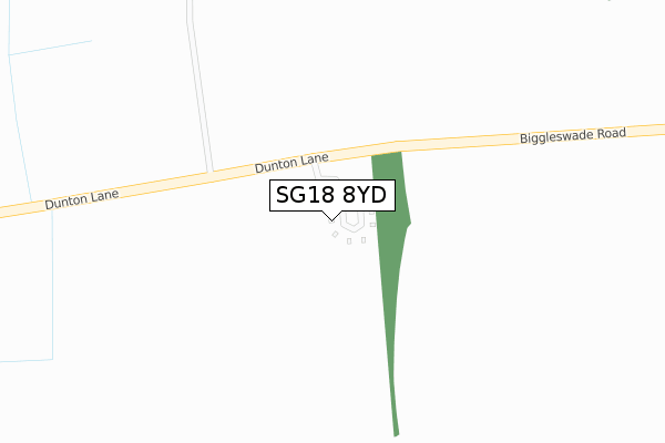
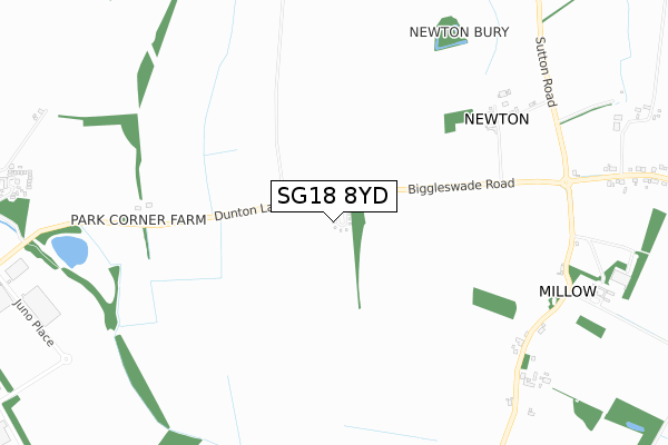
SG18 8YD is located in the Biggleswade East electoral ward, within the unitary authority of Central Bedfordshire and the English Parliamentary constituency of North East Bedfordshire. The Sub Integrated Care Board (ICB) Location is NHS Bedfordshire, Luton and Milton Keynes ICB - M1J4Y and the police force is Bedfordshire. This postcode has been in use since August 2018.


GetTheData
Source: OS Open Zoomstack (Ordnance Survey)
Licence: Open Government Licence (requires attribution)
Attribution: Contains OS data © Crown copyright and database right 2025
Source: Open Postcode Geo
Licence: Open Government Licence (requires attribution)
Attribution: Contains OS data © Crown copyright and database right 2025; Contains Royal Mail data © Royal Mail copyright and database right 2025; Source: Office for National Statistics licensed under the Open Government Licence v.3.0
| Easting | 522205 |
| Northing | 243949 |
| Latitude | 52.080431 |
| Longitude | -0.218071 |
GetTheData
Source: Open Postcode Geo
Licence: Open Government Licence
| Country | England |
| Postcode District | SG18 |
➜ See where SG18 is on a map | |
GetTheData
Source: Land Registry Price Paid Data
Licence: Open Government Licence
| Ward | Biggleswade East |
| Constituency | North East Bedfordshire |
GetTheData
Source: ONS Postcode Database
Licence: Open Government Licence
| Newton Grove Farm (Biggleswade Road) | Dunton | 630m |
| Newton Grove Farm (Biggleswade Road) | Dunton | 631m |
| Park Corner Farm (Dunton Lane) | Dunton | 693m |
| Park Corner Farm (Dunton Lane) | Dunton | 694m |
| Millow Hall Farm (Millow) | Dunton | 910m |
| Biggleswade Station | 3km |
| Sandy Station | 6.6km |
GetTheData
Source: NaPTAN
Licence: Open Government Licence
GetTheData
Source: ONS Postcode Database
Licence: Open Government Licence


➜ Get more ratings from the Food Standards Agency
GetTheData
Source: Food Standards Agency
Licence: FSA terms & conditions
| Last Collection | |||
|---|---|---|---|
| Location | Mon-Fri | Sat | Distance |
| Millow | 16:00 | 08:30 | 832m |
| Biggleswade Road | 16:20 | 09:00 | 954m |
| Dunton | 16:00 | 09:40 | 1,482m |
GetTheData
Source: Dracos
Licence: Creative Commons Attribution-ShareAlike
The below table lists the International Territorial Level (ITL) codes (formerly Nomenclature of Territorial Units for Statistics (NUTS) codes) and Local Administrative Units (LAU) codes for SG18 8YD:
| ITL 1 Code | Name |
|---|---|
| TLH | East |
| ITL 2 Code | Name |
| TLH2 | Bedfordshire and Hertfordshire |
| ITL 3 Code | Name |
| TLH25 | Central Bedfordshire |
| LAU 1 Code | Name |
| E06000056 | Central Bedfordshire |
GetTheData
Source: ONS Postcode Directory
Licence: Open Government Licence
The below table lists the Census Output Area (OA), Lower Layer Super Output Area (LSOA), and Middle Layer Super Output Area (MSOA) for SG18 8YD:
| Code | Name | |
|---|---|---|
| OA | E00087822 | |
| LSOA | E01017389 | Central Bedfordshire 006C |
| MSOA | E02003604 | Central Bedfordshire 006 |
GetTheData
Source: ONS Postcode Directory
Licence: Open Government Licence
| SG18 8RJ | Newton | 702m |
| SG18 8RH | Millow | 882m |
| SG18 8RL | Biggleswade Road | 1176m |
| SG18 8QS | Stratton Park | 1239m |
| SG18 8RG | Springfield | 1307m |
| SG18 8RN | High Street | 1448m |
| SG18 8RY | Horseshoe Close | 1459m |
| SG18 8UP | Lime Tree Drive | 1504m |
| SG18 8RZ | Fen Reach | 1518m |
| SG18 8QU | Dunton Lane | 1526m |
GetTheData
Source: Open Postcode Geo; Land Registry Price Paid Data
Licence: Open Government Licence